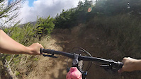
This loop follows the 4km Back Track (G2) from the bottom of Arapuke Bike park to the upper Scotts Road car park where there is a shelter and toilets. There is no potable water so bring plenty. From there you can take the Icebreaker (G2) trail to Arapuke Forest Road or skip Icebreaker and go around the car park on the Back Track side to ride the whole road up to the summit.
Be aware of and pull over for the shuttle on Arapuke Forest Road.
There is a shelter and a potable water barrel at the Summit hub. From there take Te Ara Kaikohi (G3) to Zig Zag road for a very short but steep gravel ride back to the Kahuterawa Stream bridge and the bottom car park.
Trail Issues on Route
- Minor Issue / Yellow: 1 trail (newest: Jan 16, 2026)
Stats
-
Distance7 miles
-
Altitude min502 ft
-
Altitude start502 ft
-
Altitude end528 ft
-
Climb2,049 ft
-
Descent-2,021 ft
-
Grade0.1%
-
Grade max-87.9%
-
Grade min116.6%
-
Distance climb4 miles
-
Distance down3 miles
-
Distance flat4,373 ft
11 Reviews & Comments
We hope you've been enjoying Trailforks!
Create a FREE account to view route comments and much more.
Trails in Route
| 325 ft | |||||
| 3 miles | |||||
| 4,272 ft | |||||
| 2,884 ft | |||||
| 3 miles |
Details
-
Riding area
-
Primary ActivityMountain Bike
-
Other Activities
- E-Bike
- Gravel Bike
- Adaptive Bike
- Hike
-
Difficulty ratingBlue
-
Route TypeLoop
-
eBike Allowed
-
Bike typeAM, Adaptive MTB, Gravel
- Unknown
- Snow Groomed
- Snow Packed
- Snow Covered
- Snow Cover Partial
- Freeze/thaw Cycle
- Icy
- Prevalent Mud
- Wet
- Variable
- Ideal
- Dry
- Very Dry
The colour categories are based on what percentage of riders are riding a trail in its intended direction.
- > 96%
- > 90%
- > 80%
- > 70%
- > 50%
- < 50%
- bi-directional trail
- no data
- < 2 days
- < 1 week
- < 2 weeks
- < 1 month
- < 6 months
- > 6 months
- Downhill Only
- Downhill Primary
- Both Directions
- Uphill Primary
- Uphill Only
- One Direction
- Description
- Photos
- Description & Photos
- Videos
- most popular
- popular
- less popular
- not popular
Service Road Atlas is a free to use, community-driven service for viewing and creating reports on the numerous back-country service roads around B.C. and Alberta.
Save the current map location and zoom level as your default home location whenever this page is loaded.
Save- Singletrack
- Unpaved
Photos
Videos
Recent Trail Reports Along Route
- By dickersoncantride
& contributors - #54619 - 924 views
