34.9 miles
Distance
2,738 ft
Climb
-2,762 ft
Descent
200 ft
High Point
-24 ft
Altitude change
8 ft
Altitude min
141 ft
Altitude start
118 ft
Altitude end
-39.1%
Grade max
33.6%
Grade min
14 miles
Distance climb
13 miles
Distance down
8 miles
Distance flat

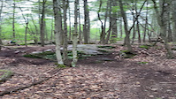
Big loop through Bath Singletrack.

Detailed Description
Bath 56K is a 35 mile moderately popular intermediate route located near Bath Maine. This mountain bike only route. This route includes 32 trails. This route climbs 2,738 ft with a max elevation of 200 ft then descends -2,762 ft.

Trail Issues on Route

  • Minor Issue / Yellow: 1 trail (newest: Mar 20, 2022)
Local Trail Association
Local trail association
Six Rivers NEMBA Chapter (www.nemba.org)
Please consider joining or donating to the local riding association to support trail development & maintenance.
Donate to earn trail karma!

Stats

  • Distance
    35 miles
  • Altitude change
    -24 ft
  • Altitude min
    8 ft
  • Altitude start
    141 ft
  • Altitude end
    118 ft
  • Climb
    2,738 ft
  • Descent
    -2,762 ft
  • Grade max
    -39.1%
  • Grade min
    33.6%
  • Distance climb
    14 miles
  • Distance down
    13 miles
  • Distance flat
    8 miles

1 Review & Comments


We hope you've been enjoying Trailforks!

Create a FREE account to view route comments and much more.

Details

no votes yet
close
3D
Trail Conditions
  • Unknown
  • Snow Groomed
  • Snow Packed
  • Snow Covered
  • Snow Cover Partial
  • Freeze/thaw Cycle
  • Icy
  • Prevalent Mud
  • Wet
  • Variable
  • Ideal
  • Dry
  • Very Dry
Trail Flow (Ridden Direction)
Trailforks scans users ridelogs to determine the most popular direction each trail is ridden. A good flowing trail network will have most trails flowing in a single direction according to their intension.
The colour categories are based on what percentage of riders are riding a trail in its intended direction.
  • > 96%
  • > 90%
  • > 80%
  • > 70%
  • > 50%
  • < 50%
  • bi-directional trail
  • no data
Trail Last Ridden
Trailforks scans ridelogs to determine the last time a trail was ridden.
  • < 2 days
  • < 1 week
  • < 2 weeks
  • < 1 month
  • < 6 months
  • > 6 months
Trail Ridden Direction
The intended direction a trail should be ridden.
  • Downhill Only
  • Downhill Primary
  • Both Directions
  • Uphill Primary
  • Uphill Only
  • One Direction
Contribute Details
Colors indicate trail is missing specified detail.
  • Description
  • Photos
  • Description & Photos
  • Videos
Trail Popularity ?
Trailforks scans ridelogs to determine which trails are ridden the most in the last 9 months. Trails are compared with nearby trails in the same city region with a possible 25 colour shades. Think of this as a heatmap, more rides = more kinetic energy = warmer colors.
  • most popular
  • popular
  • less popular
  • not popular
ATV/ORV/OHV Filter
Max Vehicle Width
inches
US Cell Coverage
Legend
cell carrier legend

Radar Time
Activity Recordings
Trailforks uses anonymized public activity data. ?
Activity Recordings
Trailforks uses anonymized public activity data. ?
Personal Heatmap
Activity Types
all / none
Options
2
Date range month
Winter Trails
Warning A routing network for winter maps does not exist. Selecting trails using the winter trails layer has been disabled.
Missing Trails
Most Popular
Least Popular
Trails are colored based on popularity. The more popular a trail is, the more red. Less popular trails trend towards green.
Jump Magnitude Heatmap
Heatmap of where riders jump on trails. Zoom in to see individual jumps, click circles to view jump details.
BC Backroad Status

Service Road Atlas is a free to use, community-driven service for viewing and creating reports on the numerous back-country service roads around B.C. and Alberta.

map legend
Slope Aspect
Direction the slope faces
Flat N NE E SE S SW W NW
Trails Deemphasized
Trails are shown in grey.
disable
Only show trails with no bike usage.
Enable
Suggested Layers
Based on selected activity type

    Save the current map location and zoom level as your default home location whenever this page is loaded.

    Save
    Trail transparency
    • Singletrack
    • Unpaved
    76
    62
    63
    67
    ALJA Rythmn Baby - Rock rollin
    ALJA Rythmn Baby - Rock rollin
    0:07 | | comments: 0 | favs:
    Jul 12, 2021
    @nwillson

    Recent Trail Reports Along Route

    statustraildateconditiondescription
    Smorgasbord
    Apr 24, 2026 @ 3:11pm (America/New_York)
    Apr 24, 2026
    Ridge Runner
    Apr 12, 2026 @ 8:41am (America/New_York)
    Apr 12, 2026
    Lots of clearing from recent logging, trail is clear and dry. Keep your eyes peeled in a few spots to follow trail as clearing, look for old tracks. do trees fouling the area, logging was clean. The old chair has finally met its demise.
    Deliverance
    Apr 12, 2026 @ 8:41am (America/New_York)
    Apr 12, 2026
    Lots of clearing from recent logging, trail is clear and dry. Keep your eyes peeled in a few spots to follow trail as clearing, look for old tracks. do trees fouling the area, logging was clean. The old chair has finally met its demise.
    Purple People Eater
    May 16, 2025 @ 1:10pm
    May 16, 2025
    Evahroney
    May 16, 2025 @ 1:10pm
    May 16, 2025
    more reports »
    • By topshammaine1TF Pro & contributors
    • #65578 - 102 views

    Hit the Trail

    Open in App

    Get this route on your phone instantly.

    Download Route

    Save to wishlist, Garmin & download.