4.6 miles
Distance
536 ft
Climb
-535 ft
Descent
326 ft
High Point

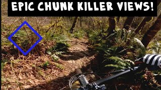
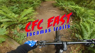
Beginner Mountain Bike Loop around Round Lake in the Lacamas Lake Park area.

Fifty percent gravel, fifty percent single track. Technical features are visible and easily walked around.

Detailed Description
Beginner Loop is a 5 mile popular easy route located near Camas Washington. This mountain bike only route. This route includes 5 trails. This route climbs 536 ft with a max elevation of 326 ft then descends -535 ft.
Local Trail Association
Local trail association
Evergreen - Southwest Chapter (www.evergreenmtb.org)
Please consider joining or donating to the local riding association to support trail development & maintenance.
donate to earn trail karma!

2 Reviews & Comments


We hope you've been enjoying Trailforks!

Create a FREE account to view route comments and much more.

Trails in Route

Details

  • Riding area
  • Primary Activity
    Mountain Bike
  • Difficulty rating
    Green
  • eBike Allowed
  • Ridelogs
    34
More Stats for Beginner Loop mountain bike route
  • Avg time
    46 min 38 sec
  • Altitude change
    0 ft
  • Altitude min
    140 ft
  • Altitude start
    192 ft
  • Altitude end
    194 ft
  • Grade max
    -25.5%
  • Grade min
    18.6%
  • Distance climb
    2 miles
  • Distance down
    2 miles
  • Distance flat
    2,510 ft
no votes yet
close
3D
Trail Conditions
  • Unknown
  • Snow Groomed
  • Snow Packed
  • Snow Covered
  • Snow Cover Partial
  • Freeze/thaw Cycle
  • Icy
  • Prevalent Mud
  • Wet
  • Variable
  • Ideal
  • Dry
  • Very Dry
Trail Flow (Ridden Direction)
Trailforks scans users ridelogs to determine the most popular direction each trail is ridden. A good flowing trail network will have most trails flowing in a single direction according to their intension.
The colour categories are based on what percentage of riders are riding a trail in its intended direction.
  • > 96%
  • > 90%
  • > 80%
  • > 70%
  • > 50%
  • < 50%
  • bi-directional trail
  • no data
Trail Last Ridden
Trailforks scans ridelogs to determine the last time a trail was ridden.
  • < 2 days
  • < 1 week
  • < 2 weeks
  • < 1 month
  • < 6 months
  • > 6 months
Trail Ridden Direction
The intended direction a trail should be ridden.
  • Downhill Only
  • Downhill Primary
  • Both Directions
  • Uphill Primary
  • Uphill Only
  • One Direction
Contribute Details
Colors indicate trail is missing specified detail.
  • Description
  • Photos
  • Description & Photos
  • Videos
Trail Popularity ?
Trailforks scans ridelogs to determine which trails are ridden the most in the last 9 months. Trails are compared with nearby trails in the same city region with a possible 25 colour shades. Think of this as a heatmap, more rides = more kinetic energy = warmer colors.
  • most popular
  • popular
  • less popular
  • not popular
ATV/ORV/OHV Filter
Max Vehicle Width
inches
US Cell Coverage
Legend
cell carrier legend

Radar Time
x Activity Recordings
Trailforks users anonymized public ridelogs from the past 6 months.
  • mountain biking recent
  • mountain biking (>6 month)
  • hiking (1 year)
  • moto (1 year)
Activity Recordings
Trailforks users anonymized public skilogs from the past 12 months.
  • Downhill Ski
  • Backcountry Ski
  • Nordic Ski
  • Snowmobile
Winter Trails
Warning A routing network for winter maps does not exist. Selecting trails using the winter trails layer has been disabled.
x Missing Trails
Most Popular
Least Popular
Trails are colored based on popularity. The more popular a trail is, the more red. Less popular trails trend towards green.
Jump Magnitude Heatmap
Heatmap of where riders jump on trails. Zoom in to see individual jumps, click circles to view jump details.
Trails Deemphasized
Trails are shown in grey.
disable
Only show trails with NO bikes.
enable

Save the current map location and zoom level as your default home location whenever this page is loaded.

Save
Trail transparency
84
144
137
86
Epic ride
Epic ride
11:36 | 116 | comments: 0 | favs:
Mar 14, 2022
cfc east (lacamas WA)
trail: CFC East
0:57 | 311 | comments: 0 | favs:
Jun 22, 2020

Recent Trail Reports Along Route

statustraildateconditiondescription
Palmer East
Dec 14, 2024 @ 2:40pm
Dec 14, 2024
Round Lake Path - Eastside
Dec 14, 2024 @ 2:40pm
Dec 14, 2024
Woodburn Falls
Nov 30, 2024 @ 3:29pm
Nov 30, 2024
CFC East
Nov 30, 2024 @ 3:28pm
Nov 30, 2024
Chute
Jul 10, 2024 @ 5:04pm
Jul 10, 2024
more reports »
  • By egnartsTF Pro & contributors
  • #28746 - 737 views