13.7 miles
Distance
2,768 ft
Climb
-2,764 ft
Descent
1,638 ft
High Point
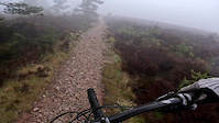
Start at Bennachie Centre, cross Milstone Hill and then over Mither Tap. Includes some good downhill sections rated hard.
Detailed Description
Bennachie Loop is a 14 mile moderately popular red route located near Inverurie. This mountain bike only route can be used one direction and has a hard overall physical rating. This route includes 10 trails. This route climbs 2,768 ft with a max elevation of 1,638 ft then descends -2,764 ft.
Local Trail Association
Please consider joining or donating to the local riding association to support trail development & maintenance.
donate to earn trail karma!
7 Reviews & Comments
-
+ 0

Trail Quarry
Blocked by fallen trees
[Reply]
Trails in Route
3,150 ft | |||||
1,785 ft | |||||
3,652 ft | |||||
1,188 ft | |||||
2,405 ft | |||||
2 miles | |||||
732 ft | |||||
1,923 ft | |||||
2,165 ft |
Details
More Stats for Bennachie Loop mountain bike route
-
Altitude min477 ft
-
Altitude start477 ft
-
Altitude end479 ft
-
Grade max-60.5%
-
Grade min57.3%
-
Distance climb7 miles
-
Distance down6 miles
-
Distance flat1 mile
close
3D
Trail Conditions
- Unknown
- Snow Groomed
- Snow Packed
- Snow Covered
- Snow Cover Inadequate
- Freeze/thaw Cycle
- Icy
- Prevalent Mud
- Wet
- Variable
- Ideal
- Dry
- Very Dry
Trail Flow (Ridden Direction)
Trailforks scans users ridelogs to determine the most popular direction each trail is ridden. A good flowing trail network will have most trails flowing in a single direction according to their intension.
The colour categories are based on what percentage of riders are riding a trail in its intended direction.
- > 96%
- > 90%
- > 80%
- > 70%
- > 50%
- < 50%
- bi-directional trail
- no data
Trail Last Ridden
Trailforks scans ridelogs to determine the last time a trail was ridden.
- < 2 days
- < 1 week
- < 2 weeks
- < 1 month
- < 6 months
- > 6 months
Trail Ridden Direction
The intended direction a trail should be ridden.
- Downhill Only
- Downhill Primary
- Both Directions
- Uphill Primary
- Uphill Only
- One Direction
Contribute Details
Colors indicate trail is missing specified detail.
- Description
- Photos
- Description & Photos
- Videos
Trail Popularity ?
Trailforks scans ridelogs to determine which trails are ridden the most in the last 9 months.
Trails are compared with nearby trails in the same city region with a possible 25 colour shades.
Think of this as a heatmap, more rides = more kinetic energy = warmer colors.
- most popular
- popular
- less popular
- not popular
ATV/ORV/OHV Filter
Max Vehicle Width
inches
Radar Time
x
Activity Recordings
Trailforks users anonymized public ridelogs from the past 6 months.
- mountain biking recent
- mountain biking (>6 month)
- hiking (1 year)
- moto (1 year)
Activity Recordings
Trailforks users anonymized public skilogs from the past 12 months.
- Downhill Ski
- Backcountry Ski
- Nordic Ski
- Snowmobile
Jump Magnitude Heatmap
Heatmap of where riders jump on trails. Zoom in to see individual jumps, click circles to view jump details.
Trails Deemphasized
Trails are shown in grey.
Only show trails with NO bikes.
Save the current map location and zoom level as your default home location whenever this page is loaded.
Save
Trail transparency
Photos
Videos

RedBull 5050
trail: The Line
17:32 | 578 | comments: 4 | favs: 5
Mar 23, 2012
Race day video from the 50/50.
Poor vis up top with 50 mph winds.
Almost 2 minute transition.
Flat peadley 'DH' track.
Crossed the line in...

new trick jump
trail: The Line
0:07 | 583 | comments: 0 | favs: 2
Jul 10, 2013
trick jumps running good but still strugling to get flip speed off the line...
Recent Trail Reports Along Route
more reports »
- By karloveloce
& contributors
- #33186 - 289 views