13.2 miles
Distance
2,429 ft
Climb
-2,438 ft
Descent
4,592 ft
High Point
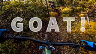
Good sized climb followed by progressively harder trails. Lots of views up high.
This route is usually dry by mid June. Check to make sure that Starbuck's is open before you climb up.
Detailed Description
Big Mac is a 13 mile moderately popular expert route located near Whitehorse Yukon. This mountain bike only route. This route includes 9 trails. This route climbs 2,429 ft with a max elevation of 4,592 ft then descends -2,438 ft.
Local Trail Association
Contagious Mountain Bike Club (cmbcyukon.ca)Please consider joining or donating to the local riding association to support trail development & maintenance.
donate to earn trail karma!
10 Reviews & Comments
We hope you've been enjoying Trailforks!
Create a FREE account to view route comments and much more.
Trails in Route
3 miles | |||||
1 mile | |||||
3 miles | |||||
2,507 ft | |||||
2 miles | |||||
912 ft | |||||
1,627 ft |
Details
-
Riding area
-
Primary ActivityMountain Bike
-
Difficulty ratingBlack Diamond
-
Bike typeAM
-
Ridelogs
More Stats for Big Mac mountain bike route
-
Avg time2 hr 15 min
-
Altitude change-7 ft
-
Altitude min2,681 ft
-
Altitude start2,757 ft
-
Altitude end2,749 ft
-
Grade max-61.1%
-
Grade min41.4%
-
Distance climb7 miles
-
Distance down5 miles
-
Distance flat1 mile
close
3D
Trail Conditions
- Unknown
- Snow Groomed
- Snow Packed
- Snow Covered
- Snow Cover Partial
- Freeze/thaw Cycle
- Icy
- Prevalent Mud
- Wet
- Variable
- Ideal
- Dry
- Very Dry
Trail Flow (Ridden Direction)
Trailforks scans users ridelogs to determine the most popular direction each trail is ridden. A good flowing trail network will have most trails flowing in a single direction according to their intension.
The colour categories are based on what percentage of riders are riding a trail in its intended direction.
- > 96%
- > 90%
- > 80%
- > 70%
- > 50%
- < 50%
- bi-directional trail
- no data
Trail Last Ridden
Trailforks scans ridelogs to determine the last time a trail was ridden.
- < 2 days
- < 1 week
- < 2 weeks
- < 1 month
- < 6 months
- > 6 months
Trail Ridden Direction
The intended direction a trail should be ridden.
- Downhill Only
- Downhill Primary
- Both Directions
- Uphill Primary
- Uphill Only
- One Direction
Contribute Details
Colors indicate trail is missing specified detail.
- Description
- Photos
- Description & Photos
- Videos
Trail Popularity ?
Trailforks scans ridelogs to determine which trails are ridden the most in the last 9 months.
Trails are compared with nearby trails in the same city region with a possible 25 colour shades.
Think of this as a heatmap, more rides = more kinetic energy = warmer colors.
- most popular
- popular
- less popular
- not popular
ATV/ORV/OHV Filter
Max Vehicle Width
inches
US Cell Coverage
Legend
Radar Time
x
Activity Recordings
Trailforks users anonymized public ridelogs from the past 6 months.
- mountain biking recent
- mountain biking (>6 month)
- hiking (1 year)
- moto (1 year)
Activity Recordings
Trailforks users anonymized public skilogs from the past 12 months.
- Downhill Ski
- Backcountry Ski
- Nordic Ski
- Snowmobile
Winter Trails
Warning
A routing network for winter maps does not exist. Selecting trails using the winter trails layer has been disabled.
x
Missing Trails
Most Popular
Least Popular
Trails are colored based on popularity. The more popular a trail is, the more red. Less popular trails trend towards green.
Jump Magnitude Heatmap
Heatmap of where riders jump on trails. Zoom in to see individual jumps, click circles to view jump details.
Trails Deemphasized
Trails are shown in grey.
Only show trails with NO bikes.
Save the current map location and zoom level as your default home location whenever this page is loaded.
Save
Trail transparency
Photos
Recent Trail Reports Along Route
more reports »
- By pburbidge
& contributors
- #16053 - 1,562 views