15.1 miles
Distance
3,263 ft
Climb
-3,262 ft
Descent
4,278 ft
High Point
2 ft
Altitude change
2,591 ft
Altitude min
3,491 ft
Altitude start
3,494 ft
Altitude end
-47.9%
Grade max
48.7%
Grade min
7 miles
Distance climb
7 miles
Distance down
4,659 ft
Distance flat

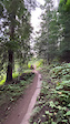
Good loop on CDA Mountain when accessing from Burma Rd on the east side of the lake. Minimizes forest service road driving and biking and provides nice warm-up and cool-down on CDA Mtn Rd.

Detailed Description
CDA Mountain Loop is a 15 mile moderately popular intermediate route located near Coeur d'Alene Idaho. This mountain bike primary route can be used one direction and has a hard overall physical rating. This route includes 8 trails. This route climbs 3,263 ft with a max elevation of 4,278 ft then descends -3,262 ft.

Trail Issues on Route

  • Significant Issue / Amber: 1 trail (newest: Apr 26, 2026)
  • Minor Issue / Yellow: 1 trail (newest: Nov 14, 2025)
Local Trail Association
Local trail association
Lake City Trail Alliance
Please consider joining or donating to the local riding association to support trail development & maintenance.
Donate to earn trail karma!

Trail Products

Stats

  • Distance
    15 miles
  • Altitude min
    2,591 ft
  • Altitude start
    3,491 ft
  • Altitude end
    3,494 ft
  • Climb
    3,263 ft
  • Descent
    -3,262 ft
  • Grade max
    -47.9%
  • Grade min
    48.7%
  • Distance climb
    7 miles
  • Distance down
    7 miles
  • Distance flat
    4,659 ft

30 Reviews & Comments


We hope you've been enjoying Trailforks!

Create a FREE account to view route comments and much more.

Details

  • Riding area
  • Primary Activity
    Mountain Bike
  • Other Activities
    • E-Bike
  • Difficulty rating
    Blue
  • Route Type
    Loop
  • eBike Allowed
  • Bike type
    AM
  • Direction
    One Direction
  • Physical rating
    Hard
no votes yet
close
3D
Trail Conditions
  • Unknown
  • Snow Groomed
  • Snow Packed
  • Snow Covered
  • Snow Cover Partial
  • Freeze/thaw Cycle
  • Icy
  • Prevalent Mud
  • Wet
  • Variable
  • Ideal
  • Dry
  • Very Dry
Trail Flow (Ridden Direction)
Trailforks scans users ridelogs to determine the most popular direction each trail is ridden. A good flowing trail network will have most trails flowing in a single direction according to their intension.
The colour categories are based on what percentage of riders are riding a trail in its intended direction.
  • > 96%
  • > 90%
  • > 80%
  • > 70%
  • > 50%
  • < 50%
  • bi-directional trail
  • no data
Trail Last Ridden
Trailforks scans ridelogs to determine the last time a trail was ridden.
  • < 2 days
  • < 1 week
  • < 2 weeks
  • < 1 month
  • < 6 months
  • > 6 months
Trail Ridden Direction
The intended direction a trail should be ridden.
  • Downhill Only
  • Downhill Primary
  • Both Directions
  • Uphill Primary
  • Uphill Only
  • One Direction
Contribute Details
Colors indicate trail is missing specified detail.
  • Description
  • Photos
  • Description & Photos
  • Videos
Trail Popularity ?
Trailforks scans ridelogs to determine which trails are ridden the most in the last 9 months. Trails are compared with nearby trails in the same city region with a possible 25 colour shades. Think of this as a heatmap, more rides = more kinetic energy = warmer colors.
  • most popular
  • popular
  • less popular
  • not popular
ATV/ORV/OHV Filter
Max Vehicle Width
inches
US Cell Coverage
Legend
cell carrier legend

Radar Time
Activity Recordings
Trailforks uses anonymized public activity data. ?
Activity Recordings
Trailforks uses anonymized public activity data. ?
Personal Heatmap
Activity Types
all / none
Options
2
Date range month
Winter Trails
Warning A routing network for winter maps does not exist. Selecting trails using the winter trails layer has been disabled.
Missing Trails
Most Popular
Least Popular
Trails are colored based on popularity. The more popular a trail is, the more red. Less popular trails trend towards green.
Jump Magnitude Heatmap
Heatmap of where riders jump on trails. Zoom in to see individual jumps, click circles to view jump details.
BC Backroad Status

Service Road Atlas is a free to use, community-driven service for viewing and creating reports on the numerous back-country service roads around B.C. and Alberta.

map legend
Slope Aspect
Direction the slope faces
Flat N NE E SE S SW W NW
Trails Deemphasized
Trails are shown in grey.
disable
Only show trails with no bike usage.
Enable
Suggested Layers
Based on selected activity type

    Save the current map location and zoom level as your default home location whenever this page is loaded.

    Save
    Trail transparency
    • Singletrack
    29
    29
    34
    27
    youtuber Discovering Idaho: #257 South Mt. Coeur D' Alene
    Discovering Idaho: #257 South Mt. Coeur D' Alene
    14:43 | 66 | comments: 0 | favs:
    Jan 4, 2026
    Faffing to hard
    Faffing to hard
    trail: Trail 257
    0:09 | 66 | comments: 0 | favs:
    Aug 22, 2024
    Log 1 Mr Faffer 0

    Recent Trail Reports Along Route

    statustraildateconditiondescription
    Trail 258
    Jun 5, 2026 @ 1:45pm (America/Creston)
    Jun 5, 2026
    Trail 257
    Jun 5, 2026 @ 1:45pm (America/Creston)
    Jun 5, 2026
    Caribou Ridge Trail
    Apr 30, 2026 @ 12:45pm (America/Los_Angeles)
    Apr 30, 2026
    Basically good unless you’re trying to set a running PR. Several blown down trees that are easy to get over.
    Trail 257 South
    Apr 26, 2026 @ 4:49pm (America/Los_Angeles)
    Apr 26, 2026
    MANY trees down. Some very difficult to pass.
    Pleasant Creek
    Nov 14, 2025 @ 7:09am (America/Los_Angeles)
    Nov 14, 2025
    awesome dirt as of the 11th of November, super fast, bit slick, but 6 ish trees down. did my best to make them passable
    more reports »
    • By kressTF Pro & contributors
    • #56773 - 567 views

    Hit the Trail

    Open in App

    Get this route on your phone instantly.

    Download Route

    Save to wishlist, Garmin & download.