10.7 miles
Distance
737 ft
Climb
-756 ft
Descent
543 ft
High Point
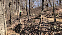
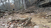
Classic Cherokee to Seneca Loop, starting at the Gravel lot / Frisbee / Rugby Field. Counter Clockwise is the popular direction, but can be ridden both ways.
Detailed Description
Cherokee Seneca Loop is a 11 mile popular intermediate route located near Louisville Kentucky. This mountain bike only route can be used both directions and has a moderate overall physical rating. This route includes 22 trails. This route climbs 737 ft with a max elevation of 543 ft then descends -756 ft.
Local Trail Association
Kentucky Mountain Bike Association - Louisville (www.kymba.org)Please consider joining or donating to the local riding association to support trail development & maintenance.
donate to earn trail karma!
6 Reviews & Comments
We hope you've been enjoying Trailforks!
Create a FREE account to view route comments and much more.
Trails in Route
5,157 ft | |||||
1,670 ft | |||||
2,566 ft | |||||
1,240 ft | |||||
1,250 ft | |||||
1,093 ft | |||||
1,145 ft | |||||
2,398 ft | |||||
564 ft | |||||
2 miles | |||||
768 ft | |||||
1,145 ft | |||||
1 mile | |||||
1,250 ft | |||||
1,713 ft | |||||
390 ft | |||||
1 mile | |||||
5,030 ft |
Details
-
Riding area
-
Primary ActivityMountain Bike
-
Difficulty ratingBlue
-
Route TypeLoop
-
eBike Allowed
-
Bike typeAM, XC
-
DirectionBoth Directions
-
Physical ratingModerate
-
Ridelogs
More Stats for Cherokee Seneca Loop mountain bike route
-
Avg time1 hr 21 min
-
Altitude min440 ft
-
Altitude start459 ft
-
Altitude end443 ft
-
Grade max-24.9%
-
Grade min30.9%
-
Distance climb5 miles
-
Distance down4 miles
-
Distance flat2 miles
close
3D
Trail Conditions
- Unknown
- Snow Groomed
- Snow Packed
- Snow Covered
- Snow Cover Partial
- Freeze/thaw Cycle
- Icy
- Prevalent Mud
- Wet
- Variable
- Ideal
- Dry
- Very Dry
Trail Flow (Ridden Direction)
Trailforks scans users ridelogs to determine the most popular direction each trail is ridden. A good flowing trail network will have most trails flowing in a single direction according to their intension.
The colour categories are based on what percentage of riders are riding a trail in its intended direction.
- > 96%
- > 90%
- > 80%
- > 70%
- > 50%
- < 50%
- bi-directional trail
- no data
Trail Last Ridden
Trailforks scans ridelogs to determine the last time a trail was ridden.
- < 2 days
- < 1 week
- < 2 weeks
- < 1 month
- < 6 months
- > 6 months
Trail Ridden Direction
The intended direction a trail should be ridden.
- Downhill Only
- Downhill Primary
- Both Directions
- Uphill Primary
- Uphill Only
- One Direction
Contribute Details
Colors indicate trail is missing specified detail.
- Description
- Photos
- Description & Photos
- Videos
Trail Popularity ?
Trailforks scans ridelogs to determine which trails are ridden the most in the last 9 months.
Trails are compared with nearby trails in the same city region with a possible 25 colour shades.
Think of this as a heatmap, more rides = more kinetic energy = warmer colors.
- most popular
- popular
- less popular
- not popular
ATV/ORV/OHV Filter
Max Vehicle Width
inches
US Cell Coverage
Legend
Radar Time
x
Activity Recordings
Trailforks users anonymized public ridelogs from the past 6 months.
- mountain biking recent
- mountain biking (>6 month)
- hiking (1 year)
- moto (1 year)
Activity Recordings
Trailforks users anonymized public skilogs from the past 12 months.
- Downhill Ski
- Backcountry Ski
- Nordic Ski
- Snowmobile
Winter Trails
Warning
A routing network for winter maps does not exist. Selecting trails using the winter trails layer has been disabled.
x
Missing Trails
Most Popular
Least Popular
Trails are colored based on popularity. The more popular a trail is, the more red. Less popular trails trend towards green.
Jump Magnitude Heatmap
Heatmap of where riders jump on trails. Zoom in to see individual jumps, click circles to view jump details.
Trails Deemphasized
Trails are shown in grey.
Only show trails with NO bikes.
Save the current map location and zoom level as your default home location whenever this page is loaded.
Save
Trail transparency
Photos
Videos

Slow Turn Crash
trail: Cherokee Loop
40 | comments: 0 | favs:
Jul 10, 2024
My brother on his second trail on a new to him bike taking a turn too slow and grabbing brakes.

Lower Big Rock Trail
trail: Cherokee Loop
0:09 | 287 | comments: 0 | favs:
Nov 19, 2019
Lower Big Rock Trail
Recent Trail Reports Along Route
more reports »
- By baileyhayden & contributors
- #16997 - 1,826 views