31.5 miles
Distance
3,112 ft
Climb
-3,107 ft
Descent
4,234 ft
High Point
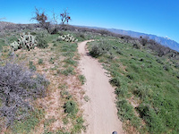
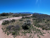
This is a great ride with some steep climbs up the road up to Maus. There are som technical spots at the beginning of Maus through the notch at the head of the canyon. A few spots there that I usually just walk the bike through. The rest of this trail is a great ride back down to honeybee and back. The lower elevation stuff after honeybee is back on pavement to Moore rd.
Detailed Description
Como loop is a 32 mile moderately popular intermediate route located near Oro Valley Arizona. This mountain bike only route can be used one direction and has a hard overall physical rating. This route includes 8 trails. This route climbs 3,112 ft with a max elevation of 4,234 ft then descends -3,107 ft.
Local Trail Association
Please consider joining or donating to the local riding association to support trail development & maintenance.
14 Reviews & Comments
-
+ 0


Trail Maus
Severely overgrown after this monsoon season.
[Reply]

Trail Honeybee West
Highly recommend riding up HB East, and back down HB West. West has some more fun rocky features to roll down, easy to flow down, plus some long smooth sections of fast cruising. Climbing up them would be not so fun.
[Reply]


Trail Ridgeline Trail
Great trail! Love the long climb to beautiful views and the descent was really fun and left me breathing hard too! Hard to get to, but so worth it.
[Reply]

Trail Alamo Spring (upper)
Top section here is advanced rideable but still some hike-a-bike. 4 yrs later from my first review. I'm a high-intermediate rider...but still was hard...if you don't mind the extreme hoisting of your bike for the half-mille to get to this section....it will be worth it to you but at least you'll have an accurate description before hand, unless of course you're superhuman????
[Reply]

Trail Alamo Spring (upper)
Entirely rideable above the spur, like really not that hard.
[Reply]


Trail Ridgeline Trail
How do you up to this without some crazy HAB??? We rode up wild burro only to end up on a double black up hill suffer fest
[Reply]


Trail Ridgeline Trail
Approach via the Honeybee trails to the east via www.trailforks.com/trails/tortolita-mountain-park-access
[Reply]
Joshuaraspberry
(Mar 27, 2019 at 11:44)
Trail Dove Mountain Access
An owner blocked the rod with his truck and was armed. I never saw a no trespassing sign on the road. I was fixing my fork earlier on the road see went ahead and set up. I’m a first timer out here and he was really heated about riders going out here. Bummer.
[Reply]
LukeSimmons
(Mar 17, 2019 at 23:37)
Trail Ridgeline Trail
Easy trail except for the hairpin turns and some small gaps. But absolutely the most amazing views in Tucson!
[Reply]

Trail Dove Mountain Access
There is now a huge gate and 'No Trespassing' sign on the east portion of this road. Requires some Indiana Jones moves to get around it. I didn't see the west portion, must be very faint.
[Reply]


Trail Ridgeline Trail
One of the best trails that I have ridden in the Tucson area. Be aware that there can be a lot of hikers on the weekends.
[Reply]

Trail Alamo Spring (upper)
So yeah not rideable hell its barel walkable
[Reply]

Trail Ridgeline Trail
Awesome 360 degrees views with tight singletrack...I would rate a 4.75 star not a 3 star as I accidentally did in the average rating section. When connected to the Wild Burro--upper section loop, it's a sweet ride!
[Reply]
Trails in Route
2 miles | |||||
1,043 ft | |||||
3 miles | |||||
2 miles | |||||
4 miles | |||||
5,226 ft |
Details
-
Primary ActivityMountain Bike
-
Difficulty ratingBlue
-
Route TypeLoop
-
DirectionOne Direction
-
Physical ratingHard
-
Ridelogs
More Stats for Como loop mountain bike route
-
Altitude min2,850 ft
-
Altitude start2,880 ft
-
Altitude end2,884 ft
-
Grade max-32.7%
-
Grade min42.5%
-
Distance climb12 miles
-
Distance down15 miles
-
Distance flat5 miles
close
3D
Trail Conditions
- Unknown
- Snow Groomed
- Snow Packed
- Snow Covered
- Snow Cover Inadequate
- Freeze/thaw Cycle
- Icy
- Prevalent Mud
- Wet
- Variable
- Ideal
- Dry
- Very Dry
Trail Flow (Ridden Direction)
Trailforks scans users ridelogs to determine the most popular direction each trail is ridden. A good flowing trail network will have most trails flowing in a single direction according to their intension.
The colour categories are based on what percentage of riders are riding a trail in its intended direction.
- > 96%
- > 90%
- > 80%
- > 70%
- > 50%
- < 50%
- bi-directional trail
- no data
Trail Last Ridden
Trailforks scans ridelogs to determine the last time a trail was ridden.
- < 2 days
- < 1 week
- < 2 weeks
- < 1 month
- < 6 months
- > 6 months
Trail Ridden Direction
The intended direction a trail should be ridden.
- Downhill Only
- Downhill Primary
- Both Directions
- Uphill Primary
- Uphill Only
- One Direction
Contribute Details
Colors indicate trail is missing specified detail.
- Description
- Photos
- Description & Photos
- Videos
Trail Popularity ?
Trailforks scans ridelogs to determine which trails are ridden the most in the last 9 months.
Trails are compared with nearby trails in the same city region with a possible 25 colour shades.
Think of this as a heatmap, more rides = more kinetic energy = warmer colors.
- most popular
- popular
- less popular
- not popular
ATV/ORV/OHV Filter
Max Vehicle Width
inches
Radar Time
x
Activity Recordings
Trailforks users anonymized public ridelogs from the past 6 months.
- mountain biking recent
- mountain biking (>6 month)
- hiking (1 year)
- moto (1 year)
Activity Recordings
Trailforks users anonymized public skilogs from the past 12 months.
- Downhill Ski
- Backcountry Ski
- Nordic Ski
- Snowmobile
Jump Magnitude Heatmap
Heatmap of where riders jump on trails. Zoom in to see individual jumps, click circles to view jump details.
Trails Deemphasized
Trails are shown in grey.
Only show trails with NO bikes.
Save the current map location and zoom level as your default home location whenever this page is loaded.
Save
Trail transparency
Photos
Recent Trail Reports Along Route
more reports »
- By longbowdon & contributors
- #5234 - 822 views