43.8 miles
Distance
4,290 ft
Climb
-4,281 ft
Descent
2 miles
High Point
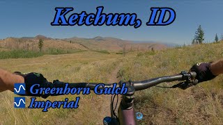
Elkhorn-Greenhorn Gulch-Up Imperial and across Mars Ridge (Very Difficult)-Down Red Warrior (river crossing at bottom)-down Warm Springs Road back to Elkhorn
Detailed Description
Condo-Mars Ridge Loop is a 44 mile popular intermediate route located near Sun Valley Idaho. This mountain bike only route. This route includes 20 trails. This route climbs 4,290 ft with a max elevation of 8,503 ft then descends -4,281 ft.
Local Trail Association
Wood River Trails Coalition (woodrivertrailscoalition.org)Please consider joining or donating to the local riding association to support trail development & maintenance.
donate to earn trail karma!
Trail Products
-
Idaho's Mountain Bike License PlateTrail Pass
22 Reviews & Comments
-
+ 0
Dankaelberer
(Jul 23, 2022 at 21:17)

Trail Greenhorn to Imperial Gulch
Fantastic flowy single track. Start up Greenhorn and down Imperial. Lots of river crossings on your way up. Trail is a little dusty, but to be expected end of July. The climb is good - could use a switchback or two towards the top - quite a grind at the end of your climb, but manageable. Downhill is super flowy with great turns, long runs where you can get some speed and some fun mild technical spots. Great ride!
[Reply]
Dankaelberer
(Jul 23, 2022 at 21:17)

Fantastic flowy single track. Start up Greenhorn and down Imperial. Lots of river crossings on your way up. Trail is a little dusty, but to be expected end of July. The climb is good - could use a switchback or two towards the top - quite a grind at the end of your climb, but manageable. Downhill is super flowy with great turns, long runs where you can get some speed and some fun mild technical spots. Great ride!
[Reply]


Great 10 mile loop 1700 vert. Nice grade to high point with only a few very punchy spots. Great flow to trail head. Dusty at bottom
[Reply]


Great 10 mile loop 1700 vert. Nice grade to high point with only a few very punchy spots. Great flow to trail head. Dusty at bottom
[Reply]
DavidBlankenship
(Aug 30, 2021 at 15:07)

Trail conditions were good today. A little dry and dusty but not too bad. Rode counter clockwise. Coming down Imperial was fantastic.
[Reply]
DavidBlankenship
(Aug 30, 2021 at 15:07)

Trail conditions were good today. A little dry and dusty but not too bad. Rode counter clockwise. Coming down Imperial was fantastic.
[Reply]

Excellent ride. Definetly best to do it as a counter-clockwise loop. Has very nice high speed sections with great turns for carving. Not technical but very fun.
[Reply]

Excellent ride. Definetly best to do it as a counter-clockwise loop. Has very nice high speed sections with great turns for carving. Not technical but very fun.
[Reply]
Thebeave
(Jun 24, 2021 at 21:12)

Agree about the great views and fun singles. I like this trail in mornings
[Reply]
Thebeave
(Jun 24, 2021 at 21:12)

Agree about the great views and fun singles. I like this trail in mornings
[Reply]
bhawk
(Jun 24, 2021 at 18:04)
Mellow climbing grade with some moto whoops and small water crossings through burnt out forest. Multi use trail so there’s also some horse poop in spots. The descent has Epic views, ripping single track, flowery meadows, with some rocky tech spots but nothing too sketchy.
[Reply]
AFugax
(Jun 27, 2020 at 16:44)

FYI- this is also a dirt bike trail - hence the 2-4 inches of dusty dirt. Some of it is fun, but I would have to disagree with the PB article from 2018 that labeled this loop as “legendary” ...it’s more meh! Please list that this is also a dirt bike trail and then those who do not want to ride in fine powder can avoid it. This was even in June, after a huge rain storm the evening before last.
[Reply]
Craigrf
(Jul 9, 2019 at 14:37)
Lots of puddles and some mud after recent rains, rode great otherwise.
[Reply]
Craigrf
(Jul 9, 2019 at 14:37)
Lots of puddles and some mud after recent rains, rode great otherwise.
[Reply]


Trail Red Warrior (152)
Good consistent climb with many creek crossings and an occasional log over the trail. I used it to access Warfield.
[Reply]


Trail Red Warrior (152)
Good consistent climb with many creek crossings and an occasional log over the trail. I used it to access Warfield.
[Reply]
Trails in Route
3,048 ft | |||||
3,780 ft | |||||
1 mile | |||||
6 miles | |||||
2 miles | |||||
3 miles | |||||
2,999 ft | |||||
446 ft | |||||
1,175 ft | |||||
2,113 ft | |||||
1,847 ft |
Details
-
Riding area
-
Primary ActivityMountain Bike
-
Difficulty ratingBlue
-
Bike typeAM
More Stats for Condo-Mars Ridge Loop mountain bike route
-
Altitude change8 ft
-
Altitude min5,574 ft
-
Altitude start6,109 ft
-
Altitude end6,115 ft
-
Grade max-38.7%
-
Grade min40.1%
-
Distance climb17 miles
-
Distance down25 miles
-
Distance flat2 miles
close
3D
Trail Conditions
- Unknown
- Snow Groomed
- Snow Packed
- Snow Covered
- Snow Cover Inadequate
- Freeze/thaw Cycle
- Icy
- Prevalent Mud
- Wet
- Variable
- Ideal
- Dry
- Very Dry
Trail Flow (Ridden Direction)
Trailforks scans users ridelogs to determine the most popular direction each trail is ridden. A good flowing trail network will have most trails flowing in a single direction according to their intension.
The colour categories are based on what percentage of riders are riding a trail in its intended direction.
- > 96%
- > 90%
- > 80%
- > 70%
- > 50%
- < 50%
- bi-directional trail
- no data
Trail Last Ridden
Trailforks scans ridelogs to determine the last time a trail was ridden.
- < 2 days
- < 1 week
- < 2 weeks
- < 1 month
- < 6 months
- > 6 months
Trail Ridden Direction
The intended direction a trail should be ridden.
- Downhill Only
- Downhill Primary
- Both Directions
- Uphill Primary
- Uphill Only
- One Direction
Contribute Details
Colors indicate trail is missing specified detail.
- Description
- Photos
- Description & Photos
- Videos
Trail Popularity ?
Trailforks scans ridelogs to determine which trails are ridden the most in the last 9 months.
Trails are compared with nearby trails in the same city region with a possible 25 colour shades.
Think of this as a heatmap, more rides = more kinetic energy = warmer colors.
- most popular
- popular
- less popular
- not popular
ATV/ORV/OHV Filter
Max Vehicle Width
inches
Radar Time
x
Activity Recordings
Trailforks users anonymized public ridelogs from the past 6 months.
- mountain biking recent
- mountain biking (>6 month)
- hiking (1 year)
- moto (1 year)
Activity Recordings
Trailforks users anonymized public skilogs from the past 12 months.
- Downhill Ski
- Backcountry Ski
- Nordic Ski
- Snowmobile
Jump Magnitude Heatmap
Heatmap of where riders jump on trails. Zoom in to see individual jumps, click circles to view jump details.
Trails Deemphasized
Trails are shown in grey.
Only show trails with NO bikes.
Save the current map location and zoom level as your default home location whenever this page is loaded.
Save
Trail transparency
Photos
Videos
youtuber

The Best Day Ever / Moose Rut x Mountain Biking in Sun Valley, ID
trail: Greenhorn to Imperial Gulch
2:09 | 29 | comments: 0 | favs:
Dec 31, 2022
youtuber

Greenhorn Gulch and Imperial Trail
trail: Greenhorn to Imperial Gulch
10:29 | 61 | comments: 0 | favs:
Aug 26, 2022
Recent Trail Reports Along Route
more reports »
- By Joeyrobby
& contributors
- #9683 - 1,062 views