
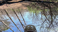
Dark & Stormy is an intermediate/advanced tour of Sharps Ridge that takes advantage of the park’s all-weather trails and directional downhill runs. Climb the ridge, then let gravity do the work on Knight Fall and Pitch Black, with fast descents, berms, technical features, and plenty of opportunities to pick up speed.
Sharps Ridge is one of Knoxville’s go-to wet-weather riding destinations, making Dark & Stormy a great choice when many other area trails are too wet to ride. Expect repeated climbs and rewarding descents as the route works its way across the ridge.
Check current trail conditions before riding and pay attention to directional trail signage.

Trail Issues on Route
- Significant Issue / Amber: 2 trails (newest: May 31, 2026)
- Minor Issue / Yellow: 1 trail (newest: Jul 16, 2026)
Local Trail Association
Appalachian Mountain Bike Club (ambcknox.org)Stats
-
Distance8 miles
-
Avg time41 min 55 sec
-
Altitude change1 ft
-
Altitude min1,060 ft
-
Altitude start1,060 ft
-
Altitude end1,060 ft
-
Climb1,053 ft
-
Descent-1,050 ft
-
Grade max-27.9%
-
Grade min37.6%
-
Distance climb4 miles
-
Distance down3 miles
-
Distance flat1 mile
3 Reviews & Comments
We hope you've been enjoying Trailforks!
Create a FREE account to view all route reviews and much more.
Trails in Route
| 289 ft | |||||
| 1,581 ft | |||||
| 1,237 ft | |||||
| 1,010 ft | |||||
| 2 miles | |||||
| 2,329 ft | |||||
| 269 ft |
Details
-
Riding area
-
Primary ActivityMountain Bike
-
Difficulty ratingBlue
-
Activity Logs
- Unknown
- Snow Groomed
- Snow Packed
- Snow Covered
- Snow Cover Partial
- Freeze/thaw Cycle
- Icy
- Prevalent Mud
- Wet
- Variable
- Ideal
- Dry
- Very Dry
The colour categories are based on what percentage of users are riding a trail in its intended direction.
- > 96%
- > 90%
- > 80%
- > 70%
- > 50%
- < 50%
- bi-directional trail
- no data
- < 2 days
- < 1 week
- < 2 weeks
- < 1 month
- < 6 months
- > 6 months
- Downhill Only
- Downhill Primary
- Both Directions
- Uphill Primary
- Uphill Only
- One Direction
- Description
- Photos
- Description & Photos
- Videos
- most popular
- popular
- less popular
- not popular
Service Road Atlas is a free to use, community-driven service for viewing and creating reports on the numerous back-country service roads around B.C. and Alberta.
Save the current map location and zoom level as your default home location whenever this page is loaded.
Save- Singletrack
Photos
Videos
Recent Trail Reports Along Route
- By mtkellogg
AMBC & contributors - #69236 - 23 views
