10.9 miles
Distance
932 ft
Climb
-931 ft
Descent
443 ft
High Point
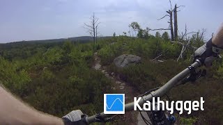
En tur genom några av delsjöområdets mest klassiska stigar som kommer ta ungefär 2 - 2½ timmar att köra igenom. Stigarna är av typisk Dejsökaraktär med en hel del tekniska partier och stigar i småkuperad terräng, på dessa stigar går det nästan aldrig på platten utan det är små klättringar och utförslöpor varvat omvartannat.
Detailed Description
Delsjön classics is a 11 mile popular red route located near Göteborg. This mountain bike only route and has a moderate overall physical rating. This route includes 29 trails. This route climbs 932 ft with a max elevation of 443 ft then descends -931 ft.
Local Trail Association
Göteborgs Stigcyklister (www.goteborgsstigcyklister.se)Please consider joining or donating to the local riding association to support trail development & maintenance.
donate to earn trail karma!
8 Reviews & Comments
We hope you've been enjoying Trailforks!
Create a FREE account to view route comments and much more.
Trails in Route
1 mile | |||||
1,053 ft | |||||
1,644 ft | |||||
1,270 ft | |||||
1,562 ft | |||||
449 ft | |||||
669 ft | |||||
2,572 ft | |||||
489 ft | |||||
2,618 ft | |||||
187 ft | |||||
1,175 ft | |||||
443 ft | |||||
144 ft | |||||
971 ft | |||||
89 ft | |||||
876 ft | |||||
2,877 ft | |||||
4,918 ft | |||||
892 ft | |||||
781 ft | |||||
144 ft | |||||
295 ft | |||||
2,224 ft | |||||
1,870 ft | |||||
3,520 ft | |||||
1,378 ft | |||||
794 ft | |||||
203 ft |
Details
-
Riding area
-
Primary ActivityMountain Bike
-
Difficulty ratingRed
-
Route TypeLoop
-
eBike Allowed
-
Bike typeAM, XC
-
Physical ratingModerate
-
Ridelogs
More Stats for Delsjön classics mountain bike route
-
Altitude min146 ft
-
Altitude start164 ft
-
Altitude end164 ft
-
Grade max-35%
-
Grade min31.5%
-
Distance climb4 miles
-
Distance down5 miles
-
Distance flat1 mile
close
3D
Trail Conditions
- Unknown
- Snow Groomed
- Snow Packed
- Snow Covered
- Snow Cover Inadequate
- Freeze/thaw Cycle
- Icy
- Prevalent Mud
- Wet
- Variable
- Ideal
- Dry
- Very Dry
Trail Flow (Ridden Direction)
Trailforks scans users ridelogs to determine the most popular direction each trail is ridden. A good flowing trail network will have most trails flowing in a single direction according to their intension.
The colour categories are based on what percentage of riders are riding a trail in its intended direction.
- > 96%
- > 90%
- > 80%
- > 70%
- > 50%
- < 50%
- bi-directional trail
- no data
Trail Last Ridden
Trailforks scans ridelogs to determine the last time a trail was ridden.
- < 2 days
- < 1 week
- < 2 weeks
- < 1 month
- < 6 months
- > 6 months
Trail Ridden Direction
The intended direction a trail should be ridden.
- Downhill Only
- Downhill Primary
- Both Directions
- Uphill Primary
- Uphill Only
- One Direction
Contribute Details
Colors indicate trail is missing specified detail.
- Description
- Photos
- Description & Photos
- Videos
Trail Popularity ?
Trailforks scans ridelogs to determine which trails are ridden the most in the last 9 months.
Trails are compared with nearby trails in the same city region with a possible 25 colour shades.
Think of this as a heatmap, more rides = more kinetic energy = warmer colors.
- most popular
- popular
- less popular
- not popular
ATV/ORV/OHV Filter
Max Vehicle Width
inches
Radar Time
x
Activity Recordings
Trailforks users anonymized public ridelogs from the past 6 months.
- mountain biking recent
- mountain biking (>6 month)
- hiking (1 year)
- moto (1 year)
Activity Recordings
Trailforks users anonymized public skilogs from the past 12 months.
- Downhill Ski
- Backcountry Ski
- Nordic Ski
- Snowmobile
Jump Magnitude Heatmap
Heatmap of where riders jump on trails. Zoom in to see individual jumps, click circles to view jump details.
Trails Deemphasized
Trails are shown in grey.
Only show trails with NO bikes.
Save the current map location and zoom level as your default home location whenever this page is loaded.
Save
Trail transparency
Photos
Videos

Delsjön - Kalhygget vid västra långvattnet
2:36 | 801 | comments: 0 | favs:
May 29, 2018
Recent Trail Reports Along Route
status | trail | date | condition | description |
---|---|---|---|---|
Dec 17, 2022 @ 7:12pm Dec 17, 2022 | ||||
Nov 26, 2022 @ 9:57pm Nov 26, 2022 | ||||
Nov 16, 2022 @ 5:50pm Nov 16, 2022 | ||||
Nov 8, 2022 @ 5:55pm Nov 8, 2022 |
- By stenmark & contributors
- #11613 - 9,741 views