
Open in App
Get this route on your phone instantly.
You'll park at the four-way near the end of Stephanie's Trail and where High Drive comes out. Climb up Gold Camp Road to the end of Captain Jack's and between the first tunnel will be your first descent on Spring Creek Trail on your left.
Enjoy it because Columbine Trail heading west (right turn) will be punishing you for that quick hit. Keep following signs for the Columbine Trail through several intersections until you reach the upper Cheyenne parking lot.
Cross the road to High Drive Climb - The Easy Side and hop over the fence. A short climb of a mile and you'll descend Captain Jack's on your right through a motorized gate. *I know you can descend other trails off of Jacks, so just have fun*
From the end of Captain Jack's, head up Gold Camp Road through the tunnels until you're back at the upper Cheyenne parking lot. Go through the gate and boulders on the far side by the port-a-potties. Continue up until you reach the connector for Buckhorn (#776) Cutoff Trail on the right side, about 0.75 miles.
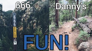
After this climb, which never gets any easier, you'll be at a flat four-way intersection of #776 (Buckhorn) and #667 (Jones/Jacks). To the right is the descent down Captain Jack's (this section is incorrectly and unofficially known as Buckhorn), left continues up to Jones Park #667 and straight (10 yards uphill) is the connecter to Bear Creek Trail (#666) (still technically Buckhorn #776). Look for the Forest Service brown sign to help!
This first descent of #776 is fun and mellow in the beginning. Then it becomes quite loose and fast! Mind those pedals and handlebars through some tight sections. The short descent of Buckhorn will end at Bear Creek Trail (#666) with a sharp, loose right hand switchback.
From here, it's just hold on and have fun until you reach High Drive. Then continue downhill until the green gate near the intersection where you parked!
We hope you've been enjoying Trailforks!
Create a FREE account to view route comments and much more.
| 3,284 ft | |||||
| 1 mile | |||||
| 2,352 ft | |||||
| 1 mile |

Service Road Atlas is a free to use, community-driven service for viewing and creating reports on the numerous back-country service roads around B.C. and Alberta.
Save the current map location and zoom level as your default home location whenever this page is loaded.
Save