
Open in App
Get this route on your phone instantly.
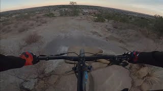
Start in Palmer at the northeast entrance off of Brenner Place. There is a "Greencrest" sign with trails on either side, both will get you to the start, but the left one is more direct. You'll see an official signpost pointing uphill to get you to Jedi to start the course.
Jedi is a fast, smooth single track that is great either way. Since this is a beginner course, you get the easiest climb right out the gate. Eventually you'll merge with Greencrest right under a power line tower, continue about a 100ft until a Y intersection with an unlabeled signpost. Take the left.
Quickly after, you'll cross over Youth Camp Trail and look for a new trail to your right that heads under another power line. This will end at another busy intersection, stay low to the right to pass under a picnic table towards a chain gate blocking vehicles from Paseo Rd.
Follow the Greencrest sign through the boulders to start a descent to the dog park. At mile 1, you'll have an intersection with Kinnickinick, take the right to cross over Paseo onto Kinnickinick. Now your day gets a little harder.
Take the right at mile 1.2 to climb Upper Kinnickinick as you ascent the drainage. Continue straight through the next Kinnickinick intersection to the gravel lot at mile 1.4. Cross over Paseo again and take a left onto Grandview. You're going to cross Paseo again at mile 1.5 to stay on Grandview, take a left.
Stay on Grandview as the trail gets easier and pops out onto a nice plateu. In the high yucca, you'll have a right turn at mile 1.9 onto Grandview Loop, then to Grandview Connector. This gets fast and swervy as you descent towards East Cheyenne.
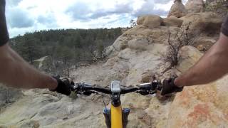
At mile 2, the trail will get rocky with low tree branches. Manage the tech as you work left onto East Cheyenne. Climb this back to Grandview to take a right at mile 2.3.
Mile 2.4, take the right onto South Canyon to descent off the plateu. There are a lot of rocks but it has plenty of smooth lines through them. There's a quick Y-intersection at mile 2.5, stay left. Then another intersection at mile 2.8, stay right to keep desending to Grandview throught the tight scrub oak.
Mile 2.9, take a left before the sandwash to join Grandview's new trail work. Take this until it hits pavement at mile 3.1, use the crosswalk over Paseo, then left onto Palmer Park Acc. You'll ride through the Stables parking lot on your right to join Palmer Point Trail at mile 3.2 on your left.
This is the longest piece of trail without a lot of directions Stay straight on Palmer Point Trail at mile 3.8 and 3.9. At mile 4.4, you'll be looking at Austin Bluffs, stay right on the trail with a rocky, armored section. If you end up on a sidewalk, you missed your turn.
Manage the tech as you are punished in the end. The tech eases up a mile 4.7 as you join a double track dirt road to sprint to the finish. Once you hit the parking lot for Lazy Loop Pavilion, you're done!
We hope you've been enjoying Trailforks!
Create a FREE account to view route comments and much more.
| 2,969 ft | |||||
| 243 ft | |||||
| 2,388 ft | |||||
| 197 ft | |||||
| 1 mile |

Service Road Atlas is a free to use, community-driven service for viewing and creating reports on the numerous back-country service roads around B.C. and Alberta.
Save the current map location and zoom level as your default home location whenever this page is loaded.
Save