

Open in App
Get this route on your phone instantly.
***There is construction off of Academy Blvd. with signs that say "Road Closed". You can still access the trail head as the road is closed further west***
Do not try to ride on game day.
Need a valid ID to gain access to USAFA. Non-military hours are from 0530-2200. Check the website for updates:
https://www.usafa.edu/visitors/getting-on-base/
This month's course is cardio with an extension to Falcon the less popular direction.
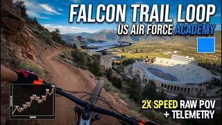
Start at the trailhead north of the stadium off of Academy Dr.. Ride south (clockwise) onto Falcon Trail until the first road crossing, Rd. 402. Then leave Falcon Trail by turning left (east) towards the stadiuim. You will cut through the stadium parking lot angling towards the stadium at first, then pavement as you near, go through the barriers and then exit on the NE bound round towards Stadium Blvd.
Cross Stadium Blvd. to a unnamed, dirt maintenance road. Follow this east and north around "Non-Potable Resorvoir #1" to Husted Rd. Turn left (west) and this will turn back to pavement. Cross Stadium Blvd. onto Academy Dr. to climb towards the starting trailhead. Turn right onto a dirt access road heading north that will access Falcon Trail.
Turn right onto Falcon Trail to complete the loop counter clockwise.
At the bottom of the Stanley Canyon descent, there are two options: Black (more difficult) to the left and the other one. You will take the more difficult as the other trail does not exist for this course.
Continue on Falcon until you reach the starting trailhead and you're done
#hardroutehardbody

We hope you've been enjoying Trailforks!
Create a FREE account to view all route reviews and much more.

| 28 miles |


Service Road Atlas is a free to use, community-driven service for viewing and creating reports on the numerous back-country service roads around B.C. and Alberta.
Save the current map location and zoom level as your default home location whenever this page is loaded.
Save| status | trail | date | condition | description |
|---|---|---|---|---|
Oct 20, 2025 @ 10:25am (America/Denver) Oct 20, 2025 | Soft sand / kitty litter throughout, but still a great quality trail. |