

Open in App
Get this route on your phone instantly.
Start from the Section 16 trailhead off of Gold Camp Road. Continue up Gold Camp through the fourway stop at the bottom of High Drive. At mile 0.65, Stephanie's Trail will be on your left in a dirt parking lot and a chain gate. Get warmed up on some tech for the next mile
When you hit Bear Creek Road, hang a left and climb toward High Drive Climb - The steep side. At mile 2.6, look for Palmer Trail on your right to keep climbing singletrack. You'll have an easier climb as the trail meanders through the woods until mile 5.6 when the descent really kicks in.
Keep that traction as the trail is always loose at the top! Have fun and keep that seat lowered.
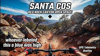
After the trail is less steep, look for a left turn onto Intemann Trail into Red Rocks Open Space. Keep in mind, there are some reroutes and construction, so this may be awkward. Connect with Red Rock Canyon Overlook Trail (Santa COS on Strava) at mile 6.7 and hang a right.
New reroutes at mile 7.4 as you make a hard right on an armored turn to climb up to connect back with the older Santa COS at mile 7.7. Keep climbing to mile 8.1 when you'll have a right turn onto Dirty Acres. Finish the climb at the five way intersection by the bench.
Continue down Section 16 Trail with a blind switchback left turn at mile 8.7. Finish the descent back at the Section 16 trailhead.

We hope you've been enjoying Trailforks!
Create a FREE account to view all route reviews and much more.

| 2 miles | |||||
| 1 mile | |||||
| 1 mile | |||||
| 587 ft | |||||
| 1,726 ft | |||||
| 1,499 ft |

Service Road Atlas is a free to use, community-driven service for viewing and creating reports on the numerous back-country service roads around B.C. and Alberta.
Save the current map location and zoom level as your default home location whenever this page is loaded.
Save