
more stats
2.4 miles
Distance
79 ft
Climb
-1,260 ft
Descent
00:20:54
Avg time
-1,181 ft
Altitude change
6,643 ft
Altitude min
7,851 ft
Altitude max
7,824 ft
Altitude start
6,644 ft
Altitude end
-9.1%
Grade
-52.3%
Grade max
15.9%
Grade min
1,555 ft
Distance climb
2 miles
Distance down
640 ft
Distance flat
00:20:54
Avg time

Section 16 Details

  • Activities
    • Mountain Bike
    • Hike
    • Trail Running
  • Riding Area
    Red Rock Canyon Open Space
    Colorado Springs, Colorado
  • Difficulty Rating
  • Voted Difficulty
    Black Diamond (7 votes)
  • Local Popularity
    75 in Mountain Biking [+]
    • 100 in Trail Running
    • 100 in Hiking
  • Global Ranking
    #31454 in Mountain Biking [+]
    • #59641 in Trail Running
    • #65105 in Hiking
  • State Ranking
    #423 in Mountain Biking · Colorado [+]
    • #1,841 in Trail Running
    • #2,077 in Hiking
  • Hiking SAC Scale
    T2 Mountain Hiking
  • Trail Type
    Singletrack
  • Bike Type
    DH, AM
  • Direction
    Both Directions
  • Trail Visibility
    Always easy to follow
  • Dogs Allowed
    Yes
  • eBike Allowed
  • TTFs on Trail
    Rock Garden
  • Ride in Rain
    Yes

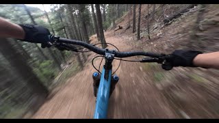
Loose, very rocky and fun descent

From the top is downhill only while you can utilize the bottom third (Intemann to Gold Camp) as a connector in both directions for Red Rocks Open Space.

Tags
Rock gardensRocky
Trail Supporters
  • BLM
    BLM
    Land Manager
Local Trail Association

Recent Activity on Trail

Past Week
  • 1 rides
  • 29 miles average
6 Months
  • 54 rides
  • 16 miles avg distance
All
  • 273 rides
  • Last: Oct 5, 2026
c1c2c3c4
January
February
March
April
May
June
July
August
September
October
November
December
Status:
on Aug 22, 2026
Very Dry
Avg: 4.47 (17 votes)
Your vote: 0

view (2,949)
close
      Directions to section-16-37798 trailhead (38.824840, -104.911320)

      Photos

      12 more »
      mtb
      76 |
      Sep 2, 2026 @ 1:50pm
      Sep 2, 2026
      mtb
      80 |
      Sep 2, 2026 @ 1:50pm
      Sep 2, 2026
      mtb
      378 |
      Sep 3, 2018 @ 2:42pm
      Sep 3, 2018
      mtb
      375 |
      Sep 3, 2018 @ 2:28pm
      Sep 3, 2018

      Videos

      2 more »
      nonstop downhill singletrack descent MTB POV...
      mtb
      13:37 | 59 | Jul 20, 2026 , Colorado Springs
      So many good trails! RED ROCKS CANYON OPEN...
      mtb
      8:12 | 691 | Dec 4, 2020 , Colorado Springs

      Routes with this trail

      ★ 4.0 • 9 miles • 1,721 ft • 6 • Loop •
      Start from the Section 16 trailhead off of Gold Camp Road. Continue up Gold Camp through the fourway stop...
      ★ 3.5 • 8 miles • 1,238 ft • 24 • Loop •
      Just one of my favorite quick loops around Red Rocks.
      ★ 3.5 • 20 miles • 3,454 ft • 30 • Loop •
      MasterNate MasterPlan this route will break you and make you cry
      4.7 ★★★★★
      17 Ratings
      5 ★ 71%
      4 ★ 24%
      3 ★ 6%
      2 ★
      1 ★

      8 Reviews & Comments

      andrewmerrill
      This trail needs a major over haul. It’s basically on old FS Trail/road with no drainage, resulting in a braided mess of gravel and chicken heads. Still rad for the area, but most soft ppl will not enjoy. Could be sick though!
      BrandonZnYG0z
      Long long rocky chutes that are fun to ride.
      dodmamaa dodmamaa
      the rework in redrock is a bit disappointing, consider taking the new parallel trail which runs parallel to the south of the red rock section.

      We hope you've been enjoying Trailforks!

      Create a FREE account to view all trail reviews and much more.

      • By JessePoTF Pro MWTA & contributors
      • #37798 - 5,518 views

      Frequently Asked Questions

      ▼ Where is Section 16 located?
      Section 16 is located in Red Rock Canyon Open Space, Colorado Springs, Colorado, United States. It is part of the Red Rock Canyon Open Space trail network. The trailhead is located at coordinates 38.82484, -104.91132.
      ▼ How hard is Section 16?
      Section 16 is rated as Double Black Diamond difficulty. The average grade is 9.1%.
      ▼ What is the elevation gain for Section 16?
      Section 16 has 79 ft of elevation gain. The trail has 1,260 ft of elevation descent. The elevation ranges from 6,643 ft to 7,851 ft.
      ▼ Is Section 16 a point to point trail?
      Section 16 is not a point to point trail. The direction is Both Directions. The trail type is singletrack.
      ▼ How long is Section 16?
      Section 16 is 2.4 miles long. The trail type is singletrack.
      ▼ Are dogs allowed on Section 16?
      Yes, dogs are allowed on Section 16. Please keep dogs on a leash where required and clean up after them.
      ▼ How do I access Section 16? Where is the closest parking trailhead?
      The closest parking and trailhead locations to Section 16 are: View all parking locations in the area.
      ▼ How long does it take to ride Section 16?
      Based on recorded activities, it takes an average of 21 minutes to ride Section 16. The trail is 2.4 miles long. Actual times will vary based on fitness level, conditions, and pace. View recent activity logs for more details.
      ▼ How busy is Section 16?
      Section 16 is a very popular trail. There have been 3,148 recorded activities on this trail. The trail has received 2,947 check-ins. View recent activity on this trail.

      Hit the Trail

      Open in App

      Get this trail on your phone instantly.

      open trail in app

      Download Trail

      Save to wishlist, Garmin & download.
      save the trail

      Find Related Routes

      Find routes and users activities that include this trail.
      find routes for this trail

      You must enter a description before submitting.