

Open in App
Get this route on your phone instantly.
Leaving the parking lot off of Vindicator Dr., head north on the newer stroller path. It will intersect Ute Valley Regional Trail very quickly, hang a right to continue north towards Vindicator. Stay on the side walk towards Centennial Blvd, use the cross walk to take the sidewalk north on Centennial. At mile 1.2, you'll see a trail peel off of Centennial and go uphill, take that trail. Be mindful, it can get washed out and have ruts.
You'll hit pavement at mile 1.6, stay the course northbound to the top of the relief and look left for the Blodgett Open Space trailhead. Cross Centennial to head towards the gate but do not go through it. You'll see a singletrack on your right heading uphill, this is Gambel Oak Trail. Pick an easy gear, because you'll be climbing for awhile.
You're first singletrack intersection is at mile 2.92, take the hard right to stay on Gambel Oak Trail. There's another intersection quite quickly at mile 2.96, to stay on Gambel Oak Trail continue right.
The trail has some relief for a bit and you'll pick up speed but know your turn is coming up quickly and is easy to blow past. The Douglas Fir Trail will be at mile 3.22 and a short punchy climb to your left. Stay on Douglas Fir Trail which will turn into Fenceline Trail, with the descent starting at mile 3.5. Time to drop your seat post and open your suspension.
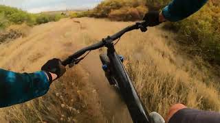
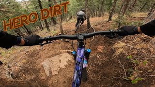
Fenceline Trail is a blast with features you can roll or jump. Just pay attention to the next turn.
At mile 4.45, you'll take the right into a field to stay on the singletrack. There's a small creek crossing at mile 4.84 then into a steep climb onto Allegheny Dr. Cross over, through the boulders to drop into a local jump park. Hit a couple, but continue through the park, staying right and climbing back up to stay out of the creek bed.
At mile 5.16, the trail will cross the creek again through a rock garden and you will meet up with a doubletrack path that parallels the storm drain. You'll cross Allegheny at mile 5.6 to continue to follow the storm drain.
This path will deadend at Flying W Ranch Rd. at mile 6, cross over and hang a left back towards Ute Valley Park. Cross Centennial, get some speed because you're going up the rock feature at the foot of the ridge to get onto Rattlesnake Ridge Trail.
Rattlesnake Ridge Trail has plenty of tech that doesn't flow and features that will have you walking. Take your time and look for a right turn onto Valley View Trail at mile 6.8. Fun bit of features before descending to Triple Treat at mile 7.2. Hang a right to keep climbing towards Nachos.
Nachos will be on your left after reaching the top, plus a little more to get to the descent at mile 7.5. Another great downhill, techy trail that ends too quickly. Cross the intersection at mile 7.7 to continue onto Juniper Trail (Strava) towards Almond Butter.
You'll drop onto the original Almond Butter (Lil Moab) at mile 8.3. **There is a city named trail named Almond Butter, that goes through the fence, you are not taking that**
At mile 8.5, you'll intersect Black and Blue Loop (South), stay straight and to the right to descend towards Black and Blue Loop (North) by crossing the armored creekbed at mile 8.65 and then take the right.
Black and Blue (North) will take you to the frontage road, hang a right at mile 9.95 to get to Black and Blue Loop (South) to re-enter Ute Valley.
At mile 11, you'll back at the bottom of old Almond, stay low like before but do not cross the armored creek, take the trail straight and climb up to the road, mile 11.36. Continue on Sunnyside Trail until you reach a steep climb at mile 11.9.
Look left for a log bench and you'll see a steep descent. It is very rollable even on a rigid. At the bottom, look right for Ute Valley Regional Trail (Arches) and you'll be quickly rewarded with an arch Drop that post and get back!
Arches has seen some stroller work but still has the MTB lines available. Keep your speed, you're almost done!
Mile 12.5, continue right back to the TH!

We hope you've been enjoying Trailforks!
Create a FREE account to view all route reviews and much more.

| 400 ft | |||||
| 1 mile | |||||
| 3,973 ft | |||||
| 1,217 ft | |||||
| 1 mile | |||||
| 1,529 ft | |||||
| 1,490 ft | |||||
| 2,631 ft | |||||
| 351 ft | |||||
| 5,026 ft | |||||
| 1,079 ft |

Service Road Atlas is a free to use, community-driven service for viewing and creating reports on the numerous back-country service roads around B.C. and Alberta.
Save the current map location and zoom level as your default home location whenever this page is loaded.
Save