10.1 miles
Distance
1,104 ft
Climb
-1,104 ft
Descent
1,158 ft
High Point
0 ft
Altitude change
504 ft
Altitude min
528 ft
Altitude start
528 ft
Altitude end
-38.6%
Grade max
44.9%
Grade min
4 miles
Distance climb
4 miles
Distance down
3 miles
Distance flat

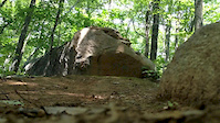
Drummer Hill is not the most beginner friendly set of trails. The Stonewall farm trails may be a better starting point if you're brand new to the sport.

This loop will take you around 1.5hrs depending on how hard you go. It'll give you a good idea of the Drummer Hill trail network. This is a great loop for any intermediate to advanced level riders. The ideal bike for this ride would be a 120-150mm trail bike. That being said, you can definitely get by with a Hardtail or rigid. There are no mandatory drops, but there are plenty of technical lines all over the place.

Variations:
Shorter Loop: Once you get to the end of the Exit 1 trail, take 48T (48 Turns) over far side. (~1hr)
Longer Loop: When 2/3rds done with Far Side, climb up 48T, to old Gilsum rd, and take Drop and Chute back to Far side. (~2hrs)

Detailed Description
Drummer Sampler loop is a 10 mile popular intermediate route located near Keene New Hampshire. This mountain bike only route can be used one direction and has a moderate overall physical rating. This route includes 24 trails. This route climbs 1,104 ft with a max elevation of 1,158 ft then descends -1,104 ft.

Trail Issues on Route

  • Minor Issue / Yellow: 2 trails (newest: Aug 12, 2023)
Local Trail Association
Local trail association
Brattleboro-Keene NEMBA Chapter (www.nemba.org)
Please consider joining or donating to the local riding association to support trail development & maintenance.
Donate to earn trail karma!

Stats

  • Distance
    10 miles
  • Avg time
    3 hr 56 min
  • Altitude min
    504 ft
  • Altitude start
    528 ft
  • Altitude end
    528 ft
  • Climb
    1,104 ft
  • Descent
    -1,104 ft
  • Grade max
    -38.6%
  • Grade min
    44.9%
  • Distance climb
    4 miles
  • Distance down
    4 miles
  • Distance flat
    3 miles

12 Reviews & Comments


We hope you've been enjoying Trailforks!

Create a FREE account to view route comments and much more.

Trails in Route

Details

  • Riding area
  • Primary Activity
    Mountain Bike
  • Difficulty rating
    Blue
  • Route Type
    Loop
  • Bike type
    AM, XC
  • Direction
    One Direction
  • Physical rating
    Moderate
  • Ridelogs
    1
Avg: 4 (1 votes)
close
3D
Trail Conditions
  • Unknown
  • Snow Groomed
  • Snow Packed
  • Snow Covered
  • Snow Cover Partial
  • Freeze/thaw Cycle
  • Icy
  • Prevalent Mud
  • Wet
  • Variable
  • Ideal
  • Dry
  • Very Dry
Trail Flow (Ridden Direction)
Trailforks scans users ridelogs to determine the most popular direction each trail is ridden. A good flowing trail network will have most trails flowing in a single direction according to their intension.
The colour categories are based on what percentage of riders are riding a trail in its intended direction.
  • > 96%
  • > 90%
  • > 80%
  • > 70%
  • > 50%
  • < 50%
  • bi-directional trail
  • no data
Trail Last Ridden
Trailforks scans ridelogs to determine the last time a trail was ridden.
  • < 2 days
  • < 1 week
  • < 2 weeks
  • < 1 month
  • < 6 months
  • > 6 months
Trail Ridden Direction
The intended direction a trail should be ridden.
  • Downhill Only
  • Downhill Primary
  • Both Directions
  • Uphill Primary
  • Uphill Only
  • One Direction
Contribute Details
Colors indicate trail is missing specified detail.
  • Description
  • Photos
  • Description & Photos
  • Videos
Trail Popularity ?
Trailforks scans ridelogs to determine which trails are ridden the most in the last 9 months. Trails are compared with nearby trails in the same city region with a possible 25 colour shades. Think of this as a heatmap, more rides = more kinetic energy = warmer colors.
  • most popular
  • popular
  • less popular
  • not popular
ATV/ORV/OHV Filter
Max Vehicle Width
inches
US Cell Coverage
Legend
cell carrier legend

Radar Time
Activity Recordings
Trailforks uses anonymized public activity data. ?
Activity Recordings
Trailforks uses anonymized public activity data. ?
Personal Heatmap
Activity Types
all / none
Options
2
Date range month
Winter Trails
Warning A routing network for winter maps does not exist. Selecting trails using the winter trails layer has been disabled.
Missing Trails
Most Popular
Least Popular
Trails are colored based on popularity. The more popular a trail is, the more red. Less popular trails trend towards green.
Jump Magnitude Heatmap
Heatmap of where riders jump on trails. Zoom in to see individual jumps, click circles to view jump details.
BC Backroad Status

Service Road Atlas is a free to use, community-driven service for viewing and creating reports on the numerous back-country service roads around B.C. and Alberta.

map legend
Slope Aspect
Direction the slope faces
Flat N NE E SE S SW W NW
Trails Deemphasized
Trails are shown in grey.
disable
Only show trails with no bike usage.
Enable
Suggested Layers
Based on selected activity type

    Save the current map location and zoom level as your default home location whenever this page is loaded.

    Save
    Trail transparency
    • Singletrack
    • Unpaved
    48
    199
    Raw NEMBA vietnam Edit
    Raw NEMBA vietnam Edit
    trail: Goat
    0:41 | 452 | comments: 0 | favs:
    Jul 18, 2014
    Just a short compilation of The Flanneled Goat Crew at NEMBA vietnam

    Recent Trail Reports Along Route

    statustraildateconditiondescription
    Dike Trail
    Aug 10, 2025 @ 2:35pm
    Aug 10, 2025
    Far Side
    Jun 19, 2025 @ 10:43am
    Jun 19, 2025
    Exit 1
    Jun 19, 2025 @ 10:43am
    Jun 19, 2025
    Lewis Pond Rd
    Jun 19, 2025 @ 10:43am
    Jun 19, 2025
    Kamikaze Slalom
    Jun 19, 2025 @ 10:43am
    Jun 19, 2025
    more reports »
    • By PhilKmetz & contributors
    • #6991 - 2,852 views

    Hit the Trail

    Open in App

    Get this route on your phone instantly.

    Download Route

    Save to wishlist, Garmin & download.