11.3 miles
Distance
1,272 ft
Climb
-1,269 ft
Descent
3,630 ft
High Point
2 ft
Altitude change
3,191 ft
Altitude min
3,342 ft
Altitude start
3,343 ft
Altitude end
-33.5%
Grade max
38.8%
Grade min
4 miles
Distance climb
5 miles
Distance down
2 miles
Distance flat

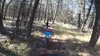
Designated Forest Loops Trail as per Cranbrook Community Forest trail map.

Detailed Description
Forests Loops is a 11 mile moderately popular intermediate route located near Cranbrook British Columbia. This mountain bike primary route. This route includes 32 trails. This route climbs 1,272 ft with a max elevation of 3,630 ft then descends -1,269 ft.

Trail Issues on Route

  • Minor Issue / Yellow: 1 trail (newest: Apr 25, 2026)
Local Trail Association
Local trail association
Wildhorse Cycling Club (bikewildhorse.ca)
Please consider joining or donating to the local riding association to support trail development & maintenance.
Donate to earn trail karma!

Stats

  • Distance
    11 miles
  • Avg time
    6 hr 39 min
  • Altitude change
    2 ft
  • Altitude min
    3,191 ft
  • Altitude start
    3,342 ft
  • Altitude end
    3,343 ft
  • Climb
    1,272 ft
  • Descent
    -1,269 ft
  • Grade max
    -33.5%
  • Grade min
    38.8%
  • Distance climb
    4 miles
  • Distance down
    5 miles
  • Distance flat
    2 miles

33 Reviews & Comments


We hope you've been enjoying Trailforks!

Create a FREE account to view route comments and much more.

Trails in Route

Forest Grove3,947 ft
Curly413 ft
Larch1,001 ft
Roller Coaster1,358 ft
Bonehead3,960 ft
Bonehead Connector1,247 ft
Upper Bonehead3,734 ft
Pilsit1,276 ft
Kettle Loop748 ft
Axel Alley1,926 ft
Upper Coaster866 ft
Hobgoblin364 ft
Migor1 mile
Kettle Loop240 ft
Hill ByPass3,045 ft
Big Tree Trail2,431 ft
Going Up2,037 ft
Arbour Trail2,290 ft

Details

  • Riding area
  • Primary Activity
    Mountain Bike
  • Other Activities
    • E-Bike
    • Horse
    • Hike
    • Trail Running
  • Difficulty rating
    Blue
  • eBike Allowed
  • Ridelogs
    3
Avg: 1.4 (5 votes)
close
3D
Trail Conditions
  • Unknown
  • Snow Groomed
  • Snow Packed
  • Snow Covered
  • Snow Cover Partial
  • Freeze/thaw Cycle
  • Icy
  • Prevalent Mud
  • Wet
  • Variable
  • Ideal
  • Dry
  • Very Dry
Trail Flow (Ridden Direction)
Trailforks scans users ridelogs to determine the most popular direction each trail is ridden. A good flowing trail network will have most trails flowing in a single direction according to their intension.
The colour categories are based on what percentage of riders are riding a trail in its intended direction.
  • > 96%
  • > 90%
  • > 80%
  • > 70%
  • > 50%
  • < 50%
  • bi-directional trail
  • no data
Trail Last Ridden
Trailforks scans ridelogs to determine the last time a trail was ridden.
  • < 2 days
  • < 1 week
  • < 2 weeks
  • < 1 month
  • < 6 months
  • > 6 months
Trail Ridden Direction
The intended direction a trail should be ridden.
  • Downhill Only
  • Downhill Primary
  • Both Directions
  • Uphill Primary
  • Uphill Only
  • One Direction
Contribute Details
Colors indicate trail is missing specified detail.
  • Description
  • Photos
  • Description & Photos
  • Videos
Trail Popularity ?
Trailforks scans ridelogs to determine which trails are ridden the most in the last 9 months. Trails are compared with nearby trails in the same city region with a possible 25 colour shades. Think of this as a heatmap, more rides = more kinetic energy = warmer colors.
  • most popular
  • popular
  • less popular
  • not popular
ATV/ORV/OHV Filter
Max Vehicle Width
inches
US Cell Coverage
Legend
cell carrier legend

Radar Time
Activity Recordings
Trailforks uses anonymized public activity data. ?
Activity Recordings
Trailforks uses anonymized public activity data. ?
Personal Heatmap
Activity Types
all / none
Options
2
Date range month
Winter Trails
Warning A routing network for winter maps does not exist. Selecting trails using the winter trails layer has been disabled.
Missing Trails
Most Popular
Least Popular
Trails are colored based on popularity. The more popular a trail is, the more red. Less popular trails trend towards green.
Jump Magnitude Heatmap
Heatmap of where riders jump on trails. Zoom in to see individual jumps, click circles to view jump details.
BC Backroad Status

Service Road Atlas is a free to use, community-driven service for viewing and creating reports on the numerous back-country service roads around B.C. and Alberta.

map legend
Slope Aspect
Direction the slope faces
Flat N NE E SE S SW W NW
Trails Deemphasized
Trails are shown in grey.
disable
Only show trails with no bike usage.
Enable
Suggested Layers
Based on selected activity type

    Save the current map location and zoom level as your default home location whenever this page is loaded.

    Save
    Trail transparency
    • Singletrack
    • Unpaved
    95
    94
    156
    132
    Pilsit Clips
    Pilsit Clips
    trail: Pilsit
    0:27 | 90 | comments: 0 | favs:
    Sep 23, 2024
    Roller coaster
    Roller coaster
    0:22 | 161 | comments: 0 | favs:
    Apr 10, 2022
    Jason Burnham on roller coaster

    Recent Trail Reports Along Route

    statustraildateconditiondescription
    Forest Grove
    Jul 1, 2026 @ 9:44am (America/Creston)
    1 day
    Hill ByPass
    Jul 1, 2026 @ 9:44am (America/Creston)
    1 day
    Axel Alley
    Jul 1, 2026 @ 9:44am (America/Creston)
    1 day
    Upper Bonehead
    Jul 1, 2026 @ 9:44am (America/Creston)
    1 day
    Kettle Loop
    Jun 28, 2026 @ 10:45am (America/Creston)
    Jun 28, 2026
    more reports »
    • By TrishaR & contributors
    • #22121 - 1,341 views

    Hit the Trail

    Open in App

    Get this route on your phone instantly.

    Download Route

    Save to wishlist, Garmin & download.