

8.1 miles
Distance
1,462 ft
Climb
-1,334 ft
Descent
1,196 ft
High Point
128 ft
Altitude change
729 ft
Altitude min
734 ft
Altitude start
863 ft
Altitude end
0.3%
Grade
-59.8%
Grade max
59%
Grade min
4 miles
Distance climb
3 miles
Distance down
4,337 ft
Distance flat

Small fun loop with a mix of the new and old trails

Detailed Description
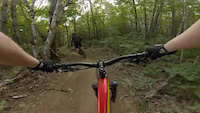
Fun loop is a 8 mile popular intermediate route located near Saint‑Ferréol‑les‑Neiges Quebec. This mountain bike primary route can be used one direction and has a moderate overall physical rating. This route includes 20 trails. This route climbs 1,462 ft with a max elevation of 1,196 ft then descends -1,334 ft.
Tags

Trail Issues on Route

  • Significant Issue / Amber: 1 trail (newest: Oct 20, 2026)

Stats

  • Distance
    8 miles
  • Avg time
    1 hr 1 min
  • Altitude min
    729 ft
  • Altitude start
    734 ft
  • Altitude end
    863 ft
  • Climb
    1,462 ft
  • Descent
    -1,334 ft
  • Grade
    0.3%
  • Grade max
    -59.8%
  • Grade min
    59%
  • Distance climb
    4 miles
  • Distance down
    3 miles
  • Distance flat
    4,337 ft

17 Reviews & Comments


We hope you've been enjoying Trailforks!

Create a FREE account to view all route reviews and much more.

Details

  • Riding area
  • Primary Activity
    Mountain Bike
  • Other Activities
    • E-Bike
  • Difficulty rating
    Blue
  • Route Type
    Loop
  • eBike Allowed
  • Bike type
    AM, XC
  • Direction
    One Direction
  • Physical rating
    Moderate
  • Activity Logs
    15
Avg: 5 (1 votes)
close
Trail transparency
  • Singletrack
  • Unpaved
'That looks really weird...'
mtb
"That looks really weird..."
trail: Cairn #21
0:16 | 134 | comments: 0 | favs:
Aug 4, 2024
***FRIDAY FAILS SUBMISSION!!!*** my dad is having a fine, pleasant xc ride on his rental Scott Genius at Mont-Sainte-Anne until the low bottom...

Recent Trail Reports Along Route

statustraildateconditiondescription
Adorila #64
Oct 21, 2026 @ 10:20am (America/Moncton)
Oct 21, 2026
Spirale Bleue
Oct 20, 2026 @ 12:45pm (America/Moncton)
Oct 20, 2026
Cairn #21
Oct 20, 2026 @ 12:45pm (America/Moncton)
Oct 20, 2026
Bouttaboutte
Oct 20, 2026 @ 12:45pm (America/Moncton)
Oct 20, 2026
Le bas est fermé avec indications de grues. Bottom is closed with signs indicating heavy construction warning
Enduro Sud
Oct 10, 2026 @ 12:55pm (America/Moncton)
Oct 10, 2026
more reports »
  • By cg84 & contributors
  • #11429 - 2,089 views

Hit the Trail

Open in App

Get this route on your phone instantly.

Download Route

Save to wishlist, Garmin & download.