11.8 miles
Distance
1,085 ft
Climb
-1,085 ft
Descent
540 ft
High Point
-1 ft
Altitude change
382 ft
Altitude min
390 ft
Altitude start
390 ft
Altitude end
-0%
Grade
-30.4%
Grade max
19.3%
Grade min
4 miles
Distance climb
4 miles
Distance down
4 miles
Distance flat

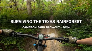
Nice mix of fun trails starting and ending a Redwood Shelter.

Detailed Description
Fun Mix is a 12 mile moderately popular easy route located near Waco Texas. This mountain bike only route. This route includes 41 trails. This route climbs 1,085 ft with a max elevation of 540 ft then descends -1,085 ft.

Trail Issues on Route

  • Closed: 2 trails (newest: Mar 30, 2024)
Local Trail Association
Local trail association
Waco Bike Club (wacobicycleclub.com)
Please consider joining or donating to the local riding association to support trail development & maintenance.

Stats

  • Distance
    12 miles
  • Altitude change
    -1 ft
  • Altitude min
    382 ft
  • Altitude start
    390 ft
  • Altitude end
    390 ft
  • Climb
    1,085 ft
  • Descent
    -1,085 ft
  • Grade
    -0%
  • Grade max
    -30.4%
  • Grade min
    19.3%
  • Distance climb
    4 miles
  • Distance down
    4 miles
  • Distance flat
    4 miles

3 Reviews & Comments


We hope you've been enjoying Trailforks!

Create a FREE account to view route comments and much more.

Trails in Route

Details

  • Riding area
  • Primary Activity
    Mountain Bike
  • Difficulty rating
    Green

Directions

  1. Walk north on River Trail.
  2. Continue for 500 meters.
  3. Keep left to stay on River Trail.
  4. Continue for 500 meters.
  5. Turn right to stay on River Trail.
  6. Continue for 700 meters.
  7. Turn left onto Act of Faith.
  8. Continue for 40 meters.
  9. Keep left to stay on Act of Faith.
  10. Continue for 200 meters.
  11. Keep right to stay on Act of Faith.
  12. Continue for 300 meters.
  13. Turn right onto Picnic (Upper).
  14. Continue for 40 meters.
  15. Turn right to stay on Picnic (Upper).
  16. Continue for 800 meters.
  17. Turn right onto Vermont.
  18. Continue for 60 meters.
  19. Turn left onto Fox Run.
  20. Continue for 500 meters.
  21. Turn right onto Rio Perdido.
  22. Continue for 10 meters.
  23. Keep left to take Tar Hill (Lower).
  24. Continue for 100 meters.
  25. Keep left to stay on Tar Hill (Lower).
  26. Continue for 300 meters.
  27. Bear right onto Circle Drive.
  28. Continue for 10 meters.
  29. Keep left to take Twister.
  30. Continue for 300 meters.
  31. Turn right to stay on Twister.
  32. Continue for 200 meters.
  33. Turn left onto Pipeline.
  34. Continue for 100 meters.
  35. Turn right onto Shyst B-Line 2.
  36. Continue for 50 meters.
  37. Bear left onto Shyst.
  38. Continue for 80 meters.
  39. Keep right to stay on Shyst.
  40. Continue for 100 meters.
  41. Turn left onto Hang Ten (Upper).
  42. Continue for 300 meters.
  43. Turn right onto Hang Ten (Lower).
  44. Continue for 100 meters.
  45. Bear left onto Hang Ten (Upper).
  46. Continue for 50 meters.
  47. Turn right to stay on Hang Ten (Upper).
  48. Continue for 200 meters.
  49. Bear left onto Shyst.
  50. Continue for 30 meters.
  51. Turn left onto Pipeline.
  52. Continue for 600 meters.
  53. Turn left onto Dead River.
  54. Continue for 100 meters.
  55. Turn left onto River Trail.
  56. Continue for 700 meters.
  57. Keep right to stay on River Trail.
  58. Continue for 100 meters.
  59. Turn left onto Twin Bridges Access.
  60. Continue for 20 meters.
  61. Turn right onto Twin Bridges.
  62. Continue for 30 meters.
  63. Bear left onto Powerline.
  64. Continue for 400 meters.
  65. Turn right to stay on Powerline.
  66. Continue for 200 meters.
  67. Turn right onto Kite.
  68. Continue for 400 meters.
  69. Turn left to stay on Kite.
  70. Continue for 400 meters.
  71. Turn right onto Colorado.
  72. Continue for 200 meters.
  73. Turn left onto Mix Master.
  74. Continue for 200 meters.
  75. Turn right onto Baseball.
  76. Continue for 70 meters.
  77. Walk south on Cliff's Cliff.
  78. Continue for 100 meters.
  79. Turn right onto Cedars.
  80. Continue for 100 meters.
  81. Turn left onto Baseball.
  82. Continue for 100 meters.
  83. Turn left onto Outback.
  84. Continue for 300 meters.
  85. Turn left to stay on Outback.
  86. Continue for 1 kilometer.
  87. Keep right to take Powder Monkey Access West.
  88. Continue for 30 meters.
  89. Turn right onto Arizona (Adeline Drive).
  90. Continue for 300 meters.
  91. Turn left onto Arizona.
  92. Continue for 70 meters.
  93. Bear left onto Phoenix.
  94. Continue for 400 meters.
  95. Turn left to stay on Phoenix.
  96. Continue for 200 meters.
  97. Keep right to take Phoenix to Coker Cola.
  98. Continue for 40 meters.
  99. Turn left onto Arizona.
  100. Continue for 50 meters.
  101. Keep right to take Arizona To Weber Run (South).
  102. Continue for 50 meters.
  103. Bear left onto Partyline Connector.
  104. Continue for 20 meters.
  105. Turn right onto Arizona.
  106. Continue for 200 meters.
  107. Keep left to stay on Arizona.
  108. Continue for 100 meters.
  109. Turn left onto Coker Cola.
  110. Continue for 100 meters.
  111. Turn left onto Arizona.
  112. Continue for 50 meters.
  113. Keep right to take Arizona To Weber Run (South).
  114. Continue for 50 meters.
  115. Keep left to take Weber Run.
  116. Continue for 30 meters.
  117. Turn right to stay on Weber Run.
  118. Continue for 100 meters.
  119. Turn right onto Rebel One.
  120. Continue for 200 meters.
  121. Turn right onto The Force.
  122. Continue for 300 meters.
no votes yet
close
3D
Trail Conditions
  • Unknown
  • Snow Groomed
  • Snow Packed
  • Snow Covered
  • Snow Cover Partial
  • Freeze/thaw Cycle
  • Icy
  • Prevalent Mud
  • Wet
  • Variable
  • Ideal
  • Dry
  • Very Dry
Trail Flow (Ridden Direction)
Trailforks scans users ridelogs to determine the most popular direction each trail is ridden. A good flowing trail network will have most trails flowing in a single direction according to their intension.
The colour categories are based on what percentage of riders are riding a trail in its intended direction.
  • > 96%
  • > 90%
  • > 80%
  • > 70%
  • > 50%
  • < 50%
  • bi-directional trail
  • no data
Trail Last Ridden
Trailforks scans ridelogs to determine the last time a trail was ridden.
  • < 2 days
  • < 1 week
  • < 2 weeks
  • < 1 month
  • < 6 months
  • > 6 months
Trail Ridden Direction
The intended direction a trail should be ridden.
  • Downhill Only
  • Downhill Primary
  • Both Directions
  • Uphill Primary
  • Uphill Only
  • One Direction
Contribute Details
Colors indicate trail is missing specified detail.
  • Description
  • Photos
  • Description & Photos
  • Videos
Trail Popularity ?
Trailforks scans ridelogs to determine which trails are ridden the most in the last 9 months. Trails are compared with nearby trails in the same city region with a possible 25 colour shades. Think of this as a heatmap, more rides = more kinetic energy = warmer colors.
  • most popular
  • popular
  • less popular
  • not popular
ATV/ORV/OHV Filter
Max Vehicle Width
inches
US Cell Coverage
Legend
cell carrier legend

Radar Time
Activity Recordings
Trailforks uses anonymized public activity data. ?
Activity Recordings
Trailforks uses anonymized public activity data. ?
Personal Heatmap
Activity Types
all / none
Options
2
Date range month
Winter Trails
Warning A routing network for winter maps does not exist. Selecting trails using the winter trails layer has been disabled.
Missing Trails
Most Popular
Least Popular
Trails are colored based on popularity. The more popular a trail is, the more red. Less popular trails trend towards green.
Jump Magnitude Heatmap
Heatmap of where riders jump on trails. Zoom in to see individual jumps, click circles to view jump details.
BC Backroad Status

Service Road Atlas is a free to use, community-driven service for viewing and creating reports on the numerous back-country service roads around B.C. and Alberta.

map legend
Slope Aspect
Direction the slope faces
Flat N NE E SE S SW W NW
Trails Deemphasized
Trails are shown in grey.
disable
Only show trails with no bike usage.
Enable
Suggested Layers
Based on selected activity type

    Save the current map location and zoom level as your default home location whenever this page is loaded.

    Save
    Trail transparency
    • Singletrack
    • Unpaved
    52
    351
    281
    337
    Cameron Park Blowout 2024 | Waco, TX | Texas...
    Cameron Park Blowout 2024 | Waco, TX | Texas Mountain Bike Racing
    40:38 | 87 | comments: 0 | favs:
    Jan 6, 2025
    Vortex Cameron Park
    Vortex Cameron Park
    trail: Vortex
    0:49 | 465 | comments: 0 | favs:
    Jun 3, 2021

    Recent Trail Reports Along Route

    statustraildateconditiondescription
    Vortex
    Mar 25, 2026 @ 9:15am (Pacific/Midway)
    Mar 25, 2026
    Torquer
    Mar 25, 2026 @ 9:15am (Pacific/Midway)
    Mar 25, 2026
    Arizona
    Mar 25, 2026 @ 9:15am (Pacific/Midway)
    Mar 25, 2026
    Weber Run Lower
    Mar 25, 2026 @ 9:15am (Pacific/Midway)
    Mar 25, 2026
    Cliff's Cliff
    Mar 25, 2026 @ 9:15am (Pacific/Midway)
    Mar 25, 2026
    more reports »
    • By NoelWeHs7TF Pro WBC & contributors
    • #64938 - 173 views

    Hit the Trail

    Open in App

    Get this route on your phone instantly.

    Download Route

    Save to wishlist, Garmin & download.