13.8 miles
Distance
1,056 ft
Climb
-1,016 ft
Descent
496 ft
High Point
40 ft
Altitude change
228 ft
Altitude min
228 ft
Altitude start
269 ft
Altitude end
0.1%
Grade
-38%
Grade max
38.7%
Grade min
6 miles
Distance climb
5 miles
Distance down
3 miles
Distance flat

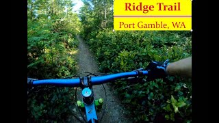
Green circle - blue square - green circle - blue square - green circle - blue square

Detailed Description
Gamblin' is a 14 mile less popular easy route located near Port Gamble Washington. This mountain bike only route. This route includes 33 trails. This route climbs 1,056 ft with a max elevation of 496 ft then descends -1,016 ft.

Trail Issues on Route

  • Closed: 1 trail (newest: Aug 24, 2025)
  • Minor Issue / Yellow: 2 trails (newest: Jun 15, 2026)
Local Trail Association
Please consider joining or donating to the local riding association to support trail development & maintenance.
Donate to earn trail karma!

Stats

  • Distance
    14 miles
  • Avg time
    1 hr 37 min
  • Altitude change
    40 ft
  • Altitude min
    228 ft
  • Altitude start
    228 ft
  • Altitude end
    269 ft
  • Climb
    1,056 ft
  • Descent
    -1,016 ft
  • Grade
    0.1%
  • Grade max
    -38%
  • Grade min
    38.7%
  • Distance climb
    6 miles
  • Distance down
    5 miles
  • Distance flat
    3 miles

12 Reviews & Comments


We hope you've been enjoying Trailforks!

Create a FREE account to view route comments and much more.

Trails in Route

Millie's Trail2,884 ft
G21001 mile
Ridge Trail2,776 ft
G1800981 ft
Clear Cut Trail2,779 ft
Big Rose3,209 ft
G1900308 ft
Big Rose459 ft
G1700968 ft
Parallel1,398 ft
G1600600 ft
Twisted Sister1 mile
Forbidden Forest5,000 ft
Twisted Sister10 ft
Road 10005,207 ft
G17001,365 ft
Maggies Rocks4,003 ft
G17001,611 ft
G18005,089 ft
Clear Cut Trail3 ft
Coyote2,379 ft
Ridge Trail1,066 ft
G21001 mile
Millie's Trail2,884 ft

Details

  • Primary Activity
    Mountain Bike
  • Difficulty rating
    Green
  • eBike Allowed
no votes yet
close
3D
Trail Conditions
  • Unknown
  • Snow Groomed
  • Snow Packed
  • Snow Covered
  • Snow Cover Partial
  • Freeze/thaw Cycle
  • Icy
  • Prevalent Mud
  • Wet
  • Variable
  • Ideal
  • Dry
  • Very Dry
Trail Flow (Ridden Direction)
Trailforks scans users ridelogs to determine the most popular direction each trail is ridden. A good flowing trail network will have most trails flowing in a single direction according to their intension.
The colour categories are based on what percentage of riders are riding a trail in its intended direction.
  • > 96%
  • > 90%
  • > 80%
  • > 70%
  • > 50%
  • < 50%
  • bi-directional trail
  • no data
Trail Last Ridden
Trailforks scans ridelogs to determine the last time a trail was ridden.
  • < 2 days
  • < 1 week
  • < 2 weeks
  • < 1 month
  • < 6 months
  • > 6 months
Trail Ridden Direction
The intended direction a trail should be ridden.
  • Downhill Only
  • Downhill Primary
  • Both Directions
  • Uphill Primary
  • Uphill Only
  • One Direction
Contribute Details
Colors indicate trail is missing specified detail.
  • Description
  • Photos
  • Description & Photos
  • Videos
Trail Popularity ?
Trailforks scans ridelogs to determine which trails are ridden the most in the last 9 months. Trails are compared with nearby trails in the same city region with a possible 25 colour shades. Think of this as a heatmap, more rides = more kinetic energy = warmer colors.
  • most popular
  • popular
  • less popular
  • not popular
ATV/ORV/OHV Filter
Max Vehicle Width
inches
US Cell Coverage
Legend
cell carrier legend

Radar Time
Activity Recordings
Trailforks uses anonymized public activity data. ?
Activity Recordings
Trailforks uses anonymized public activity data. ?
Personal Heatmap
Activity Types
all / none
Options
2
Date range month
Winter Trails
Warning A routing network for winter maps does not exist. Selecting trails using the winter trails layer has been disabled.
Missing Trails
Most Popular
Least Popular
Trails are colored based on popularity. The more popular a trail is, the more red. Less popular trails trend towards green.
Jump Magnitude Heatmap
Heatmap of where riders jump on trails. Zoom in to see individual jumps, click circles to view jump details.
BC Backroad Status

Service Road Atlas is a free to use, community-driven service for viewing and creating reports on the numerous back-country service roads around B.C. and Alberta.

map legend
Slope Aspect
Direction the slope faces
Flat N NE E SE S SW W NW
Trails Deemphasized
Trails are shown in grey.
disable
Only show trails with no bike usage.
Enable
Suggested Layers
Based on selected activity type

    Save the current map location and zoom level as your default home location whenever this page is loaded.

    Save
    Trail transparency
    • Singletrack
    • Unpaved
    22
    28
    40
    62
    Ridge Trail of Port Gamble
    Ridge Trail of Port Gamble
    3:00 | 74 | comments: 0 | favs:
    Oct 19, 2024
    G2100 of Port Gamble
    G2100 of Port Gamble
    trail: G2100
    59 | comments: 0 | favs:
    Oct 13, 2024

    Recent Trail Reports Along Route

    statustraildateconditiondescription
    Forbidden Forest
    Jun 15, 2026 @ 11:58am (America/Vancouver)
    Jun 15, 2026
    Little overgrown
    Clear Cut Trail
    Jun 14, 2026 @ 10:57pm (America/Los_Angeles)
    Jun 14, 2026
    Quite overgrown in spots. Some places as wide as your handlebars or less is all. But made it through without getting scratched!
    Maggies Rocks
    Jun 7, 2026 @ 5:05pm (America/Los_Angeles)
    Jun 7, 2026
    Overgrown! Needs a haircut.
    G1900
    Feb 20, 2026 @ 3:19pm (America/Los_Angeles)
    Feb 20, 2026
    There is extensive logging road construction branching off from this access road at multiple locations. It looks like Rayonier is going to do another massive clearcut.
    Ridge Trail
    Dec 29, 2025 @ 5:34pm (America/Vancouver)
    Dec 29, 2025
    Minimal mud. Very rideable
    more reports »
    • By bravecanaryTF Pro & contributors
    • #10525 - 995 views

    Hit the Trail

    Open in App

    Get this route on your phone instantly.

    Download Route

    Save to wishlist, Garmin & download.