

9.8 miles
Distance
373 ft
Climb
-378 ft
Descent
409 ft
High Point
-5 ft
Altitude change
244 ft
Altitude min
262 ft
Altitude start
256 ft
Altitude end
-18%
Grade max
17.5%
Grade min
4 miles
Distance climb
5 miles
Distance down
2 miles
Distance flat

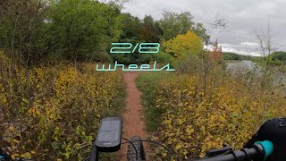
Genesee River loop starting at the bottom of Petten St. on a mixture of paved multiuse path and single track. Very pretty ride showcasing the river from both sides. Pretty crossing of the river high above the gorge down near the 104 expressway.

Detailed Description
Genesee RIver Loop is a 10 mile moderately popular intermediate route located near Rochester New York. This mountain bike primary route can be used both directions. This route includes 2 trails. This route climbs 373 ft with a max elevation of 409 ft then descends -378 ft.
Tags
CanyonRiver or creek

Local Trail Association

Local trail association
Genesee Regional Off-Road Cyclists (mygroc.com)
Please consider joining or donating to the local riding association to support trail development & maintenance.
Donate to earn trail karma!

Stats

  • Distance
    10 miles
  • Altitude min
    244 ft
  • Altitude start
    262 ft
  • Altitude end
    256 ft
  • Climb
    373 ft
  • Descent
    -378 ft
  • Grade max
    -18%
  • Grade min
    17.5%
  • Distance climb
    4 miles
  • Distance down
    5 miles
  • Distance flat
    2 miles

Comments


We hope you've been enjoying Trailforks!

Create a FREE account to view all route reviews and much more.

Details

  • Riding area
  • Primary Activity
    Mountain Bike
  • Other Activities
    • Hike
    • Trail Running
  • Difficulty rating
    Blue
  • Route Type
    Loop
  • Bike type
    AM, CX
  • Direction
    Both Directions
no votes yet
close
Trail transparency
  • Singletrack
Seneca Park Trail
mtb
Seneca Park Trail
4:23 | 144 | comments: 0 | favs:
Jan 14, 2023

Recent Trail Reports Along Route

statustraildateconditiondescription
Seneca Park Trail
Sep 11, 2023 @ 9:57am
Sep 11, 2023
Holy Sepulchre Cemetery Mountain Bike Trail
Oct 11, 2022 @ 2:52pm
Oct 11, 2022
Singletrack that follows along the Ridge of the Genesee River and along the property of the cemetery. Some wooded areas, open fields and paved portions. Seems more like a connector trail for the Genesee River Trail.
more reports »
  • By Aaeolien & contributors
  • #43462 - 746 views

Hit the Trail

Open in App

Get this route on your phone instantly.

Download Route

Save to wishlist, Garmin & download.