16 miles
Distance
2,249 ft
Climb
-2,266 ft
Descent
2,330 ft
High Point
You WILL hike-a-bike!! Don't complain about it, you've been warned. Soak in your surroundings instead.
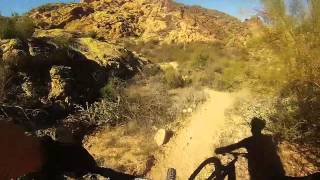
This is a Goldfield Mtns sampler. It's tough. It's beautiful. There's some great singletrack, some not-so great singletrack. There are some fun dirt roads, there are some crappy dirt roads. Don't worry, there's also some hike-a-bike. This is not your typical system trail loop!! This is a primitive, unmarked, backcountry ride experience. Know before you go!! Maybe bring some hand clippers as trails don't see a lot of traffic and catclaw may be present. Expand your horizons and appreciate the amazing places your bike can take you.
Local Trail Association
Please consider joining or donating to the local riding association to support trail development & maintenance.
donate to earn trail karma!
Trails in Route
801 ft | |||||
2,930 ft | |||||
1 miles | |||||
3,888 ft | |||||
3,287 ft | |||||
4 miles | |||||
2,418 ft | |||||
2 miles |
Details
-
Riding area
-
Difficulty ratingBlack Diamond
-
Route TypeLoop
-
Bike typeAM, XC
-
DirectionOne Direction
-
Physical ratingHard
More Stats for Goldfield Loop mountain bike route
-
Altitude min1,862 ft
-
Altitude start2,077 ft
-
Altitude end2,060 ft
-
Grade-0.02%
-
Grade max-40.097%
-
Grade min32.36%
-
Distance climb7 miles
-
Distance down8 miles
-
Distance flat2 miles
close
Trail Conditions
- Unknown
- Snow Groomed
- Snow Packed
- Snow Covered
- Freeze/thaw Cycle
- Icy
- Prevalent Mud
- Wet
- Variable
- Dry
- Very Dry
Trail Ridden Direction
Trailforks scans users ridelogs to determine the most popular direction each trail is ridden. A good flowing trail network will have most trails flowing in a single direction according to their intension.
The colour categories are based on what percentage of riders are riding a trail in its intended direction.
- > 96%
- > 90%
- > 80%
- > 70%
- > 50%
- < 50%
Trail Last Ridden
Trailforks scans ridelogs to determine the last time a trail was ridden.
- < 2 days
- < 1 week
- < 2 weeks
- < 1 month
- < 6 months
- > 6 months
Trail Ridden Direction
The intendid direction a trail should be ridden.
- Downhill Only
- Downhill Primary
- Both Directions
- Uphill Primary
- Uphill Only
- One Direction
ContributeDetails
Colors indicate trail is missing specified detail.
- Description
- Photos
- Description & Photos
- Videos
LEGEND
Trail Difficulties
Trail Report Status
- Access Road/Trail
- White
- Green
- Blue
- Black
- Double Black Diamond
Trail Report Status
- Clear / Green
- Minor Issue / Yellow
- Significant Issue / Amber
- Closed or Major Issue / Red
- Land Owner Overlay
- Wilderness (typically no bikes in USA)
- BLM (public)
- USFS (Wildlife sanctuaries darker than usfs)
- State land
- Indigenous
- Military
Trail Conditions
- Unknown
- Snow Groomed
- Snow Packed
- Snow Covered
- Freeze/thaw Cycle
- Icy
- Prevalent Mud
- Wet
- Variable
- Dry
- Very Dry
- Map Markers
Trail Head
Photo
Directory Listing
Riding Area
TTF
Parking
Viewpoint
Information
Warning
Directions
Water Fountain/Source
Sight
Restrooms
Gate
Camping
Trail Sign
Table or Bench
eBike Charging Point
Other
Trail transparency
Photos
Recent Trail Reports Along Route
more reports »
- embed Goldfield Loop route on your website
- By schillingsworth TRAILFORKS & contributors
- #11440 - 325 views
- login to download gpx or kml files.
Open route in mobile app