
8.0 miles
Distance
1,779 ft
Climb
-1,778 ft
Descent
1 mile
High Point
1 ft
Altitude change
6,086 ft
Altitude min
6,087 ft
Altitude start
6,089 ft
Altitude end
-77.8%
Grade max
81.6%
Grade min
4 miles
Distance climb
3 miles
Distance down
2,858 ft
Distance flat

Please be respectful of private land when parking near the trailhead.

Detailed Description
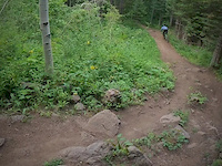
Grove Drake Loop is a 8 mile moderately popular intermediate route located near Victor Idaho. This mountain bike primary route can be used one direction and has a moderate overall physical rating. This route includes 2 trails. This route climbs 1,779 ft with a max elevation of 7,731 ft then descends -1,778 ft.
Tags
BermsRiver or creek

Local Trail Association

Local trail association
Mountain Bike the Tetons (www.mountainbiketetons.org)
Please consider joining or donating to the local riding association to support trail development & maintenance.
Donate to earn trail karma!

Stats

  • Distance
    8 miles
  • Altitude min
    6,086 ft
  • Altitude start
    6,087 ft
  • Altitude end
    6,089 ft
  • Climb
    1,779 ft
  • Descent
    -1,778 ft
  • Grade max
    -77.8%
  • Grade min
    81.6%
  • Distance climb
    4 miles
  • Distance down
    3 miles
  • Distance flat
    2,858 ft

3 Reviews & Comments

Birdr2
Wonderful loop. Uphill is 75% ride-able, 25% hike-able. Amazing views of Tetons. Wild flowers are in bloom. Downhill is roots and rocky, consistent, fun, medium tech. No gnar, but really satisfying. Wish it were longer! Loop took approx 2hrs.
PedalorPaddle
Great trail with some variety. Definitely earn your downhill getting up there. South Grove Creek is dirt road. The single track is beautiful! Big Hole Crest gets steep and the trail is more narrow, soft, not as well packed. Views are gorgeous! Drake Creek provides steep technical downhill over rocks and fun root drops/steps. If that’s not your style, go up South Grove Creek, turn around and glide back down for a smooth ride.

We hope you've been enjoying Trailforks!

Create a FREE account to view all route reviews and much more.

Trails in Route

Details

  • Riding area
  • Primary Activity
    Mountain Bike
  • Other Activities
    • E-Bike
  • Difficulty rating
    Blue
  • Route Type
    Loop
  • eBike Allowed
  • Bike type
    AM
  • Direction
    One Direction
  • Physical rating
    Moderate

Directions

  1. Bike west on West 8000 South.
  2. Continue for 50 meters.
  3. Turn left.
  4. Continue for 200 meters.
  5. Turn left onto South 4500 West.
  6. Continue for 200 meters.
  7. Turn right onto Grove Creek Road.
  8. Continue for 600 meters.
  9. Bike west on Grove Creek Road.
  10. Continue for 400 meters.
  11. Bike northwest on Grove Creek Road.
  12. Continue for 60 meters.
  13. Bike northwest on Grove Creek Road.
  14. Continue for 100 meters.
  15. Bike west.
  16. Continue for 200 meters.
  17. Bike west.
  18. Continue for 100 meters.
  19. Bike west.
  20. Continue for 80 meters.
  21. Bike west.
  22. Continue for 50 meters.
  23. Bear left onto South Grove Creek.
  24. Continue for 400 meters.
  25. Bike southwest on South Grove Creek.
  26. Continue for 1 kilometer.
  27. Bike south on South Grove Creek.
  28. Continue for 1.5 kilometers.
  29. Bike northwest on South Grove Creek.
  30. Continue for 80 meters.
  31. Turn left onto Big Hole Crest.
  32. Continue for 200 meters.
  33. Bike south on Big Hole Crest.
  34. Continue for 500 meters.
  35. Bike southeast on Big Hole Crest.
  36. Continue for 600 meters.
  37. Turn left onto Drake Creek.
  38. Continue for 200 meters.
  39. Bike south on Drake Creek.
  40. Continue for 2 kilometers.
  41. Bike northeast on Drake Creek.
  42. Continue for 70 meters.
  43. Bike north on Drake Creek.
  44. Continue for less than 10 meters.
  45. Bike east on West 9000 South.
  46. Continue for 100 meters.
  47. Bike east on West 9000 South.
  48. Continue for 60 meters.
  49. Bike northeast on West 9000 South.
  50. Continue for 200 meters.
  51. Bike east on West 9000 South.
  52. Continue for 400 meters.
  53. Bike east on West 9000 South.
  54. Continue for 30 meters.
  55. Bike east on West 9000 South.
  56. Continue for less than 10 meters.
  57. Bike southeast on South 4500 West.
  58. Continue for less than 10 meters.
  59. Bike northwest on South 4500 West.
  60. Continue for 40 meters.
  61. Bike north on South 4500 West.
  62. Continue for 80 meters.
  63. Bike north on South 4500 West.
  64. Continue for 90 meters.
  65. Bike southeast on South 4500 West.
  66. Continue for 200 meters.
  67. Turn left onto West 9000 South.
  68. Continue for 70 meters.
  69. Bike west on West 9000 South.
  70. Continue for 70 meters.
  71. Turn right onto South 4500 West.
  72. Continue for 400 meters.
  73. Bike north on South 4500 West.
  74. Continue for 200 meters.
  75. Bike north on South 4500 West.
  76. Continue for 200 meters.
  77. Bike northeast on South 4500 West.
  78. Continue for 60 meters.
  79. Bike north on South 4500 West.
  80. Continue for 30 meters.
  81. Bike north on South 4500 West.
  82. Continue for 60 meters.
  83. Bike north on South 4500 West.
  84. Continue for 50 meters.
  85. Bike northwest on South 4500 West.
  86. Continue for 100 meters.
  87. Bike northwest on South 4500 West.
  88. Continue for 70 meters.
  89. Bike north on South 4500 West.
  90. Continue for 200 meters.
  91. Bike east on South 4500 West.
  92. Continue for 60 meters.
  93. Bear left to stay on South 4500 West.
  94. Continue for 100 meters.
  95. Bike north on South 4500 West.
  96. Continue for 300 meters.
  97. Bike northwest on South 4500 West.
  98. Continue for 400 meters.
  99. Turn right.
  100. Continue for 200 meters.
  101. Turn right onto West 8000 South.
  102. Continue for 40 meters.
no votes yet
close
Trail transparency
  • Singletrack
mtb
141
mtb
118
mtb
120
mtb
113
Hardtail hoonin'
mtb
Hardtail hoonin'
0:36 | 376 | comments: 0 | favs: 1
Aug 2, 2020
#idaho #hardtail #steel #esker @eskercycles

Recent Trail Reports Along Route

statustraildateconditiondescription
South Grove Creek
Aug 15, 2026 @ 2:07pm (America/Boise)
Aug 15, 2026
Drake Creek
May 27, 2026 @ 8:40am (America/Boise)
May 27, 2026
more reports »
  • By wygatorTF Pro & contributors
  • #35647 - 2,258 views

Hit the Trail

Open in App

Get this route on your phone instantly.

Download Route

Save to wishlist, Garmin & download.