

6.1 miles
Distance
1,047 ft
Climb
-1,043 ft
Descent
1,657 ft
High Point
5 ft
Altitude change
752 ft
Altitude min
752 ft
Altitude start
758 ft
Altitude end
-34.8%
Grade max
28.9%
Grade min
3 miles
Distance climb
3 miles
Distance down
2,710 ft
Distance flat

In formal logic, there's a construct called If-Then. It's defined by

If (hypothesis)
Then (conclusion)

What on earth does this have to do with mountain biking? Well, consider this:

If you pedal uphill for 3.5 miles
Then
a. You'll collapse at the top, abandon all your gear, hitch a ride down on a passing horse, and never mountain bike again
OR
b. You'll wobble back downhill and swear off riding at Daley Ranch
OR
c. You'll gulp down some water, lower your seat, and whoop and laugh for 2.5 miles of downhill bliss.

"Um, I'll take 'c' for $200, Alex."

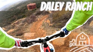
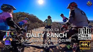
There's no warmup as this route starts right away with a steep climb on Lower Caballo. You'll get a break in a few spots but prepare for a long climb with technical sections mixed in. You'll then turn onto Upper Caballo, where things ease up a bit, and then roll through more climbing on Coyote Run and Diamondback Trail. You'll soon turn south and get rewarded for all that climbing with the longest downhill stretch at Daley Ranch. It alternates between rowdy and rough one minute, then fast and flowy the next. It all ends with a fast, flowy, and steep section filled with banked switchbacks.

As you load the bike onto the car, you might just be thinking, "I had no idea that logic could be so much fun. I should have paid more attention in school." And that's perfectly logical.

A few things to note:

1. The route is suitable for intermediate riders and consists of trails rated green and blue.

2. Please bring a bell. The trails are filled with hikers and horses, especially on weekends, and sightlines are limited. Watch your speed on the way down and be courteous. Horses always have the right-of-way.

3. All the trails are sanctioned and legal. Have fun

Detailed Description
If-Then is a 6 mile popular intermediate route located near Escondido California. This mountain bike only route can be used one direction and has a moderate overall physical rating. This route includes 10 trails. This route climbs 1,047 ft with a max elevation of 1,657 ft then descends -1,043 ft.
Tags
FlowyTight and twistyWater source

Local Trail Association

Local trail association
San Diego Mountain Biking Association (sdmba.com)
Please consider joining or donating to the local riding association to support trail development & maintenance.
Donate to earn trail karma!

Stats

  • Distance
    6 miles
  • Avg time
    50 min 59 sec
  • Altitude min
    752 ft
  • Altitude start
    752 ft
  • Altitude end
    758 ft
  • Climb
    1,047 ft
  • Descent
    -1,043 ft
  • Grade max
    -34.8%
  • Grade min
    28.9%
  • Distance climb
    3 miles
  • Distance down
    3 miles
  • Distance flat
    2,710 ft

24 Reviews & Comments


We hope you've been enjoying Trailforks!

Create a FREE account to view all route reviews and much more.

Details

  • Riding area
  • Primary Activity
    Mountain Bike
  • Difficulty rating
    Blue
  • Route Type
    Loop
  • Bike type
    AM, XC
  • Direction
    One Direction
  • Physical rating
    Moderate
  • Activity Logs
    4

Directions

  1. Bike west on Lower Caballo.
  2. Continue for 2 kilometers.
  3. Keep left to take Upper Caballo.
  4. Continue for 600 meters.
  5. Bike west on Upper Caballo.
  6. Continue for 300 meters.
  7. Turn left onto Lower Sage.
  8. Continue for 300 meters.
  9. Turn right onto East Ridge.
  10. Continue for 400 meters.
  11. Bike north on East Ridge.
  12. Continue for 100 meters.
  13. Turn right onto Coyote Run.
  14. Continue for 500 meters.
  15. Bear left onto Diamondback Trail.
  16. Continue for 300 meters.
  17. Bike north on Diamondback Trail.
  18. Continue for 400 meters.
  19. Turn right onto Upper Sage.
  20. Continue for 400 meters.
  21. Bike east on Upper Sage.
  22. Continue for 200 meters.
  23. Turn right onto Lower Sage.
  24. Continue for 300 meters.
  25. Bike southeast on Lower Sage.
  26. Continue for 800 meters.
  27. Bike southwest on Lower Sage.
  28. Continue for 500 meters.
  29. Bike south on Lower Sage.
  30. Continue for 60 meters.
  31. Bear left onto Quail Run.
  32. Continue for 500 meters.
  33. Bike southeast on Quail Run.
  34. Continue for 400 meters.
  35. Bike southwest on Quail Run.
  36. Continue for 90 meters.
  37. Bear left onto Lower Caballo.
  38. Continue for 2 kilometers.
Avg: 3 (1 votes)
close
Trail transparency
  • Singletrack
  • Unpaved
mtb
trail: Upper Sage
75
mtb
trail: Quail Run
108
mtb
201 | 1 faves
mtb
trail: Lower Sage
78
San Diego mountain biking Daley Ranch trail...
mtb
San Diego mountain biking Daley Ranch trail review 
trail: Quail Run
16:24 | 128 | comments: 0 | favs:
Feb 19, 2025

Recent Trail Reports Along Route

statustraildateconditiondescription
Coyote Run
Sep 3, 2026 @ 8:52am (America/Los_Angeles)
Sep 3, 2026
Lower Sage
Sep 3, 2026 @ 8:52am (America/Los_Angeles)
Sep 3, 2026
Lower Caballo
Sep 3, 2026 @ 8:52am (America/Los_Angeles)
Sep 3, 2026
Little loose on a few of the flat turns but nothing serious. My favorite trail at Daley Ranch.
Quail Run
Sep 3, 2026 @ 8:52am (America/Los_Angeles)
Sep 3, 2026
Diamondback Trail
Apr 16, 2026 @ 9:53am (America/Tijuana)
Apr 16, 2026
more reports »

Hit the Trail

Open in App

Get this route on your phone instantly.

Download Route

Save to wishlist, Garmin & download.
