
9.6 miles
Distance
721 ft
Climb
-585 ft
Descent
4,713 ft
High Point
134 ft
Altitude change
4,356 ft
Altitude min
4,516 ft
Altitude start
4,649 ft
Altitude end
0.3%
Grade
-28.3%
Grade max
21.7%
Grade min
5 miles
Distance climb
3 miles
Distance down
2 miles
Distance flat

Long Canyon - Deadman’s Pass - Aerie - Cockscomb - continue on Cockscomb - Rupp - AZ Cypress - back to Dry Creek Rd.

Detailed Description
Intermediate: Dry Creek Loop is a 10 mile popular intermediate route located near Sedona Arizona. This mountain bike only route and has a moderate overall physical rating. This route includes 5 trails. This route climbs 721 ft with a max elevation of 4,713 ft then descends -585 ft.
Tags
CanyonRiver or creek

Trail Issues on Route

  • Significant Issue / Amber: 1 trail (newest: Jul 18, 2026)

Local Trail Association

Please consider joining or donating to the local riding association to support trail development & maintenance.
Donate to earn trail karma!

Stats

  • Distance
    10 miles
  • Avg time
    1 hr 58 min
  • Altitude min
    4,356 ft
  • Altitude start
    4,516 ft
  • Altitude end
    4,649 ft
  • Climb
    721 ft
  • Descent
    -585 ft
  • Grade
    0.3%
  • Grade max
    -28.3%
  • Grade min
    21.7%
  • Distance climb
    5 miles
  • Distance down
    3 miles
  • Distance flat
    2 miles

21 Reviews & Comments


We hope you've been enjoying Trailforks!

Create a FREE account to view all route reviews and much more.

Trails in Route

Deadmans Pass1 mile
Aerie (Lower)4,318 ft
Cockscomb2 miles
AZ Cypress Alt1,929 ft
Fr9589-b1,693 ft

Details

  • Riding area
  • Primary Activity
    Mountain Bike
  • Difficulty rating
    Blue
  • Route Type
    Loop
  • eBike Allowed
  • Physical rating
    Moderate

Directions

  1. Walk west on Long Canyon.
  2. Continue for 1.5 kilometers.
  3. Bear left onto Deadmans Pass.
  4. Continue for 2 kilometers.
  5. Bear left onto Aerie (Lower).
  6. Continue for 1.5 kilometers.
  7. Turn left onto Cockscomb.
  8. Continue for 1.5 kilometers.
  9. Turn right to stay on Cockscomb.
  10. Continue for 1.5 kilometers.
  11. Turn left onto Rupp.
  12. Continue for 1.5 kilometers.
  13. Keep left to take AZ Cypress Alt.
  14. Continue for 700 meters.
  15. Turn left onto AZ Cypress.
  16. Continue for 400 meters.
  17. Keep right to stay on AZ Cypress.
  18. Continue for 200 meters.
  19. Turn left to stay on AZ Cypress.
  20. Continue for 600 meters.
  21. Turn right to stay on AZ Cypress.
  22. Continue for 700 meters.
  23. Turn left to stay on AZ Cypress.
  24. Continue for 700 meters.
  25. Turn left onto Boynton Pass Road.
  26. Continue for 100 meters.
  27. Turn right onto Long Canyon Road.
  28. Continue for 1 kilometer.
  29. Walk northwest on Long Canyon.
  30. Continue for 1.5 kilometers.
no votes yet
close
Trail transparency
  • Singletrack
  • Unpaved
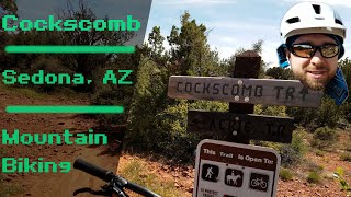
Sedona Mountain Biking // Aerie to Cockscomb: Pt 2
mtb
Sedona Mountain Biking // Aerie to Cockscomb: Pt 2
trail: Cockscomb
9:31 | 415 | comments: 0 | favs:
Aug 18, 2022
Sedona Mountain Biking // Aerie to Cockscomb: Pt 1
mtb
Sedona Mountain Biking // Aerie to Cockscomb: Pt 1
10:43 | 551 | comments: 0 | favs:
Aug 9, 2022

Recent Trail Reports Along Route

statustraildateconditiondescription
Aerie (Lower)
Oct 13, 2026 @ 1:32pm (America/Phoenix)
Oct 13, 2026
Deadmans Pass
Oct 13, 2026 @ 1:32pm (America/Phoenix)
Oct 13, 2026
Cockscomb
Oct 13, 2026 @ 1:32pm (America/Phoenix)
Oct 13, 2026
AZ Cypress Alt
Jul 18, 2026 @ 12:27pm (America/Phoenix)
Jul 18, 2026
Major Water drainage issue, large mud holes
Fr9589-b
Mar 8, 2025 @ 9:07am
Mar 8, 2025
more reports »
  • By ThunderMountainBikesTF Pro & contributors
  • #61962 - 490 views

Hit the Trail

Open in App

Get this route on your phone instantly.

Download Route

Save to wishlist, Garmin & download.