7.8 miles
Distance
774 ft
Climb
-716 ft
Descent
594 ft
High Point
56 ft
Altitude change
239 ft
Altitude min
239 ft
Altitude start
295 ft
Altitude end
0.1%
Grade
-18.1%
Grade max
21.4%
Grade min
3 miles
Distance climb
2 miles
Distance down
2 miles
Distance flat

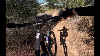
Extremely fun beginner loop without any crazy long climbing, and hits some of the most fun trails in Fort Ord. Highly recommended for riders of all levels.

Detailed Description
Kyle's Bench Loop is a 8 mile popular easy route located near Marina California. This mountain bike only route. This route includes 7 trails. This route climbs 774 ft with a max elevation of 594 ft then descends -716 ft.

Trail Issues on Route

  • Minor Issue / Yellow: 1 trail (newest: May 7, 2021)
Local Trail Association
Please consider joining or donating to the local riding association to support trail development & maintenance.
Donate to earn trail karma!

Stats

  • Distance
    8 miles
  • Avg time
    1 hr 23 min
  • Altitude change
    56 ft
  • Altitude min
    239 ft
  • Altitude start
    239 ft
  • Altitude end
    295 ft
  • Climb
    774 ft
  • Descent
    -716 ft
  • Grade
    0.1%
  • Grade max
    -18.1%
  • Grade min
    21.4%
  • Distance climb
    3 miles
  • Distance down
    2 miles
  • Distance flat
    2 miles

6 Reviews & Comments


We hope you've been enjoying Trailforks!

Create a FREE account to view route comments and much more.

Trails in Route

Jerry Smith Access Corridor2,930 ft
Trail 571,260 ft
Trail 622,710 ft
Trail 961,093 ft
Trail 941,175 ft
Trail 591,900 ft
Trail 69 - North2,441 ft

Details

  • Riding area
  • Primary Activity
    Mountain Bike
  • Difficulty rating
    Green
  • Ridelogs
    9
Avg: 3.5 (2 votes)
close
3D
Trail Conditions
  • Unknown
  • Snow Groomed
  • Snow Packed
  • Snow Covered
  • Snow Cover Partial
  • Freeze/thaw Cycle
  • Icy
  • Prevalent Mud
  • Wet
  • Variable
  • Ideal
  • Dry
  • Very Dry
Trail Flow (Ridden Direction)
Trailforks scans users ridelogs to determine the most popular direction each trail is ridden. A good flowing trail network will have most trails flowing in a single direction according to their intension.
The colour categories are based on what percentage of riders are riding a trail in its intended direction.
  • > 96%
  • > 90%
  • > 80%
  • > 70%
  • > 50%
  • < 50%
  • bi-directional trail
  • no data
Trail Last Ridden
Trailforks scans ridelogs to determine the last time a trail was ridden.
  • < 2 days
  • < 1 week
  • < 2 weeks
  • < 1 month
  • < 6 months
  • > 6 months
Trail Ridden Direction
The intended direction a trail should be ridden.
  • Downhill Only
  • Downhill Primary
  • Both Directions
  • Uphill Primary
  • Uphill Only
  • One Direction
Contribute Details
Colors indicate trail is missing specified detail.
  • Description
  • Photos
  • Description & Photos
  • Videos
Trail Popularity ?
Trailforks scans ridelogs to determine which trails are ridden the most in the last 9 months. Trails are compared with nearby trails in the same city region with a possible 25 colour shades. Think of this as a heatmap, more rides = more kinetic energy = warmer colors.
  • most popular
  • popular
  • less popular
  • not popular
ATV/ORV/OHV Filter
Max Vehicle Width
inches
US Cell Coverage
Legend
cell carrier legend

Radar Time
Activity Recordings
Trailforks uses anonymized public activity data. ?
Activity Recordings
Trailforks uses anonymized public activity data. ?
Personal Heatmap
Activity Types
all / none
Options
2
Date range month
Winter Trails
Warning A routing network for winter maps does not exist. Selecting trails using the winter trails layer has been disabled.
Missing Trails
Most Popular
Least Popular
Trails are colored based on popularity. The more popular a trail is, the more red. Less popular trails trend towards green.
Jump Magnitude Heatmap
Heatmap of where riders jump on trails. Zoom in to see individual jumps, click circles to view jump details.
BC Backroad Status

Service Road Atlas is a free to use, community-driven service for viewing and creating reports on the numerous back-country service roads around B.C. and Alberta.

map legend
Slope Aspect
Direction the slope faces
Flat N NE E SE S SW W NW
Trails Deemphasized
Trails are shown in grey.
disable
Only show trails with no bike usage.
Enable
Suggested Layers
Based on selected activity type

    Save the current map location and zoom level as your default home location whenever this page is loaded.

    Save
    Trail transparency
    • Singletrack
    • Unpaved
    175
    72
    73
    77
    MTB at Ft Ord - 62 & 50 & 50 & 15...
    MTB at Ft Ord - 62 & 50 & 50 & 15 - NOV 3-2024
    trail: Trail 62
    15:16 | 155 | comments: 0 | favs:
    Nov 5, 2024
    First Group Ride!⎜Trails 62, 71, 24 &...
    First Group Ride!⎜Trails 62, 71, 24 & 63⎜Fort Ord Mountain Biking
    trail: Trail 62
    10:02 | 689 | comments: 0 | favs:
    Jul 22, 2020

    Recent Trail Reports Along Route

    statustraildateconditiondescription
    Trail 59
    May 6, 2026 @ 7:58am (America/Los_Angeles)
    May 6, 2026
    Trail has been brushed out to clear overgrown vegetation.
    Trail 62
    Feb 21, 2026 @ 11:46am (America/Los_Angeles)
    Feb 21, 2026
    Trail 96
    Feb 21, 2026 @ 9:12am (America/Los_Angeles)
    Feb 21, 2026
    Trail 69 - North
    Feb 14, 2026 @ 9:20am (America/Los_Angeles)
    Feb 14, 2026
    Trail 94
    Oct 13, 2024 @ 11:00am
    Oct 13, 2024
    more reports »
    • By Butane & contributors
    • #20731 - 3,187 views

    Hit the Trail

    Open in App

    Get this route on your phone instantly.

    Download Route

    Save to wishlist, Garmin & download.