
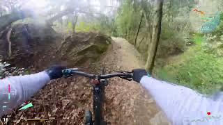
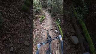
Il sentiero Curlo Trail#34 non è segnalato. L'entrata rimane in salita oltre un livello rosso e bianco.
Anello che unisce i sentieri Ciuto Express Trail, Fontanassa Trail ( nella sua sezione alta ), Curlo Trail#34 e Gustin.
Si parte dal Ciuto Express Trail ( accessibile dal sentiero per l'omonimo Forte ), lo si percorre appieno e la risalita al piazzale ci porterà al Fontanassa Trail.
Dopo il bivio con Forte Angeli, tirando diritto si arriverà, dopo non molto, all'incrocio con la strada ex Forte che prenderemo per ritorno al piazzale.
Da qui il Curlo Trail#34 ci permetterà di arrivare all'ingresso del Gustin evitando l'asfalto.
Seguiamo per intero quest'ultimo e arriveremo in zona Cà di Bò, fine della Route
Trail Issues on Route
- Minor Issue / Yellow: 1 trail (newest: Oct 27, 2026)
Links
Local Trail Association
Konca Verde Ride ExperienceStats
-
Distance7 miles
-
Altitude min151 ft
-
Altitude start1,237 ft
-
Altitude end285 ft
-
Climb2,308 ft
-
Descent-3,259 ft
-
Grade-2.4%
-
Grade max-86%
-
Grade min146.1%
-
Distance climb3 miles
-
Distance down4 miles
-
Distance flat5,167 ft
6 Reviews & Comments
We hope you've been enjoying Trailforks!
Create a FREE account to view all route reviews and much more.
Trails in Route
| 1 mile | |||||
| 1 mile |
Details
-
Riding area
-
Primary ActivityMountain Bike
-
Other Activities
- E-Bike
-
Difficulty ratingBlue
-
Route TypeLoop
-
eBike Allowed
-
Bike typeDH, AM
-
DirectionOne Direction
-
Physical ratingModerate
- Unknown
- Snow Groomed
- Snow Packed
- Snow Covered
- Snow Cover Partial
- Freeze/thaw Cycle
- Icy
- Prevalent Mud
- Wet
- Variable
- Ideal
- Dry
- Very Dry
The colour categories are based on what percentage of users are riding a trail in its intended direction.
- > 96%
- > 90%
- > 80%
- > 70%
- > 50%
- < 50%
- bi-directional trail
- no data
- < 2 days
- < 1 week
- < 2 weeks
- < 1 month
- < 6 months
- > 6 months
- Downhill Only
- Downhill Primary
- Both Directions
- Uphill Primary
- Uphill Only
- One Direction
- Description
- Photos
- Description & Photos
- Videos
- most popular
- popular
- less popular
- not popular
Service Road Atlas is a free to use, community-driven service for viewing and creating reports on the numerous back-country service roads around B.C. and Alberta.
Save the current map location and zoom level as your default home location whenever this page is loaded.
Save- Singletrack
- Unpaved
Photos
Videos
Recent Trail Reports Along Route
- By Pietro2 & contributors
- #22685 - 747 views

