
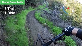
Parking in the water district, you start down the new Waterworks drop in, then take Escalator back up the the old drop in for another lap of Waterworks. After climbing back up, you take the left fork to continue onto The Undertaker (marked as Los Flores Ridge). Before you go under Antonio Parkway, you turn right to continue onto Spitfire. Then another lap on Spitfire and a final lap on Waterworks to finish things off for the day.

Trail Issues on Route
- Minor Issue / Yellow: 2 trails (newest: Jun 27, 2026)
Local Trail Association
Laguna Canyon RidersStats
-
Distance9 miles
-
Avg time1 hr 13 min
-
Altitude min401 ft
-
Altitude start603 ft
-
Altitude end591 ft
-
Climb970 ft
-
Descent-982 ft
-
Grade max-28.2%
-
Grade min25.7%
-
Distance climb4 miles
-
Distance down4 miles
-
Distance flat4,790 ft
37 Reviews & Comments
We hope you've been enjoying Trailforks!
Create a FREE account to view all route reviews and much more.
Trails in Route
| 495 ft | |||||
| 3,333 ft | |||||
| 2,201 ft | |||||
| 1,001 ft | |||||
| 3,333 ft | |||||
| 2,201 ft | |||||
| 1,001 ft | |||||
| 417 ft | |||||
| 1,020 ft | |||||
| 3,123 ft | |||||
| 2 miles | |||||
| 2,201 ft | |||||
| 1,001 ft | |||||
| 417 ft | |||||
| 2,182 ft | |||||
| 3,123 ft | |||||
| 2,201 ft | |||||
| 1,001 ft | |||||
| 3,333 ft | |||||
| 2,205 ft |
Details
-
Riding area
-
Primary ActivityMountain Bike
-
Difficulty ratingGreen
-
Route TypeLoop
-
Bike typeDH, AM, XC, DJ, Fat
-
DirectionOne Direction
-
Physical ratingModerate
-
Activity Logs
- Unknown
- Snow Groomed
- Snow Packed
- Snow Covered
- Snow Cover Partial
- Freeze/thaw Cycle
- Icy
- Prevalent Mud
- Wet
- Variable
- Ideal
- Dry
- Very Dry
The colour categories are based on what percentage of users are riding a trail in its intended direction.
- > 96%
- > 90%
- > 80%
- > 70%
- > 50%
- < 50%
- bi-directional trail
- no data
- < 2 days
- < 1 week
- < 2 weeks
- < 1 month
- < 6 months
- > 6 months
- Downhill Only
- Downhill Primary
- Both Directions
- Uphill Primary
- Uphill Only
- One Direction
- Description
- Photos
- Description & Photos
- Videos
- most popular
- popular
- less popular
- not popular
Service Road Atlas is a free to use, community-driven service for viewing and creating reports on the numerous back-country service roads around B.C. and Alberta.
Save the current map location and zoom level as your default home location whenever this page is loaded.
Save- Singletrack
Photos
Videos
Recent Trail Reports Along Route
- By DPTR & contributors
- #34529 - 1,024 views
