12.3 miles
Distance
1,105 ft
Climb
-1,106 ft
Descent
547 ft
High Point
156 ft
Altitude min
421 ft
Altitude start
420 ft
Altitude end
-53.5%
Grade max
38.6%
Grade min
5 miles
Distance climb
5 miles
Distance down
3 miles
Distance flat

Riding after rain is not reccomended, give the tracks at least a week to dry out before riding and check the trail status on the NPWS website
This route is not AMTB friendly due to the akward nature of the climbs

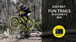
This all-mountain loop of Loftus takes in the best green and blue tracks of the northern end of the Royal National Park. This route is natural and techy and traverses a wide variety of trails in the park. The most challenging features on this loop have b-lines so it should be achieveable for most riders.

From the Loftus Oval carpark, turn right onto HQ Holden, cross Farnell Avenue and follow the trails on the Princes Highway towards Engadine. Turn off the Engadine Lakes Fire Trail onto Don't Pinch Me and the Teapot Trail. Climb up to Loftus Trig then head down South Connex and Can of Worms back towards Farnell Avenue.

From Farnell Avenue, join Blair Witch and the Sginalhouse Trail before weaving back through the forest towards Loftus Oval. Head down Upper Middle Bogan and Holy Trail before traversing Along Savilles Creek. At the top of the Savilles Creek climb, you can join Bobcats to add some black tech spice into the route - this hasn't been included to cap the difficulty at blue but it will loop you back onto the start of Savilles Creek so have an explore if you've got some energy From the top of Savilles Creek, join Ziggy & Zaggy before rolling back towards the finish.

I have tested this loop on my Garmin but if there are any segments that need tidying up please let me know and I will fix them.

Detailed Description
Loftus all-mountain loop is a 12 mile intermediate route located near Sydney. This mountain bike primary route can be used both directions and has a hard overall physical rating. This route includes 24 trails. This route climbs 1,105 ft with a max elevation of 547 ft then descends -1,106 ft.
Local Trail Association
Local trail association
Northern Beaches Mountain Biking Group (nobmob.com)
Please consider joining or donating to the local riding association to support trail development & maintenance.
Donate to earn trail karma!

Stats

  • Distance
    12 miles
  • Altitude min
    156 ft
  • Altitude start
    421 ft
  • Altitude end
    420 ft
  • Climb
    1,105 ft
  • Descent
    -1,106 ft
  • Grade max
    -53.5%
  • Grade min
    38.6%
  • Distance climb
    5 miles
  • Distance down
    5 miles
  • Distance flat
    3 miles

53 Reviews & Comments


We hope you've been enjoying Trailforks!

Create a FREE account to view route comments and much more.

Details

  • Riding area
  • Primary Activity
    Mountain Bike
  • Other Activities
    • E-Bike
  • Difficulty rating
    Blue
  • Route Type
    Loop
  • eBike Allowed
  • Bike type
    AM, XC
  • Direction
    Both Directions
  • Physical rating
    Hard
no votes yet
close
3D
Trail Conditions
  • Unknown
  • Snow Groomed
  • Snow Packed
  • Snow Covered
  • Snow Cover Partial
  • Freeze/thaw Cycle
  • Icy
  • Prevalent Mud
  • Wet
  • Variable
  • Ideal
  • Dry
  • Very Dry
Trail Flow (Ridden Direction)
Trailforks scans users ridelogs to determine the most popular direction each trail is ridden. A good flowing trail network will have most trails flowing in a single direction according to their intension.
The colour categories are based on what percentage of riders are riding a trail in its intended direction.
  • > 96%
  • > 90%
  • > 80%
  • > 70%
  • > 50%
  • < 50%
  • bi-directional trail
  • no data
Trail Last Ridden
Trailforks scans ridelogs to determine the last time a trail was ridden.
  • < 2 days
  • < 1 week
  • < 2 weeks
  • < 1 month
  • < 6 months
  • > 6 months
Trail Ridden Direction
The intended direction a trail should be ridden.
  • Downhill Only
  • Downhill Primary
  • Both Directions
  • Uphill Primary
  • Uphill Only
  • One Direction
Contribute Details
Colors indicate trail is missing specified detail.
  • Description
  • Photos
  • Description & Photos
  • Videos
Trail Popularity ?
Trailforks scans ridelogs to determine which trails are ridden the most in the last 9 months. Trails are compared with nearby trails in the same city region with a possible 25 colour shades. Think of this as a heatmap, more rides = more kinetic energy = warmer colors.
  • most popular
  • popular
  • less popular
  • not popular
ATV/ORV/OHV Filter
Max Vehicle Width
inches
US Cell Coverage
Legend
cell carrier legend

Radar Time
Activity Recordings
Trailforks uses anonymized public activity data. ?
Activity Recordings
Trailforks uses anonymized public activity data. ?
Personal Heatmap
Activity Types
all / none
Options
2
Date range month
Winter Trails
Warning A routing network for winter maps does not exist. Selecting trails using the winter trails layer has been disabled.
Missing Trails
Most Popular
Least Popular
Trails are colored based on popularity. The more popular a trail is, the more red. Less popular trails trend towards green.
Jump Magnitude Heatmap
Heatmap of where riders jump on trails. Zoom in to see individual jumps, click circles to view jump details.
BC Backroad Status

Service Road Atlas is a free to use, community-driven service for viewing and creating reports on the numerous back-country service roads around B.C. and Alberta.

map legend
Slope Aspect
Direction the slope faces
Flat N NE E SE S SW W NW
Trails Deemphasized
Trails are shown in grey.
disable
Only show trails with no bike usage.
Enable
Suggested Layers
Based on selected activity type

    Save the current map location and zoom level as your default home location whenever this page is loaded.

    Save
    Trail transparency
    • Singletrack
    57
    38
    25
    152

    Recent Trail Reports Along Route

    statustraildateconditiondescription
    Blair Witch
    Jun 6, 2026 @ 11:56am (Australia/Sydney)
    Jun 5, 2026
    Link
    Jun 6, 2026 @ 11:56am (Australia/Sydney)
    Jun 5, 2026
    Highway Trail (Middle)
    Jun 6, 2026 @ 11:56am (Australia/Sydney)
    Jun 5, 2026
    Pond Trail Add on
    Jun 6, 2026 @ 11:56am (Australia/Sydney)
    Jun 5, 2026
    Box Divit
    Jun 6, 2026 @ 11:56am (Australia/Sydney)
    Jun 5, 2026
    more reports »
    • By MacroTiaraTF Pro & contributors
    • #67398 - 14 views

    Hit the Trail

    Open in App

    Get this route on your phone instantly.

    Download Route

    Save to wishlist, Garmin & download.