

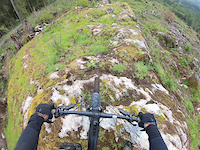
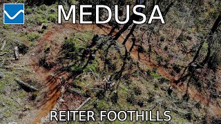
Starting from the parking lot located at the end of 429th street in Gold Bar, begin riding through the blackberry patch to make it into the forest where the climbing starts.
Once on the climb trail, the goal is to reach the vista loop using the east entrance that comes off the May Creek trail and then make loops as you head back towards the parking lot to hit all the singletrack.
If you're looking for an adventure and more miles, the May Creek trail beyond the vista trail's east entrance can be taken as an out and back to May Creek Falls. Expect some hike a bike creek crossings and rough trail through old road grades.
Local Trail Association
Sky Valley Singletrack (www.instagram.com)Trail Products
Stats
-
Distance4 miles
-
Altitude change-2 ft
-
Altitude min391 ft
-
Altitude start396 ft
-
Altitude end394 ft
-
Climb847 ft
-
Descent-850 ft
-
Grade max-48.4%
-
Grade min46.1%
-
Distance climb2 miles
-
Distance down2 miles
-
Distance flat1,522 ft
7 Reviews & Comments
We hope you've been enjoying Trailforks!
Create a FREE account to view all route reviews and much more.
Trails in Route
| 4,058 ft | |||||
| 3 miles | |||||
| 2,372 ft | |||||
| 2,306 ft |

Details
-
Riding area
-
Primary ActivityMountain Bike
-
Difficulty ratingBlue
Directions
- Bike west on Cramp On.
- Continue for 600 meters.
- Bike northwest on Cramp On.
- Continue for 300 meters.
- Turn right to stay on Cramp On.
- Continue for 200 meters.
- Turn right to stay on Cramp On.
- Continue for 200 meters.
- Bike northeast on Cramp On.
- Continue for 20 meters.
- Bike north on May Creek Trail.
- Continue for less than 10 meters.
- Bike southeast on May Creek Trail.
- Continue for 10 meters.
- Bike southeast on May Creek Trail.
- Continue for 60 meters.
- Bike southeast on May Creek Trail.
- Continue for 300 meters.
- Bike southeast on May Creek Trail.
- Continue for 800 meters.
- Bike east on May Creek Trail.
- Continue for 20 meters.
- Turn left onto Sky Valley Vista Trail.
- Continue for 200 meters.
- Bike west on Sky Valley Vista Trail.
- Continue for 700 meters.
- Bike north on Sky Valley Vista Trail.
- Continue for 300 meters.
- Bike west on Sky Valley Vista Trail.
- Continue for 300 meters.
- Bike northwest on Sky Valley Vista Trail.
- Continue for 200 meters.
- Bike southeast on Sky Valley Vista Trail.
- Continue for 10 meters.
- Turn right onto Cramp On.
- Continue for 10 meters.
- Turn right onto MY-21.
- Continue for 200 meters.
- Bike west on MY-21.
- Continue for 50 meters.
- Bear right onto Half Mile Loop.
- Continue for 200 meters.
- Bike northwest on Half Mile Loop.
- Continue for 300 meters.
- Bike southeast on Half Mile Loop.
- Continue for 300 meters.
- Bike south on Half Mile Loop.
- Continue for 20 meters.
- Turn left onto Cramp On.
- Continue for 200 meters.
- Bike northwest on Flash.
- Continue for 80 meters.
- Bike north on Flash.
- Continue for 10 meters.
- Bike northwest on MY-21.
- Continue for 30 meters.
- Bike northwest on MY-21.
- Continue for 300 meters.
- Bike southwest on Medusa.
- Continue for 200 meters.
- Bike southeast on Medusa.
- Continue for 600 meters.
- Bike east on Medusa.
- Continue for less than 10 meters.
- Bear right onto Cramp On.
- Continue for 200 meters.
- Unknown
- Snow Groomed
- Snow Packed
- Snow Covered
- Snow Cover Partial
- Freeze/thaw Cycle
- Icy
- Prevalent Mud
- Wet
- Variable
- Ideal
- Dry
- Very Dry
The colour categories are based on what percentage of users are riding a trail in its intended direction.
- > 96%
- > 90%
- > 80%
- > 70%
- > 50%
- < 50%
- bi-directional trail
- no data
- < 2 days
- < 1 week
- < 2 weeks
- < 1 month
- < 6 months
- > 6 months
- Downhill Only
- Downhill Primary
- Both Directions
- Uphill Primary
- Uphill Only
- One Direction
- Description
- Photos
- Description & Photos
- Videos
- most popular
- popular
- less popular
- not popular
Service Road Atlas is a free to use, community-driven service for viewing and creating reports on the numerous back-country service roads around B.C. and Alberta.
Save the current map location and zoom level as your default home location whenever this page is loaded.
Save- Singletrack
Photos
Videos
Recent Trail Reports Along Route
- By jordanlacroix
SVS & contributors - #55400 - 623 views

