4.7 miles
Distance
634 ft
Climb
-644 ft
Descent
1,089 ft
High Point
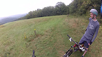
This loop caters for the advanced beginner, Ascutney-style. It includes some intermediate terrain that the real beginner may find challenging, yet help with progression. A rocky brook crossing, some wide boardwalks and a bridge over a brook on Raina's run.
Detailed Description
Lou's Loop is a 5 mile moderately popular easy route located near Brownsville Vermont. This mountain bike only route. This route includes 9 trails. This route climbs 634 ft with a max elevation of 1,089 ft then descends -644 ft.
Local Trail Association
Ascutney Trails Association (www.ascutneytrails.com)Please consider joining or donating to the local riding association to support trail development & maintenance.
donate to earn trail karma!
We hope you've been enjoying Trailforks!
Create a FREE account to view route comments and much more.
Trails in Route
1,991 ft | |||||
1,834 ft | |||||
295 ft | |||||
682 ft | |||||
171 ft | |||||
4,085 ft | |||||
4,055 ft |
Details
-
Riding area
-
Primary ActivityMountain Bike
-
Difficulty ratingGreen
-
eBike Allowed
-
Ridelogs
More Stats for Lou's Loop mountain bike route
-
Avg time1 hr 10 min
-
Altitude change-9 ft
-
Altitude min738 ft
-
Altitude start823 ft
-
Altitude end814 ft
-
Grade max-35.6%
-
Grade min25.8%
-
Distance climb2 miles
-
Distance down2 miles
-
Distance flat3,281 ft
Directions
- Walk northeast on Gravelle's Grinder.
- Continue for 80 meters.
- Turn right onto Lou's Loop.
- Continue for 400 meters.
- Bear left onto Last Mile.
- Continue for less than 10 meters.
- Bear right to stay on Last Mile.
- Continue for less than 10 meters.
- Turn left onto Lou's Loop.
- Continue for 700 meters.
- Turn right onto Last Mile.
- Continue for 20 meters.
- Keep right to stay on Last Mile.
- Continue for 20 meters.
- Keep left to stay on Last Mile.
- Continue for less than 10 meters.
- Keep left to stay on Last Mile.
- Continue for 300 meters.
- Turn left to stay on Last Mile.
- Continue for 200 meters.
- Keep right to stay on Last Mile.
- Continue for 700 meters.
- Keep right to take Utility Road.
- Continue for 200 meters.
- Keep right to stay on Utility Road.
- Continue for 100 meters.
- Turn left onto Deer Run.
- Continue for 600 meters.
- Make a sharp right onto Utility Road.
- Continue for 60 meters.
- Turn left onto Raina's Run.
- Continue for 200 meters.
- Bear left onto Picnic.
- Continue for 10 meters.
- Keep straight to stay on Picnic.
- Continue for less than 10 meters.
- Keep straight to stay on Picnic.
- Continue for less than 10 meters.
- Keep right to stay on Picnic.
- Continue for 30 meters.
- Keep straight to stay on Picnic.
- Continue for less than 10 meters.
- Keep left to stay on Picnic.
- Continue for 10 meters.
- Keep right to stay on Picnic.
- Continue for less than 10 meters.
- Keep right to stay on Picnic.
- Continue for less than 10 meters.
- Keep left to stay on Picnic.
- Continue for less than 10 meters.
- Keep straight to stay on Picnic.
- Continue for 10 meters.
- Keep right to stay on Picnic.
- Continue for less than 10 meters.
- Keep left to stay on Picnic.
- Continue for less than 10 meters.
- Keep left to stay on Picnic.
- Continue for less than 10 meters.
- Keep left to stay on Picnic.
- Continue for 10 meters.
- Keep right to stay on Picnic.
- Continue for 20 meters.
- Keep right to stay on Picnic.
- Continue for 30 meters.
- Keep right to stay on Picnic.
- Continue for 20 meters.
- Keep right to stay on Picnic.
- Continue for 10 meters.
- Bear right to stay on Picnic.
- Continue for 30 meters.
- Keep straight to stay on Picnic.
- Continue for 20 meters.
- Bear left to stay on Picnic.
- Continue for less than 10 meters.
- Keep left to stay on Picnic.
- Continue for less than 10 meters.
- Keep straight to stay on Picnic.
- Continue for less than 10 meters.
- Keep left to stay on Picnic.
- Continue for less than 10 meters.
- Keep left to stay on Picnic.
- Continue for 10 meters.
- Keep straight to stay on Picnic.
- Continue for less than 10 meters.
- Keep right to stay on Picnic.
- Continue for less than 10 meters.
- Keep right to stay on Picnic.
- Continue for less than 10 meters.
- Keep right to stay on Picnic.
- Continue for less than 10 meters.
- Keep straight to stay on Picnic.
- Continue for 10 meters.
- Keep left to stay on Picnic.
- Continue for 10 meters.
- Keep left to stay on Picnic.
- Continue for less than 10 meters.
- Keep straight to stay on Picnic.
- Continue for 20 meters.
- Keep straight to stay on Picnic.
- Continue for 10 meters.
- Keep right to stay on Picnic.
- Continue for 20 meters.
- Keep left to stay on Picnic.
- Continue for 20 meters.
- Turn left to stay on Picnic.
- Continue for 40 meters.
- Keep straight to stay on Picnic.
- Continue for less than 10 meters.
- Keep right to stay on Picnic.
- Continue for less than 10 meters.
- Keep straight to stay on Picnic.
- Continue for 10 meters.
- Keep right to stay on Picnic.
- Continue for 10 meters.
- Keep right to stay on Picnic.
- Continue for less than 10 meters.
- Keep right to stay on Picnic.
- Continue for less than 10 meters.
- Keep straight to stay on Picnic.
- Continue for 10 meters.
- Keep left to stay on Picnic.
- Continue for less than 10 meters.
- Keep straight to stay on Picnic.
- Continue for 20 meters.
- Keep straight to stay on Picnic.
- Continue for less than 10 meters.
- Keep straight to stay on Picnic.
- Continue for less than 10 meters.
- Keep left to stay on Picnic.
- Continue for less than 10 meters.
- Keep straight to stay on Picnic.
- Continue for 10 meters.
- Keep straight to stay on Picnic.
- Continue for 20 meters.
- Turn left to stay on Picnic.
- Continue for 40 meters.
- Keep straight to stay on Picnic.
- Continue for 10 meters.
- Keep right to stay on Picnic.
- Continue for less than 10 meters.
- Keep left to stay on Picnic.
- Continue for 10 meters.
- Keep right to stay on Picnic.
- Continue for less than 10 meters.
- Keep straight to stay on Picnic.
- Continue for 20 meters.
- Keep left to stay on Picnic.
- Continue for less than 10 meters.
- Keep left to stay on Picnic.
- Continue for less than 10 meters.
- Keep straight to stay on Picnic.
- Continue for less than 10 meters.
- Keep left to stay on Picnic.
- Continue for 10 meters.
- Keep right to stay on Picnic.
- Continue for less than 10 meters.
- Keep left to stay on Picnic.
- Continue for 10 meters.
- Keep right to stay on Picnic.
- Continue for less than 10 meters.
- Keep straight to stay on Picnic.
- Continue for less than 10 meters.
- Keep right to stay on Picnic.
- Continue for less than 10 meters.
- Keep left to stay on Picnic.
- Continue for 10 meters.
- Keep right to stay on Picnic.
- Continue for 10 meters.
- Keep right to stay on Picnic.
- Continue for 10 meters.
- Keep right to stay on Picnic.
- Continue for less than 10 meters.
- Keep straight to stay on Picnic.
- Continue for 20 meters.
- Keep left to stay on Picnic.
- Continue for 10 meters.
- Keep right to stay on Picnic.
- Continue for 20 meters.
- Keep left to stay on Picnic.
- Continue for 10 meters.
- Bear left onto Hay Ride.
- Continue for 1 kilometer.
- Make a sharp left to stay on Hay Ride.
- Continue for less than 10 meters.
- Bear right onto Picnic.
- Continue for 40 meters.
- Turn right onto Hay Ride.
- Continue for 100 meters.
- Turn left to stay on Hay Ride.
- Continue for 30 meters.
- Turn right to stay on Hay Ride.
- Continue for 30 meters.
- Keep left to stay on Hay Ride.
- Continue for 60 meters.
- Turn right to stay on Hay Ride.
- Continue for 30 meters.
- Make a right U-turn to stay on Hay Ride.
- Continue for 30 meters.
- Turn left to stay on Hay Ride.
- Continue for 50 meters.
- Turn right onto Blue Dipper.
- Continue for 100 meters.
- Make a sharp right onto Picnic.
- Continue for 1.5 kilometers.
- Turn right onto Home Again.
- Continue for 200 meters.
- Turn right onto Ascutney Outdoors Trail.
- Continue for less than 10 meters.
- Turn right onto Last Mile.
- Continue for less than 10 meters.
- Turn left to stay on Last Mile.
- Continue for 20 meters.
close
3D
Trail Conditions
- Unknown
- Snow Groomed
- Snow Packed
- Snow Covered
- Snow Cover Partial
- Freeze/thaw Cycle
- Icy
- Prevalent Mud
- Wet
- Variable
- Ideal
- Dry
- Very Dry
Trail Flow (Ridden Direction)
Trailforks scans users ridelogs to determine the most popular direction each trail is ridden. A good flowing trail network will have most trails flowing in a single direction according to their intension.
The colour categories are based on what percentage of riders are riding a trail in its intended direction.
- > 96%
- > 90%
- > 80%
- > 70%
- > 50%
- < 50%
- bi-directional trail
- no data
Trail Last Ridden
Trailforks scans ridelogs to determine the last time a trail was ridden.
- < 2 days
- < 1 week
- < 2 weeks
- < 1 month
- < 6 months
- > 6 months
Trail Ridden Direction
The intended direction a trail should be ridden.
- Downhill Only
- Downhill Primary
- Both Directions
- Uphill Primary
- Uphill Only
- One Direction
Contribute Details
Colors indicate trail is missing specified detail.
- Description
- Photos
- Description & Photos
- Videos
Trail Popularity ?
Trailforks scans ridelogs to determine which trails are ridden the most in the last 9 months.
Trails are compared with nearby trails in the same city region with a possible 25 colour shades.
Think of this as a heatmap, more rides = more kinetic energy = warmer colors.
- most popular
- popular
- less popular
- not popular
ATV/ORV/OHV Filter
Max Vehicle Width
inches
US Cell Coverage
Legend
Radar Time
x
Activity Recordings
Trailforks users anonymized public ridelogs from the past 6 months.
- mountain biking recent
- mountain biking (>6 month)
- hiking (1 year)
- moto (1 year)
Activity Recordings
Trailforks users anonymized public skilogs from the past 12 months.
- Downhill Ski
- Backcountry Ski
- Nordic Ski
- Snowmobile
Winter Trails
Warning
A routing network for winter maps does not exist. Selecting trails using the winter trails layer has been disabled.
x
Missing Trails
Most Popular
Least Popular
Trails are colored based on popularity. The more popular a trail is, the more red. Less popular trails trend towards green.
Jump Magnitude Heatmap
Heatmap of where riders jump on trails. Zoom in to see individual jumps, click circles to view jump details.
Trails Deemphasized
Trails are shown in grey.
Only show trails with NO bikes.
Save the current map location and zoom level as your default home location whenever this page is loaded.
Save
Trail transparency
Photos
Videos

Hayride Mt. Ascutney
trail: Hay Ride
10:46 | 444 | comments: 0 | favs:
Aug 31, 2013
Riding with Bennett down Hay ride Mt. Ascutney Vt.
Recent Trail Reports Along Route
more reports »
- By atainfo
ATA & contributors
- #30674 - 1,095 views