
5.7 miles
Distance
1,211 ft
Climb
-1,202 ft
Descent
961 ft
High Point
10 ft
Altitude change
279 ft
Altitude min
627 ft
Altitude start
636 ft
Altitude end
-46.9%
Grade max
58.9%
Grade min
3 miles
Distance climb
2 miles
Distance down
2,825 ft
Distance flat

Technical up and down, all mixed together.

Detailed Description
Lung Test is a 6 mile moderately popular intermediate route located near Victoria British Columbia. This mountain bike only route. This route includes 15 trails. This route climbs 1,211 ft with a max elevation of 961 ft then descends -1,202 ft.
Tags

Trail Issues on Route

  • Significant Issue / Amber: 1 trail (newest: Mar 13, 2026)
  • Minor Issue / Yellow: 1 trail (newest: Sep 26, 2026)
Route Supporters

Local Trail Association

Local trail association
South Island Mountain Bike Society (simbs.com)
Please consider joining or donating to the local riding association to support trail development & maintenance.
Donate to earn trail karma!

Stats

  • Distance
    6 miles
  • Altitude change
    10 ft
  • Altitude min
    279 ft
  • Altitude start
    627 ft
  • Altitude end
    636 ft
  • Climb
    1,211 ft
  • Descent
    -1,202 ft
  • Grade max
    -46.9%
  • Grade min
    58.9%
  • Distance climb
    3 miles
  • Distance down
    2 miles
  • Distance flat
    2,825 ft

7 Reviews & Comments


We hope you've been enjoying Trailforks!

Create a FREE account to view all route reviews and much more.

Trails in Route

Details

  • Riding area
  • Primary Activity
    Mountain Bike
  • Difficulty rating
    Blue
  • eBike Allowed
no votes yet
close
Trail transparency
  • Singletrack
  • Unpaved
mtb
73
mtb
95
mtb
117
mtb
Last Car on the Ferry and the top part of...
mtb
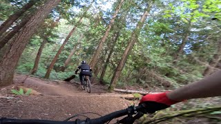
Last Car on the Ferry and the top part of Joe's Berms
0:43 | 184 | comments: 0 | favs:
May 14, 2024
Last Car on the Ferry at Partridge Hills in...
mtb
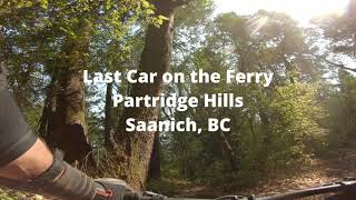
Last Car on the Ferry at Partridge Hills in Saanich, BC
3:32 | 151 | comments: 0 | favs:
May 2, 2024

Recent Trail Reports Along Route

statustraildateconditiondescription
Sadie's Woods
Nov 8, 2026 @ 1:44pm (America/Vancouver)
Nov 8, 2026
Rocks and roots are wet, but overall the dirt is in awesome condition. Trail is clear.
Gnartridge
Nov 8, 2026 @ 1:44pm (America/Vancouver)
Nov 8, 2026
Rocks and roots are wet, but overall the dirt is in awesome condition. Trail is clear.
Hawk
Oct 25, 2026 @ 8:26am (America/Vancouver)
Oct 25, 2026
I hiked the trail and it was clear. No sign of any trees blocking the trail.
Hawk
Sep 26, 2026 @ 8:18am (America/Vancouver)
Sep 26, 2026
Tree down
Last Car on the Ferry
Aug 16, 2026 @ 3:28pm (America/Vancouver)
Aug 16, 2026
more reports »
  • By keeqanTF Pro & contributors
  • #69316 - 25 views

Hit the Trail

Open in App

Get this route on your phone instantly.

Download Route

Save to wishlist, Garmin & download.