
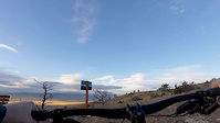
This mixed terrain route starts and finishes at the "M" hill and takes you up to the Granite Memorial, providing spectacular views of Butte and an opportunity to soak in the town's rich history. This is a great ride to do if you are new to Butte, or wanting a break from more difficult singletrack climbs.
It can be ridden in either direction, although I recommend riding it counter clockwise as you will have the majority of your ascent on a paved path, and the majority of your descent on dirt singletrack. Connecting these two distinct sections is a mixture of Sealed and gravel roads that take you through Walkerville.

Local Trail Association
Highlands Cycling Club (www.bikebutte.org)Trail Products
Stats
-
Distance8 miles
-
Avg time1 hr 40 min
-
Altitude min5,655 ft
-
Altitude start5,712 ft
-
Altitude end5,728 ft
-
Climb795 ft
-
Descent-780 ft
-
Grade max-23.7%
-
Grade min40.5%
-
Distance climb5 miles
-
Distance down4 miles
-
Distance flat1,430 ft
We hope you've been enjoying Trailforks!
Create a FREE account to view all route reviews and much more.
Trails in Route
| 217 ft | |||||
| 4,121 ft | |||||
| 2,169 ft | |||||
Details
-
Riding area
-
Primary ActivityMountain Bike
-
Other Activities
- Gravel Bike
- Winter Fat Bike
- Hike
- Trail Running
-
Difficulty ratingGreen
-
Route TypeLoop
-
eBike Allowed
-
Bike typeXC, Gravel
-
DirectionBoth Directions
-
Physical ratingModerate
Directions
- Bike south.
- Continue for 80 meters.
- Bike northeast on BA&P Hill Trail.
- Continue for 3 kilometers.
- Turn left to stay on BA&P Hill Trail.
- Continue for 700 meters.
- Bear left onto BA&P Connector.
- Continue for 200 meters.
- Turn left onto BA&P Hill Trail.
- Continue for 800 meters.
- Bike north on Badger Road.
- Continue for 100 meters.
- Bike west on Badger Road.
- Continue for 100 meters.
- Bike northwest on Alexander Street.
- Continue for 100 meters.
- Bike north on Cora Terrace.
- Continue for 200 meters.
- Bike west on Ryan Road.
- Continue for 300 meters.
- Bike west on Ryan Road.
- Continue for 200 meters.
- Keep right to stay on Ryan Road.
- Continue for 300 meters.
- Bike southwest on Ryan Road.
- Continue for 300 meters.
- Bike west on Big Butte Trail West.
- Continue for 400 meters.
- Bike northeast on Auditor.
- Continue for 1.5 kilometers.
- Bike south on Auditor.
- Continue for 400 meters.
- Bike southwest on Neversweat.
- Continue for 50 meters.
- Turn right to stay on Neversweat.
- Continue for 300 meters.
- Bike east on Neversweat.
- Continue for 30 meters.
- Bear right onto MT-5.
- Continue for less than 10 meters.
- Turn right onto Butte Bike Park Perimeter Trail.
- Continue for 80 meters.
- Bike southwest on Butte Bike Park Perimeter Trail.
- Continue for 30 meters.
- Bike west on Butte Bike Park Perimeter Trail.
- Continue for 20 meters.
- Bike west on Butte Bike Park Perimeter Trail.
- Continue for 1.5 kilometers.
- Bike southeast on Butte Bike Park Perimeter Trail.
- Continue for 20 meters.
- Unknown
- Snow Groomed
- Snow Packed
- Snow Covered
- Snow Cover Partial
- Freeze/thaw Cycle
- Icy
- Prevalent Mud
- Wet
- Variable
- Ideal
- Dry
- Very Dry
The colour categories are based on what percentage of users are riding a trail in its intended direction.
- > 96%
- > 90%
- > 80%
- > 70%
- > 50%
- < 50%
- bi-directional trail
- no data
- < 2 days
- < 1 week
- < 2 weeks
- < 1 month
- < 6 months
- > 6 months
- Downhill Only
- Downhill Primary
- Both Directions
- Uphill Primary
- Uphill Only
- One Direction
- Description
- Photos
- Description & Photos
- Videos
- most popular
- popular
- less popular
- not popular
Service Road Atlas is a free to use, community-driven service for viewing and creating reports on the numerous back-country service roads around B.C. and Alberta.
Save the current map location and zoom level as your default home location whenever this page is loaded.
Save- Singletrack
- Paved
Videos
