
1.9 miles
Distance
235 ft
Climb
-228 ft
Descent
775 ft
High Point
7 ft
Altitude change
656 ft
Altitude min
656 ft
Altitude start
663 ft
Altitude end
0.1%
Grade
-23.3%
Grade max
24.9%
Grade min
3,980 ft
Distance climb
4,252 ft
Distance down
1,726 ft
Distance flat

About 2 miles of trails with access to a lookout of Lake Bellaire
Detailed Description
Maple Leaf is a 2 mile moderately popular intermediate route located near Bellaire Michigan. This mountain bike primary route can be used both directions and has a moderate overall physical rating. This route includes 12 trails. This route climbs 235 ft with a max elevation of 775 ft then descends -228 ft.
Tags
Family friendlyLakeViews

Local Trail Association

Local trail association
Glacial Hills Trails (www.glacialhillstrails.org)
Please consider joining or donating to the local riding association to support trail development & maintenance.

Stats

  • Distance
    2 miles
  • Avg time
    53 min 44 sec
  • Altitude min
    656 ft
  • Altitude start
    656 ft
  • Altitude end
    663 ft
  • Climb
    235 ft
  • Descent
    -228 ft
  • Grade
    0.1%
  • Grade max
    -23.3%
  • Grade min
    24.9%
  • Distance climb
    3,980 ft
  • Distance down
    4,252 ft
  • Distance flat
    1,726 ft

1 Review & Comments

i81fish2bellaire
Maple Leaf (2.2 miles) is accessed from the Eckhardt Trailhead from either the Kiosk path leading to Intersection X (#1) or Intersection Y (#4). Maple Leaf offers an abundance of rolling terrain. Starting at Intersection X, a counterclockwise journey encounters a huge Maple Tree, the trails namesake. At that point the winding trail ascends steadily through a grove of conifers, seasonal wildflowers, and wild raspberry bushes. At Intersection Z (#6) an option is presented to diversion to the Outlook viewpoint. The route then winds to the north through a hardwood forest and back to the Kiosk at the Eckhardt Trailhead.

We hope you've been enjoying Trailforks!

Create a FREE account to view all route reviews and much more.

Details

  • Riding area
  • Primary Activity
    Mountain Bike
  • Other Activities
    • Hike
    • Trail Running
    • Snowshoe
    • Backcountry Ski
  • Difficulty rating
    Blue
  • Route Type
    Loop
  • eBike Allowed
  • Bike type
    AM, Fat
  • Direction
    Both Directions
  • Physical rating
    Moderate
  • Activity Logs
    9
no votes yet
close
Trail transparency
  • Singletrack
mtb
312
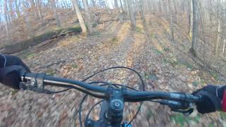
Quick clip from a leafy day at Glacial Hils
mtb
Quick clip from a leafy day at Glacial Hils
0:51 | 595 | comments: 0 | favs:
Apr 23, 2018
Glacial Hills fall fun
mtb
Glacial Hills fall fun
3:16 | 691 | comments: 0 | favs:
Apr 23, 2018

Recent Trail Reports Along Route

statustraildateconditiondescription
GH #7 - #15
Sep 4, 2026 @ 10:04am (America/Detroit)
Sep 4, 2026
GH #9 - #10
Sep 4, 2026 @ 10:04am (America/Detroit)
Sep 4, 2026
GH #8 - #9
Aug 20, 2026 @ 2:13pm (America/Menominee)
Aug 20, 2026
GH #18 - #19
Aug 20, 2026 @ 2:13pm (America/Menominee)
Aug 20, 2026
GH #13 - #15
May 24, 2026 @ 2:34pm (America/Menominee)
May 24, 2026
more reports »
  • By i81fish2bellaire GHT & contributors
  • #11780 - 1,375 views

Hit the Trail

Open in App

Get this route on your phone instantly.

Download Route

Save to wishlist, Garmin & download.