

Open in App
Get this route on your phone instantly.
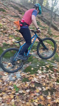
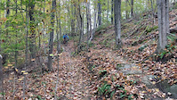
Quick out/back loop from the trailhead to the summit and down and back. Miles are low but it's challenging and lots of features and geology to entertain you. Note that this route takes you down a technical rock roller on the downhill section, but there is a b-line to the left to avoid it all together.
We hope you've been enjoying Trailforks!
Create a FREE account to view all route reviews and much more.
| 1,998 ft | |||||
| 2,493 ft | |||||
| 4,600 ft | |||||
| 1,424 ft | |||||
| 1,962 ft |

Service Road Atlas is a free to use, community-driven service for viewing and creating reports on the numerous back-country service roads around B.C. and Alberta.
Save the current map location and zoom level as your default home location whenever this page is loaded.
Save MWF & contributors