
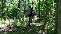
The expert loop of the 2016 Kona Mountain Bike Adventure Series Ride at Trail of Tears. This ride originates from the Race Lane parking lot instead of Camp Lyndon which is a private camp that was only rented for the day of the event.
This loop encompasses the majority of the trails in the West Barnstable Conservation Area while trying to ride them in the best direction (depending on who you talk to).

Trail Issues on Route
- Significant Issue / Amber: 1 trail (newest: Jul 24, 2026)
Local Trail Association
Cape Cod NEMBA Chapter (nemba-capecod.org)Stats
-
Distance17 miles
-
Avg time1 hr 23 min
-
Altitude min79 ft
-
Altitude start89 ft
-
Altitude end79 ft
-
Climb1,054 ft
-
Descent-1,062 ft
-
Grade max-18.8%
-
Grade min30.6%
-
Distance climb6 miles
-
Distance down7 miles
-
Distance flat4 miles
10 Reviews & Comments
We hope you've been enjoying Trailforks!
Create a FREE account to view all route reviews and much more.
Trails in Route
| 4,491 ft | |||||
| 463 ft | |||||
| 748 ft | |||||
| 810 ft | |||||
| 2,139 ft | |||||
| 2,759 ft | |||||
| 3,222 ft | |||||
| 3,839 ft | |||||
| 600 ft | |||||
| 2,582 ft | |||||
| 5,036 ft | |||||
| 2 miles | |||||
| 2 miles | |||||
| 509 ft | |||||
| 1,362 ft | |||||
| 3,570 ft | |||||
| 4,836 ft | |||||
| 3,619 ft |
Details
-
Riding area
-
Primary ActivityMountain Bike
-
Difficulty ratingBlue
-
Route TypeLoop
-
eBike Allowed
-
Bike typeXC
-
Physical ratingModerate
-
Activity Logs
- Unknown
- Snow Groomed
- Snow Packed
- Snow Covered
- Snow Cover Partial
- Freeze/thaw Cycle
- Icy
- Prevalent Mud
- Wet
- Variable
- Ideal
- Dry
- Very Dry
The colour categories are based on what percentage of users are riding a trail in its intended direction.
- > 96%
- > 90%
- > 80%
- > 70%
- > 50%
- < 50%
- bi-directional trail
- no data
- < 2 days
- < 1 week
- < 2 weeks
- < 1 month
- < 6 months
- > 6 months
- Downhill Only
- Downhill Primary
- Both Directions
- Uphill Primary
- Uphill Only
- One Direction
- Description
- Photos
- Description & Photos
- Videos
- most popular
- popular
- less popular
- not popular
Service Road Atlas is a free to use, community-driven service for viewing and creating reports on the numerous back-country service roads around B.C. and Alberta.
Save the current map location and zoom level as your default home location whenever this page is loaded.
Save- Singletrack
Photos
Videos
Recent Trail Reports Along Route
- By waterbooy
CC NEMBA & contributors - #9514 - 2,490 views
