
3.9 miles
Distance
475 ft
Climb
-511 ft
Descent
2,005 ft
High Point
-36 ft
Altitude change
1,528 ft
Altitude min
1,564 ft
Altitude start
1,529 ft
Altitude end
-0.2%
Grade
-53.5%
Grade max
23.5%
Grade min
2 miles
Distance climb
2 miles
Distance down
2,267 ft
Distance flat

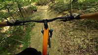
All trail blue loop on the Western Slope highlighting some of the best built trail over the past few years.

Detailed Description
Mid-Mountain Blue Loop Highlights is a 4 mile popular intermediate route located near McGaheysville Virginia. This mountain bike primary route can be used one direction and has a moderate overall physical rating. This route includes 5 trails. This route climbs 475 ft with a max elevation of 2,005 ft then descends -511 ft.
Tags
Machine-built

Trail Issues on Route

  • Minor Issue / Yellow: 4 trails (newest: Oct 13, 2026)
Route Supporters

Local Trail Association

Local trail association
Shenandoah Valley Bicycle Coalition (svbcoalition.org)
Please consider joining or donating to the local riding association to support trail development & maintenance.
Donate to earn trail karma!

Stats

  • Distance
    4 miles
  • Avg time
    44 min 6 sec
  • Altitude min
    1,528 ft
  • Altitude start
    1,564 ft
  • Altitude end
    1,529 ft
  • Climb
    475 ft
  • Descent
    -511 ft
  • Grade
    -0.2%
  • Grade max
    -53.5%
  • Grade min
    23.5%
  • Distance climb
    2 miles
  • Distance down
    2 miles
  • Distance flat
    2,267 ft

2 Reviews & Comments


We hope you've been enjoying Trailforks!

Create a FREE account to view all route reviews and much more.

Trails in Route

Details

  • Riding area
  • Primary Activity
    Mountain Bike
  • Other Activities
    • E-Bike
    • Gravel Bike
  • Difficulty rating
    Blue
  • Route Type
    Loop
  • eBike Allowed
  • Bike type
    XC, Gravel
  • Direction
    One Direction
  • Physical rating
    Moderate
  • Activity Logs
    4

Directions

  1. Walk southeast on Happiest Hour.
  2. Continue for 300 meters.
  3. Turn right onto Red, White & Blue.
  4. Continue for 70 meters.
  5. Walk southeast on Red, White & Blue.
  6. Continue for 700 meters.
  7. Walk southeast on Red, White & Blue.
  8. Continue for 300 meters.
  9. Bear right onto Upper Prologue Road.
  10. Continue for less than 10 meters.
  11. Turn left onto 24 Gravity Monkey.
  12. Continue for less than 10 meters.
  13. Turn left onto Red White and Blue.
  14. Continue for 400 meters.
  15. Walk north on Red White and Blue.
  16. Continue for 200 meters.
  17. Walk southeast on Red White and Blue.
  18. Continue for 200 meters.
  19. Walk southwest on Red White and Blue.
  20. Continue for 200 meters.
  21. Walk northwest on Red White and Blue.
  22. Continue for 40 meters.
  23. Walk west on Red White and Blue.
  24. Continue for 20 meters.
  25. Walk southwest on 24 Gravity Monkey.
  26. Continue for 20 meters.
  27. Walk south on Red White and Blue.
  28. Continue for 40 meters.
  29. Walk south on Red White and Blue.
  30. Continue for 200 meters.
  31. Walk southeast on Red White and Blue.
  32. Continue for 300 meters.
  33. Walk south on Red White and Blue.
  34. Continue for 100 meters.
  35. Walk south on Red White and Blue.
  36. Continue for 20 meters.
  37. Make a sharp left onto 37 Upper Homestead.
  38. Continue for 600 meters.
  39. Keep left to take 10 Lower Ravine.
  40. Continue for 100 meters.
  41. Walk northeast on 10 Lower Ravine.
  42. Continue for 200 meters.
  43. Walk northeast on 10 Lower Ravine.
  44. Continue for 50 meters.
  45. Walk north on Quarantine (Blue).
  46. Continue for 100 meters.
  47. Walk west on Quarantine (Blue).
  48. Continue for 500 meters.
  49. Keep left to take Quarantine.
  50. Continue for 100 meters.
  51. Walk northwest on Quarantine.
  52. Continue for 300 meters.
  53. Bear right onto Happy Hour.
  54. Continue for 200 meters.
  55. Walk southwest on Happy Hour.
  56. Continue for 600 meters.
  57. Bear right onto 40 Chimney Trail.
  58. Continue for 20 meters.
  59. Keep left to take Red, White & Blue.
  60. Continue for 40 meters.
  61. Walk southwest on Red, White & Blue.
  62. Continue for 60 meters.
  63. Walk southwest on Happiest Hour.
  64. Continue for 100 meters.
  65. Walk southwest on Happiest Hour.
  66. Continue for 200 meters.
  67. Walk northwest on Happiest Hour.
  68. Continue for 40 meters.
  69. Walk northwest on Happiest Hour.
  70. Continue for 40 meters.
  71. Walk northwest on Kiosk Trail.
  72. Continue for 60 meters.
  73. Walk west on Kiosk Trail.
  74. Continue for 40 meters.
no votes yet
close
Trail transparency
  • Singletrack
mtb
trail: Happy Hour
242
mtb
trail: Happy Hour
184
mtb
trail: Happy Hour
235
Massanutten Western Slope - Happy Hour Trail
mtb
Massanutten Western Slope - Happy Hour Trail
trail: Happy Hour
3:06 | 106 | comments: 0 | favs:
Jun 30, 2023
I believe this was mostly happy hour to the bottom.
Virginia mountain biking. Western Slope.
mtb
Virginia mountain biking. Western Slope.
trail: Happy Hour
0:58 | 242 | comments: 0 | favs:
Oct 8, 2021

Recent Trail Reports Along Route

statustraildateconditiondescription
Happy Hour
Oct 13, 2026 @ 4:56pm (America/New_York)
Oct 13, 2026
Small tree down across trail, can navigate over or around
Red White and Blue
Aug 18, 2026 @ 9:49pm (America/New_York)
Aug 18, 2026
14 inch tree down light debris
Quarantine (Blue)
Jul 10, 2026 @ 8:32am (America/New_York)
Jul 10, 2026
Red White and Blue
May 28, 2026 @ 5:03pm (America/New_York)
May 28, 2026
Small tree down across trail, can navigate over or around
Happiest Hour
Oct 4, 2025 @ 1:00pm (America/New_York)
Oct 4, 2025
more reports »
  • By Kyle-LawrenceTF Pro SVBC & contributors
  • #44827 - 861 views

Hit the Trail

Open in App

Get this route on your phone instantly.

Download Route

Save to wishlist, Garmin & download.