
Open in App
Get this route on your phone instantly.
Ride at your own risk. Cell phone service is spotty once you get on to Moosepackers Trail and Ridgeback.
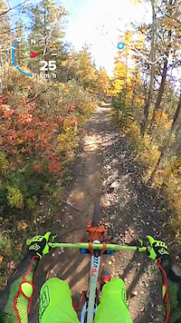
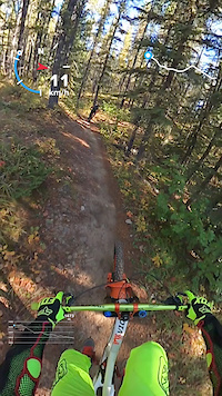
This is a classic ride, updated for modern times. From Station Flats, ride Elbow Valley to Sulphur Springs, and then climb up Pneuma. Feel free to bail to the road if Pneuma isn't working for you. You can stay on Pneuma all the way to the end, or if you took the road from Special K, Race of Spades or lower, continue on the road until you get to the top. On your right will be a gravel access road with a gate. This is the trail to the Kananaskis Fire Lookout. Follow that until the turnoff to Moosepackers appears on your right [there's a sign], at the bottom of a long gravel downhill. Moosepackers leads into Ridgeback and back to Station Flats.
Just shy of 25 km, fast riders will get it done in less than 2.5 hours, but it can take much longer if you have mechanicals, or cough up a lung on Pneuma. The original loop involved taking Sulphur Springs and then heading directly up the road. Once you got to the bottom of Moosepackers you would take the access road to Tom Snow and ride that all the way back.
The vast majority of people ride this loop clockwise. It can be done counter-clockwise, but that eliminates almost all the fun downhills, which would suck.
Check the individual trail descriptions for more details.
We hope you've been enjoying Trailforks!
Create a FREE account to view route comments and much more.
| 4,629 ft | |||||
| 2 miles | |||||
| 3 miles | |||||
| 2 miles | |||||
| 2 miles | |||||
| 6 miles | |||||
| 1,250 ft |

Service Road Atlas is a free to use, community-driven service for viewing and creating reports on the numerous back-country service roads around B.C. and Alberta.
Save the current map location and zoom level as your default home location whenever this page is loaded.
Save