19.4 miles
Distance
2,392 ft
Climb
-2,409 ft
Descent
672 ft
High Point
-16 ft
Altitude change
46 ft
Altitude min
62 ft
Altitude start
46 ft
Altitude end
-49.6%
Grade max
41.4%
Grade min
9 miles
Distance climb
8 miles
Distance down
2 miles
Distance flat

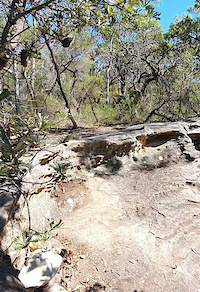
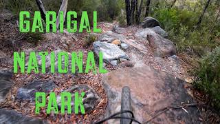
31 km loop from Mt Narra, over to Belrose, into the Cascades, up to Wildflowers, down Bunnings and back up and out to finish at bottom of Mt Narra. Laughing.

Detailed Description
NB 31km Loop is a 19 mile popular intermediate route located near Sydney. This mountain bike only route can be used one direction and has a moderate overall physical rating. This route includes 19 trails. This route climbs 2,392 ft with a max elevation of 672 ft then descends -2,409 ft.

Trail Issues on Route

  • Closed: 1 trail (newest: Jul 3, 2026)
  • Minor Issue / Yellow: 3 trails (newest: Jun 12, 2026)
Local Trail Association
Local trail association
Trail Care
Please consider joining or donating to the local riding association to support trail development & maintenance.
Donate to earn trail karma!

Stats

  • Distance
    19 miles
  • Altitude min
    46 ft
  • Altitude start
    62 ft
  • Altitude end
    46 ft
  • Climb
    2,392 ft
  • Descent
    -2,409 ft
  • Grade max
    -49.6%
  • Grade min
    41.4%
  • Distance climb
    9 miles
  • Distance down
    8 miles
  • Distance flat
    2 miles

56 Reviews & Comments


We hope you've been enjoying Trailforks!

Create a FREE account to view route comments and much more.

Details

  • Riding area
  • Primary Activity
    Mountain Bike
  • Difficulty rating
    Blue
  • Route Type
    Loop
  • eBike Allowed
  • Bike type
    AM
  • Direction
    One Direction
  • Physical rating
    Moderate
no votes yet
close
3D
Trail Conditions
  • Unknown
  • Snow Groomed
  • Snow Packed
  • Snow Covered
  • Snow Cover Partial
  • Freeze/thaw Cycle
  • Icy
  • Prevalent Mud
  • Wet
  • Variable
  • Ideal
  • Dry
  • Very Dry
Trail Flow (Ridden Direction)
Trailforks scans users ridelogs to determine the most popular direction each trail is ridden. A good flowing trail network will have most trails flowing in a single direction according to their intension.
The colour categories are based on what percentage of riders are riding a trail in its intended direction.
  • > 96%
  • > 90%
  • > 80%
  • > 70%
  • > 50%
  • < 50%
  • bi-directional trail
  • no data
Trail Last Ridden
Trailforks scans ridelogs to determine the last time a trail was ridden.
  • < 2 days
  • < 1 week
  • < 2 weeks
  • < 1 month
  • < 6 months
  • > 6 months
Trail Ridden Direction
The intended direction a trail should be ridden.
  • Downhill Only
  • Downhill Primary
  • Both Directions
  • Uphill Primary
  • Uphill Only
  • One Direction
Contribute Details
Colors indicate trail is missing specified detail.
  • Description
  • Photos
  • Description & Photos
  • Videos
Trail Popularity ?
Trailforks scans ridelogs to determine which trails are ridden the most in the last 9 months. Trails are compared with nearby trails in the same city region with a possible 25 colour shades. Think of this as a heatmap, more rides = more kinetic energy = warmer colors.
  • most popular
  • popular
  • less popular
  • not popular
ATV/ORV/OHV Filter
Max Vehicle Width
inches
US Cell Coverage
Legend
cell carrier legend

Radar Time
Activity Recordings
Trailforks uses anonymized public activity data. ?
Activity Recordings
Trailforks uses anonymized public activity data. ?
Personal Heatmap
Activity Types
all / none
Options
2
Date range month
Winter Trails
Warning A routing network for winter maps does not exist. Selecting trails using the winter trails layer has been disabled.
Missing Trails
Most Popular
Least Popular
Trails are colored based on popularity. The more popular a trail is, the more red. Less popular trails trend towards green.
Jump Magnitude Heatmap
Heatmap of where riders jump on trails. Zoom in to see individual jumps, click circles to view jump details.
BC Backroad Status

Service Road Atlas is a free to use, community-driven service for viewing and creating reports on the numerous back-country service roads around B.C. and Alberta.

map legend
Slope Aspect
Direction the slope faces
Flat N NE E SE S SW W NW
Trails Deemphasized
Trails are shown in grey.
disable
Only show trails with no bike usage.
Enable
Suggested Layers
Based on selected activity type

    Save the current map location and zoom level as your default home location whenever this page is loaded.

    Save
    Trail transparency
    • Singletrack
    • Unpaved
    13
    12
    11
    14
    Slab chute
    Slab chute
    0:16 | 17 | comments: 0 | favs:
    Jan 3, 2026

    Recent Trail Reports Along Route

    statustraildateconditiondescription
    Muppet Show
    Jul 4, 2026 @ 2:42pm (Australia/Sydney)
    2 days
    Fenced off and closed by National Parks
    Beam Me Up
    Jun 24, 2026 @ 3:05pm (Australia/Sydney)
    Jun 23, 2026
    King Brown Alley
    Jun 24, 2026 @ 3:05pm (Australia/Sydney)
    Jun 23, 2026
    Voltz
    Jun 24, 2026 @ 3:05pm (Australia/Sydney)
    Jun 23, 2026
    Oxy Connector
    Jun 13, 2026 @ 2:33pm (Australia/Sydney)
    Jun 12, 2026
    more reports »
    • By Scotlandislandferal & contributors
    • #54967 - 1,350 views

    Hit the Trail

    Open in App

    Get this route on your phone instantly.

    Download Route

    Save to wishlist, Garmin & download.