
9.7 miles
Distance
1,371 ft
Climb
-1,375 ft
Descent
1,227 ft
High Point
-4 ft
Altitude change
827 ft
Altitude min
853 ft
Altitude start
850 ft
Altitude end
-56.2%
Grade max
35.6%
Grade min
5 miles
Distance climb
4 miles
Distance down
4,104 ft
Distance flat

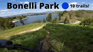
The 10 mile Nurburgring of the West Coast, taking you round the whole outside perimiter of the Bonelli Park trails in a counter clockwise direction. Featuring 5 of the toughest climbs in the park and 7 of the longest descents. The whole route consists of almost all dirt, some rock gardens, 1 river crossing, and minimal road crossings. Takes roughly 90-120 minutes to complete 1 lap

Detailed Description
Nurburgring Loop is a 10 mile moderately popular intermediate route located near San Dimas California. This mountain bike only route can be used both directions and has a moderate overall physical rating. This route includes 18 trails. This route climbs 1,371 ft with a max elevation of 1,227 ft then descends -1,375 ft.
Tags
River or creekRock gardens

Local Trail Association

Local trail association
Mount Wilson Bicycling Association (mwba.org)
Please consider joining or donating to the local riding association to support trail development & maintenance.
Donate to earn trail karma!

Stats

  • Distance
    10 miles
  • Avg time
    1 hr 57 min
  • Altitude min
    827 ft
  • Altitude start
    853 ft
  • Altitude end
    850 ft
  • Climb
    1,371 ft
  • Descent
    -1,375 ft
  • Grade max
    -56.2%
  • Grade min
    35.6%
  • Distance climb
    5 miles
  • Distance down
    4 miles
  • Distance flat
    4,104 ft

4 Reviews & Comments


We hope you've been enjoying Trailforks!

Create a FREE account to view all route reviews and much more.

Trails in Route

Walnut1 mile
Upper Beehive3,241 ft
574,449 ft
Coyote2 miles
Radar771 ft
Singletrack Thru the Trees938 ft
Crosby Trail1,936 ft
Rocky Trail1,755 ft
McKinley Access Path1,296 ft
Vietnam2,923 ft
North Shore1 mile

Details

  • Riding area
  • Primary Activity
    Mountain Bike
  • Difficulty rating
    Blue
  • Route Type
    Loop
  • Bike type
    AM, XC
  • Direction
    Both Directions
  • Physical rating
    Moderate
  • Activity Logs
    1
Avg: 3 (1 votes)
close
Trail transparency
  • Singletrack
  • Unpaved
  • Paved
Rocky Trail
mtb
Rocky Trail
14:59 | 217 | comments: 0 | favs:
Nov 21, 2024
Frank G. Bonelli Park - Mountain Bike Loop
mtb
Frank G. Bonelli Park - Mountain Bike Loop
28:19 | 346 | comments: 0 | favs:
Jul 2, 2024

Recent Trail Reports Along Route

statustraildateconditiondescription
Vietnam
May 2, 2026 @ 1:21pm (America/Los_Angeles)
May 2, 2026
Water either receded or they fixed it but the overflow is gone and passable again. Creek is low as well
North Shore
Apr 29, 2026 @ 6:43pm (America/Los_Angeles)
Apr 29, 2026
McKinley Access Path
Apr 29, 2026 @ 6:43pm (America/Los_Angeles)
Apr 29, 2026
Walnut
Feb 1, 2026 @ 6:51pm (America/Los_Angeles)
Feb 1, 2026
Upper Beehive
Feb 1, 2026 @ 6:51pm (America/Los_Angeles)
Feb 1, 2026
more reports »
  • By rowdyphil & contributors
  • #26824 - 1,977 views

Hit the Trail

Open in App

Get this route on your phone instantly.

Download Route

Save to wishlist, Garmin & download.