


Open in App
Get this route on your phone instantly.
Ore Chute is like no other system trail on the Front Range. Designed for advanced and expert riders, it's a hand-built, double-black trail that traverses from the northern peak on Maryland Mountain roughly 1,000' feet down to the creek. It is steep with many sections of fall-line trail and a steep slab ride before the halfway point.
Three bike-only downhill trails start from the saddle just below the summit of Maryland Mountain. Fast Money is a ripping blue intermediate downhill, Hard Money is steeper and more technical with optional gap jumps and rock features. And then there's Ore Chute. If you haven't ridden Hard Money yet, try that first and know that Ore Chute is a true double-black and is twice as difficult as Hard Money. If you think you are ready for Ore Chute, read on.
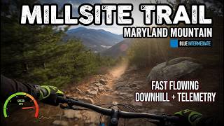
Start from the Maryland Mountain trailhead and cross the bridge. Take the first right on Millsite Trail and then hang a left on Easy Money. You'll climb all the way to the saddle.
The first move on Ore Chute is a "squirrel catcher" or filter designed to give riders a taste of the trail. If you need to walk this feature, think twice about continuing on, it doesn't get any easier. If the first move went well, then carry on. You'll go through 4 more steep rock features and then you'll come to a bailout on your left. Again, if you've been walking more than you've been riding, take the bailout. No shame and it's quick climb back to the saddle to hit Hard Money or Fast Money.
Past the bail-out you'll come to the signature feature - a steep rock slab on the right. There's a black-level ride around to the left. A few more moves and you'll come to an intersection with Hard Money. This interchange was designed so you can mix and match Ore Chute and Hard Money - and also have one last bailout. If you continue on Ore Chute you are about half way down until the trail terminates at Millsite Trail. Go left for another lap, right to get back back to the trailhead.
We hope you've been enjoying Trailforks!
Create a FREE account to view all route reviews and much more.
| 2 miles | |||||
| 755 ft | |||||
| 3,238 ft |


Service Road Atlas is a free to use, community-driven service for viewing and creating reports on the numerous back-country service roads around B.C. and Alberta.
Save the current map location and zoom level as your default home location whenever this page is loaded.
Save| status | trail | date | condition | description |
|---|---|---|---|---|
Aug 20, 2026 @ 3:42pm (America/Denver) Aug 20, 2026 | ||||
Aug 20, 2026 @ 3:42pm (America/Denver) Aug 20, 2026 | ||||
May 12, 2026 @ 11:17am (America/Denver) May 12, 2026 |
 BMA & contributors