

31.6 miles
Distance
6,960 ft
Climb
-6,959 ft
Descent
4,865 ft
High Point
1 ft
Altitude change
1,810 ft
Altitude min
1,816 ft
Altitude start
1,818 ft
Altitude end
-81.4%
Grade max
70.2%
Grade min
17 miles
Distance climb
12 miles
Distance down
3 miles
Distance flat

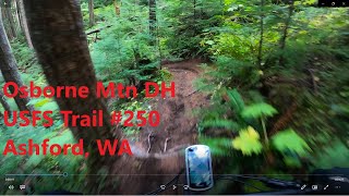
This route is a step up from the Osbourne mt full route. It adds a nice climb up Silver Creek and a challenging traverse of Allen Mt. The turn off from the paved road is easy to miss so check your Trailforks

Detailed Description
Osbourne mt mega loop is a 32 mile moderately popular expert route located near Packwood Washington. This mountain bike only route can be used one direction and has a hard overall physical rating. This route includes 5 trails. This route climbs 6,960 ft with a max elevation of 4,865 ft then descends -6,959 ft.
Tags
River or creek

Trail Issues on Route

  • Minor Issue / Yellow: 2 trails (newest: Sep 8, 2021)

Local Trail Association

Local trail association
Evergreen - Cowlitz-Naches Chapter (www.evergreenmtb.org)
Please consider joining or donating to the local riding association to support trail development & maintenance.
Donate to earn trail karma!

Stats

  • Distance
    32 miles
  • Avg time
    6 hr 34 min
  • Altitude min
    1,810 ft
  • Altitude start
    1,816 ft
  • Altitude end
    1,818 ft
  • Climb
    1 mile
  • Descent
    -6,959 ft
  • Grade max
    -81.4%
  • Grade min
    70.2%
  • Distance climb
    17 miles
  • Distance down
    12 miles
  • Distance flat
    3 miles

5 Reviews & Comments


We hope you've been enjoying Trailforks!

Create a FREE account to view all route reviews and much more.

Details

  • Riding area
  • Primary Activity
    Mountain Bike
  • Difficulty rating
    Black Diamond
  • Route Type
    Loop
  • eBike Allowed
  • Bike type
    AM, XC
  • Direction
    One Direction
  • Physical rating
    Hard
no votes yet
close
Trail transparency
  • Singletrack
  • Unpaved

Recent Trail Reports Along Route

statustraildateconditiondescription
Silver Creek Trail
Sep 19, 2026 @ 4:51pm (America/Los_Angeles)
Sep 19, 2026
All cleae
Allen Mountain Trail
Sep 19, 2026 @ 4:51pm (America/Los_Angeles)
Sep 19, 2026
All cleae
Osborne Mountain Trail
Jul 17, 2026 @ 5:59pm (America/Los_Angeles)
Jul 17, 2026
No trees down. Great dirt after the July 16 rain. A little brushy in a few spots at the top, but nothing note worthy compared to the rest of the loop.
Silver Creek to NF-5240 Connector Road
Sep 8, 2021 @ 3:46pm
Sep 8, 2021
Major PNW pinstriping potential. Probably better to park at the pit at the turnoff.
NF-8460 Connector to Allen Mountain Trail
Jun 24, 2020 @ 8:39am
Jun 24, 2020
Patchy Compact Snow
more reports »
  • By i-g-o-rTF Pro & contributors
  • #9893 - 1,762 views

Hit the Trail

Open in App

Get this route on your phone instantly.

Download Route

Save to wishlist, Garmin & download.