

17.0 miles
Distance
639 ft
Climb
-641 ft
Descent
930 ft
High Point
-1 ft
Altitude change
892 ft
Altitude min
907 ft
Altitude start
906 ft
Altitude end
-0%
Grade
-22.2%
Grade max
22.2%
Grade min
4 miles
Distance climb
4 miles
Distance down
9 miles
Distance flat

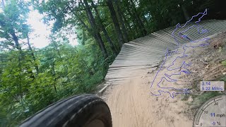
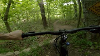
Advanced 17 mile route encompassing Phase 2, Boneyard, Roll Model, Shredwalk, and the Alum Creek Multipurpose Trail. Phase 2 is ridden counter-clockwise. See local trail signage for directionality on Roll Model and the Alum Creek Multipurpose Trail. Trail runners should travel in the opposite direction from bike traffic.

Detailed Description
P2 + Connector + Multi is a 17 mile popular easy route located near Delaware Ohio. This mountain bike primary route can be used both directions and has a hard overall physical rating. This route includes 5 trails. This route climbs 639 ft with a max elevation of 930 ft then descends -641 ft.
Tags
River or creek

Trail Issues on Route

  • Minor Issue / Yellow: 1 trail (newest: Sep 19, 2026)

Local Trail Association

Local trail association
Central Ohio Mountain Biking Organization (www.combomtb.com)
Please consider joining or donating to the local riding association to support trail development & maintenance.
Donate to earn trail karma!

Stats

  • Distance
    17 miles
  • Altitude min
    892 ft
  • Altitude start
    907 ft
  • Altitude end
    906 ft
  • Climb
    639 ft
  • Descent
    -641 ft
  • Grade
    -0%
  • Grade max
    -22.2%
  • Grade min
    22.2%
  • Distance climb
    4 miles
  • Distance down
    4 miles
  • Distance flat
    9 miles

3 Reviews & Comments


We hope you've been enjoying Trailforks!

Create a FREE account to view all route reviews and much more.

Trails in Route

Details

  • Riding area
  • Primary Activity
    Mountain Bike
  • Other Activities
    • E-Bike
    • Trail Running
  • Difficulty rating
    Green
  • Route Type
    Loop
  • eBike Allowed
  • Bike type
    AM, XC
  • Direction
    Both Directions
  • Physical rating
    Hard

Directions

  1. Walk southeast on Phase II.
  2. Continue for 9 kilometers.
  3. Turn right onto Phase II Access.
  4. Continue for 20 meters.
  5. Turn left onto Africa Road.
  6. Continue for 100 meters.
  7. Walk south on Africa Road.
  8. Continue for 90 meters.
  9. Turn right onto Cheshire Road.
  10. Continue for 60 meters.
  11. Walk east on Cheshire Road.
  12. Continue for 50 meters.
  13. Turn right onto Africa Road.
  14. Continue for 30 meters.
  15. Walk south on Africa Road.
  16. Continue for 100 meters.
  17. Walk south on Africa Road.
  18. Continue for 80 meters.
  19. Walk south on Africa Road.
  20. Continue for 30 meters.
  21. Walk north on Africa Road.
  22. Continue for 20 meters.
  23. Walk south on Africa Road.
  24. Continue for 300 meters.
  25. Walk northwest on Alum Multi-use Trail.
  26. Continue for 30 meters.
  27. Walk southeast on Alum Multi-use Trail.
  28. Continue for 3 kilometers.
  29. Walk west on Alum Multi-use Trail.
  30. Continue for 6 kilometers.
  31. Walk south on Africa Road.
  32. Continue for 40 meters.
  33. Make a right U-turn to stay on Africa Road.
  34. Continue for 300 meters.
  35. Walk south on Africa Road.
  36. Continue for 10 meters.
  37. Walk north on Africa Road.
  38. Continue for 100 meters.
  39. Walk east on Cheshire Road.
  40. Continue for 60 meters.
  41. Turn left onto Africa Road.
  42. Continue for 10 meters.
  43. Walk east on Cheshire Road.
  44. Continue for 60 meters.
  45. Turn left onto Africa Road.
  46. Continue for 90 meters.
  47. Walk north on Africa Road.
  48. Continue for 100 meters.
  49. Turn right onto Phase II Access.
  50. Continue for 20 meters.
  51. Turn right onto Phase II.
  52. Continue for 20 meters.
no votes yet
close
Trail transparency
  • Singletrack
mtb
trail: Roll Model
39
mtb
trail: Roll Model
43
mtb
trail: Roll Model
40
mtb
Alum Creek Phase 2 MTB trail 4K Full Loop
mtb
Alum Creek Phase 2 MTB trail 4K Full Loop
trail: Phase 2
35:41 | 1142 | comments: 0 | favs:
Aug 30, 2022
Alum Creek Phase 2
mtb
Alum Creek Phase 2
trail: Phase 2
2:30 | 1258 | comments: 0 | favs:
May 25, 2020

Recent Trail Reports Along Route

statustraildateconditiondescription
Phase 2
Sep 26, 2026 @ 10:43am (America/New_York)
Sep 26, 2026
mostly dry, just a couple damp spots
Roll Model
Sep 19, 2026 @ 12:12pm (America/New_York)
Sep 19, 2026
A few wet spots
Alum Multi-use Trail
Sep 7, 2026 @ 10:25am (America/New_York)
Sep 7, 2026
Shredwalk
Sep 7, 2026 @ 10:25am (America/New_York)
Sep 7, 2026
more reports »
  • By gnarbageTF Pro COMBO & contributors
  • #67436 - 164 views

Hit the Trail

Open in App

Get this route on your phone instantly.

Download Route

Save to wishlist, Garmin & download.
