

20.3 miles
Distance
4,420 ft
Climb
-4,425 ft
Descent
2 miles
High Point
-7 ft
Altitude change
4,260 ft
Altitude min
4,267 ft
Altitude start
4,259 ft
Altitude end
-68.6%
Grade max
81%
Grade min
12 miles
Distance climb
7 miles
Distance down
5,243 ft
Distance flat

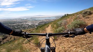
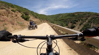
Loop from Centerville Parrish Creek trail head going up to the top of skyline drive via bountiful access road. Drop from the top down the Parrish Creek trail. Stay to the south side of the slope after the first descent and the trail becomes vague. The trail from then on out is clear.

Detailed Description
Parrish Loop is a 20 mile popular intermediate route located near Centerville Utah. This mountain bike only route can be used one direction and has a moderate overall physical rating. This route includes 5 trails. This route climbs 4,420 ft with a max elevation of 8,323 ft then descends -4,425 ft.
Tags
DropsRiver or creek

Local Trail Association

Please consider joining or donating to the local riding association to support trail development & maintenance.
Donate to earn trail karma!

Stats

  • Distance
    20 miles
  • Avg time
    2 hr 24 min
  • Altitude min
    4,260 ft
  • Altitude start
    4,267 ft
  • Altitude end
    4,259 ft
  • Climb
    4,420 ft
  • Descent
    -4,425 ft
  • Grade max
    -68.6%
  • Grade min
    81%
  • Distance climb
    12 miles
  • Distance down
    7 miles
  • Distance flat
    5,243 ft

Comments


We hope you've been enjoying Trailforks!

Create a FREE account to view all route reviews and much more.

Details

  • Riding area
  • Primary Activity
    Mountain Bike
  • Difficulty rating
    Blue
  • Route Type
    Loop
  • Bike type
    AM
  • Direction
    One Direction
  • Physical rating
    Moderate
no votes yet
close
Trail transparency
  • Singletrack
  • Unpaved
mtb
82
mtb
80
mtb
83
mtb
94

Recent Trail Reports Along Route

statustraildateconditiondescription
BST (Parrish Creek)
Oct 10, 2026 @ 10:35am (America/Boise)
Oct 10, 2026
BST (Centerville)
Oct 10, 2026 @ 10:35am (America/Boise)
Oct 10, 2026
BST (Bountiful) Alt
Apr 12, 2026 @ 11:34am (America/Boise)
Apr 12, 2026
BST (Bountiful Range)
Nov 4, 2023 @ 10:21am
Nov 4, 2023
BST (Bountiful Lower)
Nov 4, 2023 @ 10:21am
Nov 4, 2023
more reports »
  • By BeefHeadTF Pro & contributors
  • #9595 - 1,800 views

Hit the Trail

Open in App

Get this route on your phone instantly.

Download Route

Save to wishlist, Garmin & download.
