6.1 miles
Distance
963 ft
Climb
-951 ft
Descent
4,036 ft
High Point
12 ft
Altitude change
3,607 ft
Altitude min
3,607 ft
Altitude start
3,619 ft
Altitude end
-36.6%
Grade max
31%
Grade min
3 miles
Distance climb
2 miles
Distance down
3,455 ft
Distance flat

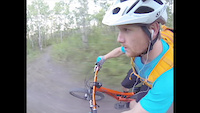
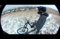
This has become my usual route through Paskapoo Slopes. Using short repeats of sections of Fenceline, Ridge Run, Homestead and Lemon Orchard, this ride ties together most of the best trails, which are ridden in the more enjoyable direction.

Detailed Description
Paskapoo Prime is a 6 mile moderately popular intermediate route located near Calgary Alberta. This mountain bike only route can be used one direction and has a moderate overall physical rating. This route includes 21 trails. This route climbs 963 ft with a max elevation of 4,036 ft then descends -951 ft.

Trail Issues on Route

  • Significant Issue / Amber: 1 trail (newest: Sep 8, 2025)
  • Minor Issue / Yellow: 2 trails (newest: Jun 20, 2026)
Local Trail Association
Local trail association
Calgary Mountain Bike Alliance (www.cmbalink.com)
Please consider joining or donating to the local riding association to support trail development & maintenance.
Donate to earn trail karma!

Stats

  • Distance
    6 miles
  • Avg time
    1 hr 11 min
  • Altitude min
    3,607 ft
  • Altitude start
    3,607 ft
  • Altitude end
    3,619 ft
  • Climb
    963 ft
  • Descent
    -951 ft
  • Grade max
    -36.6%
  • Grade min
    31%
  • Distance climb
    3 miles
  • Distance down
    2 miles
  • Distance flat
    3,455 ft

17 Reviews & Comments


We hope you've been enjoying Trailforks!

Create a FREE account to view route comments and much more.

Trails in Route

Details

  • Riding area
  • Primary Activity
    Mountain Bike
  • Difficulty rating
    Blue
  • Route Type
    Loop
  • Bike type
    AM, XC, Fat
  • Direction
    One Direction
  • Physical rating
    Moderate
  • Ridelogs
    13
no votes yet
close
3D
Trail Conditions
  • Unknown
  • Snow Groomed
  • Snow Packed
  • Snow Covered
  • Snow Cover Partial
  • Freeze/thaw Cycle
  • Icy
  • Prevalent Mud
  • Wet
  • Variable
  • Ideal
  • Dry
  • Very Dry
Trail Flow (Ridden Direction)
Trailforks scans users ridelogs to determine the most popular direction each trail is ridden. A good flowing trail network will have most trails flowing in a single direction according to their intension.
The colour categories are based on what percentage of riders are riding a trail in its intended direction.
  • > 96%
  • > 90%
  • > 80%
  • > 70%
  • > 50%
  • < 50%
  • bi-directional trail
  • no data
Trail Last Ridden
Trailforks scans ridelogs to determine the last time a trail was ridden.
  • < 2 days
  • < 1 week
  • < 2 weeks
  • < 1 month
  • < 6 months
  • > 6 months
Trail Ridden Direction
The intended direction a trail should be ridden.
  • Downhill Only
  • Downhill Primary
  • Both Directions
  • Uphill Primary
  • Uphill Only
  • One Direction
Contribute Details
Colors indicate trail is missing specified detail.
  • Description
  • Photos
  • Description & Photos
  • Videos
Trail Popularity ?
Trailforks scans ridelogs to determine which trails are ridden the most in the last 9 months. Trails are compared with nearby trails in the same city region with a possible 25 colour shades. Think of this as a heatmap, more rides = more kinetic energy = warmer colors.
  • most popular
  • popular
  • less popular
  • not popular
ATV/ORV/OHV Filter
Max Vehicle Width
inches
US Cell Coverage
Legend
cell carrier legend

Radar Time
Activity Recordings
Trailforks uses anonymized public activity data. ?
Activity Recordings
Trailforks uses anonymized public activity data. ?
Personal Heatmap
Activity Types
all / none
Options
2
Date range month
Winter Trails
Warning A routing network for winter maps does not exist. Selecting trails using the winter trails layer has been disabled.
Missing Trails
Most Popular
Least Popular
Trails are colored based on popularity. The more popular a trail is, the more red. Less popular trails trend towards green.
Jump Magnitude Heatmap
Heatmap of where riders jump on trails. Zoom in to see individual jumps, click circles to view jump details.
BC Backroad Status

Service Road Atlas is a free to use, community-driven service for viewing and creating reports on the numerous back-country service roads around B.C. and Alberta.

map legend
Slope Aspect
Direction the slope faces
Flat N NE E SE S SW W NW
Trails Deemphasized
Trails are shown in grey.
disable
Only show trails with no bike usage.
Enable
Suggested Layers
Based on selected activity type

    Save the current map location and zoom level as your default home location whenever this page is loaded.

    Save
    Trail transparency
    • Singletrack
    46
    54
    37
    151 | 1 comments
    Eastlands
    Eastlands
    trail: Grunty
    3:09 | 1397 | comments: 0 | favs:
    Sep 4, 2013
    Having fun with the GoPro on the weekend.
    Team Sloap - Winter Sloap
    Team Sloap - Winter Sloap
    trail: Shrubbery
    0:14 | 634 | comments: 1 | favs: 4
    Oct 20, 2012
    Riding some neck deep pow down some shrubbery. Squeaky brake dreams.

    Recent Trail Reports Along Route

    statustraildateconditiondescription
    Boardwalk
    Jun 20, 2026 @ 9:28am (America/Creston)
    Jun 20, 2026
    Grunty
    May 9, 2026 @ 1:57pm (America/Creston)
    May 9, 2026
    Traverse
    May 9, 2026 @ 1:57pm (America/Creston)
    May 9, 2026
    Shrubbery
    May 9, 2026 @ 1:57pm (America/Creston)
    May 9, 2026
    Jungle Run
    May 9, 2026 @ 1:57pm (America/Creston)
    May 9, 2026
    more reports »
    • By aka-bigsteveTF Pro & contributors
    • #8159 - 2,814 views

    Hit the Trail

    Open in App

    Get this route on your phone instantly.

    Download Route

    Save to wishlist, Garmin & download.