
3.5 miles
Distance
656 ft
Climb
-650 ft
Descent
1 mile
High Point
7 ft
Altitude change
7,090 ft
Altitude min
7,452 ft
Altitude start
7,457 ft
Altitude end
-48.8%
Grade max
35.7%
Grade min
2 miles
Distance climb
1 mile
Distance down
2,844 ft
Distance flat

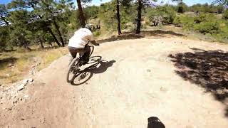
This is the counterclockwise version of the new upper loop.

Detailed Description
Pinal Peak Loop Counter Clockwise is a 4 mile popular intermediate route located near Globe Arizona. This mountain bike only route can be used both directions and has a moderate overall physical rating. This route includes 2 trails. This route climbs 656 ft with a max elevation of 7,533 ft then descends -650 ft.
Tags
Family friendlySummitViews

Trail Issues on Route

  • Minor Issue / Yellow: 1 trail (newest: Nov 11, 2026)
Route Supporters

Local Trail Association

Local trail association
Tonto Gravity Riders (www.tontogravityriders.org)
Please consider joining or donating to the local riding association to support trail development & maintenance.
Donate to earn trail karma!

Stats

  • Distance
    4 miles
  • Altitude min
    7,090 ft
  • Altitude start
    7,452 ft
  • Altitude end
    7,457 ft
  • Climb
    656 ft
  • Descent
    -650 ft
  • Grade max
    -48.8%
  • Grade min
    35.7%
  • Distance climb
    2 miles
  • Distance down
    1 mile
  • Distance flat
    2,844 ft

1 Review & Comments


We hope you've been enjoying Trailforks!

Create a FREE account to view all route reviews and much more.

Details

  • Riding area
  • Primary Activity
    Mountain Bike
  • Difficulty rating
    Blue
  • Route Type
    Loop
  • eBike Allowed
  • Bike type
    AM, XC
  • Direction
    Both Directions
  • Physical rating
    Moderate

Directions

  1. Walk southwest on Pinal Mtn. Rd..
  2. Continue for 10 meters.
  3. Walk southwest on Pinal Mtn. Rd..
  4. Continue for 70 meters.
  5. Walk southwest on Pinal Mtn. Rd..
  6. Continue for 200 meters.
  7. Walk east on Pinal Mtn. Rd..
  8. Continue for 30 meters.
  9. Walk east on Pinal Mtn. Rd..
  10. Continue for 200 meters.
  11. Walk southwest on Pinal Mtn. Rd..
  12. Continue for 100 meters.
  13. Walk east on Pinal Mtn. Rd..
  14. Continue for 70 meters.
  15. Walk northeast on Pinal Mtn. Rd..
  16. Continue for 200 meters.
no votes yet
close
Trail transparency
  • Singletrack

Recent Trail Reports Along Route

statustraildateconditiondescription
Pinal Vista Loop (Northside)
Nov 11, 2026 @ 7:26am (America/Phoenix)
Nov 11, 2026
downed tress with one major one on the west end switchbacks. reporter
Pinal Vista Loop (Southside)
May 27, 2026 @ 7:33pm (America/Phoenix)
May 27, 2026
Perfect! reporter
more reports »
  • By clkwrkTF Pro TGR & contributors
  • #65775 - 338 views

Hit the Trail

Open in App

Get this route on your phone instantly.

Download Route

Save to wishlist, Garmin & download.