16.2 miles
Distance
1,396 ft
Climb
-1,386 ft
Descent
429 ft
High Point
10 ft
Altitude change
262 ft
Altitude min
289 ft
Altitude start
299 ft
Altitude end
-66.6%
Grade max
27.5%
Grade min
7 miles
Distance climb
7 miles
Distance down
2 miles
Distance flat

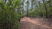
The pines Loop course Margret river

Detailed Description
Pines loop is a 16 mile less popular intermediate route located near Margaret River. This mountain bike only route can be used one direction. This route includes 65 trails. This route climbs 1,396 ft with a max elevation of 429 ft then descends -1,386 ft.

Trail Issues on Route

  • Minor Issue / Yellow: 2 trails (newest: Oct 21, 2021)
Local Trail Association
Local trail association
Margaret River Off Road Cycling Association (www.mrorca.org.au)
Please consider joining or donating to the local riding association to support trail development & maintenance.
Donate to earn trail karma!

Stats

  • Distance
    16 miles
  • Avg time
    2 hr 38 min
  • Altitude min
    262 ft
  • Altitude start
    289 ft
  • Altitude end
    299 ft
  • Climb
    1,396 ft
  • Descent
    -1,386 ft
  • Grade max
    -66.6%
  • Grade min
    27.5%
  • Distance climb
    7 miles
  • Distance down
    7 miles
  • Distance flat
    2 miles

15 Reviews & Comments


We hope you've been enjoying Trailforks!

Create a FREE account to view route comments and much more.

Details

  • Riding area
  • Primary Activity
    Mountain Bike
  • Difficulty rating
    Blue
  • Route Type
    Loop
  • Bike type
    AM, XC
  • Direction
    One Direction
  • Ridelogs
    2
no votes yet
close
3D
Trail Conditions
  • Unknown
  • Snow Groomed
  • Snow Packed
  • Snow Covered
  • Snow Cover Partial
  • Freeze/thaw Cycle
  • Icy
  • Prevalent Mud
  • Wet
  • Variable
  • Ideal
  • Dry
  • Very Dry
Trail Flow (Ridden Direction)
Trailforks scans users ridelogs to determine the most popular direction each trail is ridden. A good flowing trail network will have most trails flowing in a single direction according to their intension.
The colour categories are based on what percentage of riders are riding a trail in its intended direction.
  • > 96%
  • > 90%
  • > 80%
  • > 70%
  • > 50%
  • < 50%
  • bi-directional trail
  • no data
Trail Last Ridden
Trailforks scans ridelogs to determine the last time a trail was ridden.
  • < 2 days
  • < 1 week
  • < 2 weeks
  • < 1 month
  • < 6 months
  • > 6 months
Trail Ridden Direction
The intended direction a trail should be ridden.
  • Downhill Only
  • Downhill Primary
  • Both Directions
  • Uphill Primary
  • Uphill Only
  • One Direction
Contribute Details
Colors indicate trail is missing specified detail.
  • Description
  • Photos
  • Description & Photos
  • Videos
Trail Popularity ?
Trailforks scans ridelogs to determine which trails are ridden the most in the last 9 months. Trails are compared with nearby trails in the same city region with a possible 25 colour shades. Think of this as a heatmap, more rides = more kinetic energy = warmer colors.
  • most popular
  • popular
  • less popular
  • not popular
ATV/ORV/OHV Filter
Max Vehicle Width
inches
US Cell Coverage
Legend
cell carrier legend

Radar Time
Activity Recordings
Trailforks uses anonymized public activity data. ?
Activity Recordings
Trailforks uses anonymized public activity data. ?
Personal Heatmap
Activity Types
all / none
Options
2
Date range month
Winter Trails
Warning A routing network for winter maps does not exist. Selecting trails using the winter trails layer has been disabled.
Missing Trails
Most Popular
Least Popular
Trails are colored based on popularity. The more popular a trail is, the more red. Less popular trails trend towards green.
Jump Magnitude Heatmap
Heatmap of where riders jump on trails. Zoom in to see individual jumps, click circles to view jump details.
BC Backroad Status

Service Road Atlas is a free to use, community-driven service for viewing and creating reports on the numerous back-country service roads around B.C. and Alberta.

map legend
Slope Aspect
Direction the slope faces
Flat N NE E SE S SW W NW
Trails Deemphasized
Trails are shown in grey.
disable
Only show trails with no bike usage.
Enable
Suggested Layers
Based on selected activity type

    Save the current map location and zoom level as your default home location whenever this page is loaded.

    Save
    Trail transparency
    • Singletrack
    • Unpaved
    47
    64
    53
    42
    MTB Big Pine Banksy Jump
    MTB Big Pine Banksy Jump
    trail: Big Pine
    0:08 | 29 | comments: 0 | favs:
    Jan 29, 2025
    Pugsley Margaret River
    Pugsley Margaret River
    trail: Pugsley
    0:43 | 35 | comments: 0 | favs:
    Dec 21, 2024

    Recent Trail Reports Along Route

    statustraildateconditiondescription
    High Horse
    Mar 16, 2026 @ 3:26pm (Australia/Perth)
    Mar 16, 2026
    Good climb
    Pugsley
    Mar 16, 2026 @ 3:26pm (Australia/Perth)
    Mar 16, 2026
    Lots of fun
    Ashton Road (Open)
    Oct 17, 2025 @ 9:37am (Australia/Perth)
    Oct 16, 2025
    Rock n Root
    Oct 17, 2025 @ 9:37am (Australia/Perth)
    Oct 16, 2025
    Big Climb
    Oct 17, 2025 @ 9:37am (Australia/Perth)
    Oct 16, 2025
    more reports »
    • By drewhansonTF Pro & contributors
    • #10145 - 2,712 views

    Hit the Trail

    Open in App

    Get this route on your phone instantly.

    Download Route

    Save to wishlist, Garmin & download.