


Open in App
Get this route on your phone instantly.
Ideal from July-October, snow is always a possibility, this is a high alpine route!
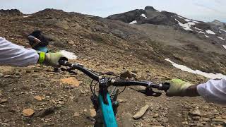
This Route start at Les Violettes (2220m) and climbs to La Plaine Morte (2980m can also be done by Gondola) then ride around the Glacier to Cabane du Wildstrubel where you can get some great food. The trail descends to the Rawyl pass and flows through the Plan des Roses to lake Tseuzier. You then follow the alpine waterway bisse d'Ayent all the way down till it merges into the bisse de Claveau which end just above Sion (the local capital) with a short descent that finishes by the terrace of the local brewery.
This route is Unsanctioned, Ride at your own Risk!
We hope you've been enjoying Trailforks!
Create a FREE account to view all route reviews and much more.
| 2 miles | |||||
| 3,255 ft | |||||
| 4,760 ft | |||||
| 1 mile | |||||
| 1 mile | |||||
| 4,990 ft | |||||
| 1 mile | |||||
| 4,511 ft | |||||
| 2,392 ft | |||||
| 1,457 ft | |||||
| 2,785 ft | |||||
| 5,259 ft | |||||
| 1,276 ft | |||||
| 2,907 ft | |||||
| 3,602 ft | |||||
| 3,999 ft | |||||
| 4,012 ft | |||||
| 5 miles |

Service Road Atlas is a free to use, community-driven service for viewing and creating reports on the numerous back-country service roads around B.C. and Alberta.
Save the current map location and zoom level as your default home location whenever this page is loaded.
Save